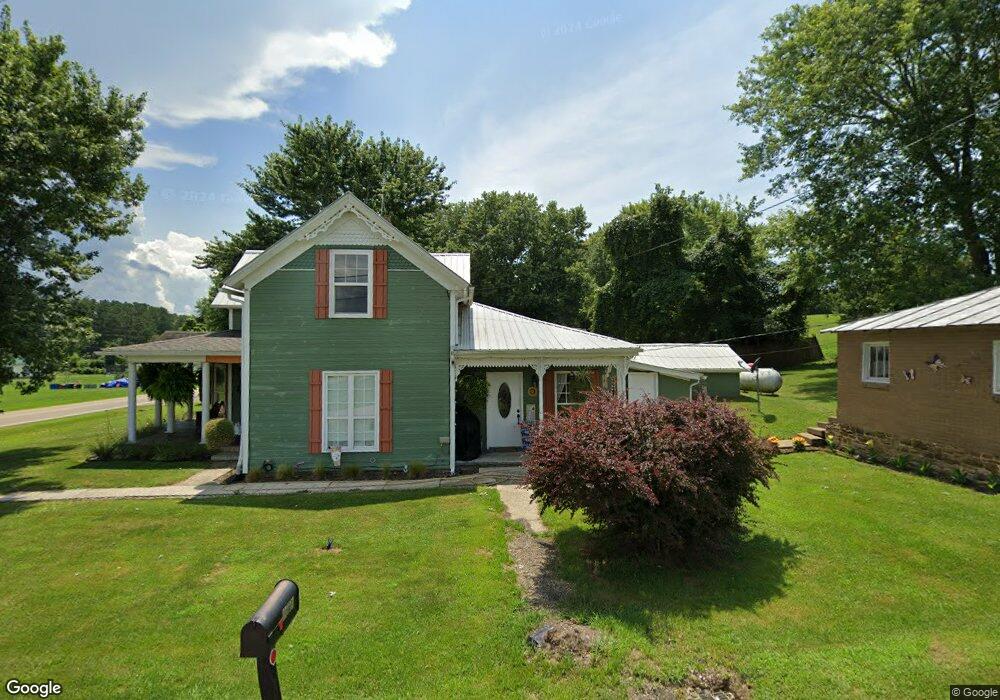
31015 State Route 325 Langsville, OH 45741
Estimated Value: $102,000 - $212,000
3
Beds
2
Baths
1,290
Sq Ft
$106/Sq Ft
Est. Value
About This Home
This home is located at 31015 State Route 325, Langsville, OH 45741 and is currently estimated at $137,371, approximately $106 per square foot. 31015 State Route 325 is a home with nearby schools including Meigs Primary School, Meigs Middle School, and Meigs High School.
Ownership History
Date
Name
Owned For
Owner Type
Purchase Details
Closed on
Nov 22, 2021
Sold by
Mcvey Harlie and Ward David Chase
Bought by
Boling Morgan Jade and Boling David Lee
Current Estimated Value
Home Financials for this Owner
Home Financials are based on the most recent Mortgage that was taken out on this home.
Original Mortgage
$86,330
Outstanding Balance
$79,216
Interest Rate
3.09%
Mortgage Type
New Conventional
Estimated Equity
$58,155
Purchase Details
Closed on
Mar 5, 2021
Sold by
Oiler Brian S and Oiler Linda
Bought by
Mcvey Harlie and Ward David Chase
Home Financials for this Owner
Home Financials are based on the most recent Mortgage that was taken out on this home.
Original Mortgage
$88,369
Interest Rate
2.7%
Mortgage Type
FHA
Purchase Details
Closed on
Dec 31, 1997
Bought by
Oiler Linda Oiler Brian S
Create a Home Valuation Report for This Property
The Home Valuation Report is an in-depth analysis detailing your home's value as well as a comparison with similar homes in the area
Home Values in the Area
Average Home Value in this Area
Purchase History
| Date | Buyer | Sale Price | Title Company |
|---|---|---|---|
| Boling Morgan Jade | $89,000 | None Available | |
| Mcvey Harlie | $90,000 | Secure Title Services Ltd | |
| Mcvey Harlie | -- | Secure Title | |
| Oiler Linda Oiler Brian S | $28,000 | -- |
Source: Public Records
Mortgage History
| Date | Status | Borrower | Loan Amount |
|---|---|---|---|
| Open | Boling Morgan Jade | $86,330 | |
| Previous Owner | Mcvey Harlie | $88,369 |
Source: Public Records
Tax History Compared to Growth
Tax History
| Year | Tax Paid | Tax Assessment Tax Assessment Total Assessment is a certain percentage of the fair market value that is determined by local assessors to be the total taxable value of land and additions on the property. | Land | Improvement |
|---|---|---|---|---|
| 2024 | $903 | $28,190 | $4,250 | $23,940 |
| 2023 | $903 | $28,190 | $4,250 | $23,940 |
| 2022 | $945 | $28,190 | $4,250 | $23,940 |
| 2021 | $675 | $16,990 | $2,640 | $14,350 |
| 2020 | $625 | $16,940 | $2,640 | $14,300 |
| 2019 | $617 | $16,940 | $2,640 | $14,300 |
| 2018 | $514 | $14,250 | $1,750 | $12,500 |
| 2017 | $514 | $14,250 | $1,750 | $12,500 |
| 2016 | $508 | $14,250 | $1,750 | $12,500 |
| 2014 | $490 | $15,260 | $1,750 | $13,510 |
| 2013 | $490 | $15,260 | $1,750 | $13,510 |
Source: Public Records
Map
Nearby Homes
- 30285 Briar Ridge Rd
- 30284 Briar Ridge Rd
- 30286 Briar Ridge Rd
- 32325 Red Hill Rd Unit (SeclusionCabin at B
- 0 Briar Ridge Rd Unit 11566708
- 0 Briar Ridge Rd Unit 24580050
- 0 Briar Ridge Rd Unit 24580053
- 31166 Edmundson Rd
- 0 Red Hill Rd Unit 25653294
- 0 Red Hill Rd Unit 11594354
- 0 Edmundson Rd Unit (Tract 5 at Big Timb
- 0 Edmundson Rd Unit (Tract 2 at Big Timb
- 0 Edmundson Rd Unit (Tract 6 at Big Timb
- 0 Edmundson Rd Unit 23463048
- 0 Edmundson Rd Unit 2429533
- 0 Edmundson Rd Unit 23607169
- 0 Edmundson Rd Unit 25511220
- 31428 Will Vance Rd
- 28033 State Route 124
- 28600 Ohio 124
- 31004 State Route 325
- 31032 State Route 325
- 29645 Briar Ridge Rd
- 30996 State Route 325
- 31121 Red Hill Rd
- 30986 State Route 325
- 31025 State Route 325
- 29673 Briar Ridge Rd
- 30982 State Route 325
- 31134 Red Hill Rd
- 30976 State Route 325
- 30976 State Route 325
- 31171 Red Hill Rd
- 29727 Briar Ridge Rd
- 31235 Red Hill Rd
- 29757 Briar Ridge Rd
- 30920 State Route 325
- 31557 Hampton Hollow Rd
- 30854 State Route 325
- 29554 Sanford Davis Rd