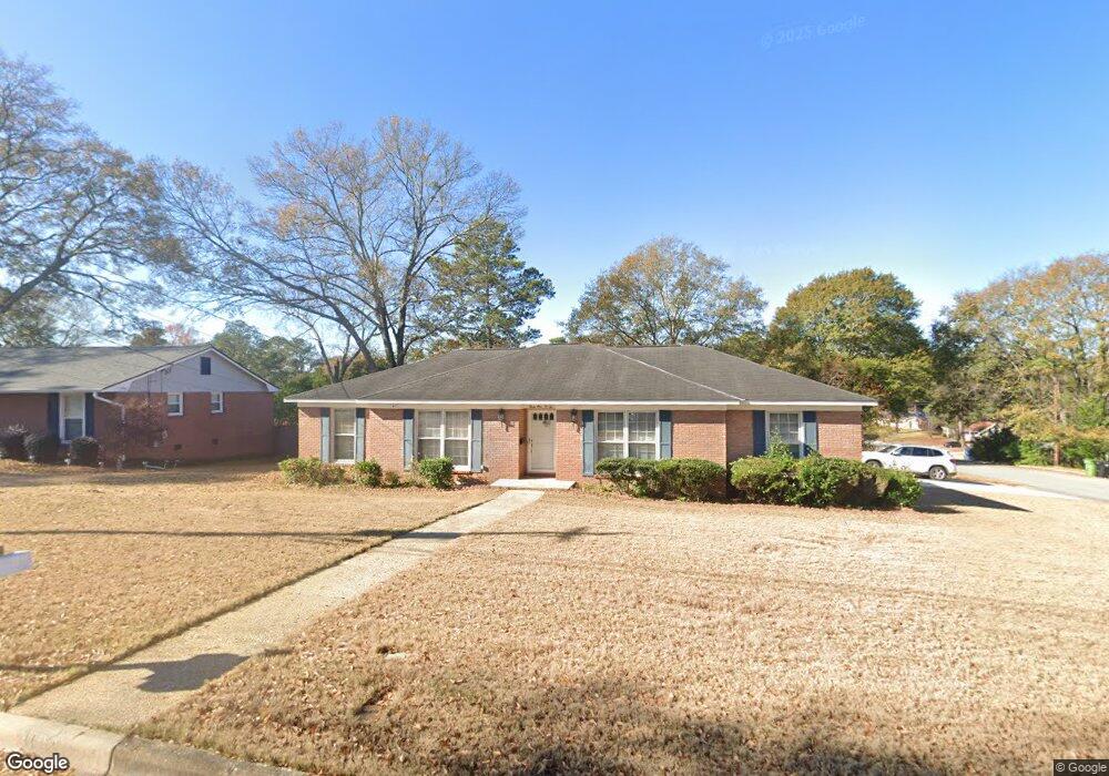
3102 Apache Dr Columbus, GA 31909
North Columbus NeighborhoodEstimated Value: $161,000 - $195,579
3
Beds
3
Baths
1,808
Sq Ft
$98/Sq Ft
Est. Value
About This Home
This home is located at 3102 Apache Dr, Columbus, GA 31909 and is currently estimated at $177,395, approximately $98 per square foot. 3102 Apache Dr is a home located in Muscogee County with nearby schools including Allen Elementary School, Arnold Middle School, and Jordan Vocational High School.
Ownership History
Date
Name
Owned For
Owner Type
Purchase Details
Closed on
Jul 22, 2025
Sold by
Tovey Pamela Sue
Bought by
Taylor James Paskel
Current Estimated Value
Create a Home Valuation Report for This Property
The Home Valuation Report is an in-depth analysis detailing your home's value as well as a comparison with similar homes in the area
Home Values in the Area
Average Home Value in this Area
Purchase History
| Date | Buyer | Sale Price | Title Company |
|---|---|---|---|
| Taylor James Paskel | $92,500 | None Listed On Document | |
| Taylor James Paskel | $92,500 | None Listed On Document | |
| Taylor James Paskel | -- | None Listed On Document | |
| Taylor James Paskel | -- | None Listed On Document | |
| 3102 Apache Dr Llc | -- | None Listed On Document | |
| 3102 Apache Dr Llc | -- | None Listed On Document |
Source: Public Records
Tax History
| Year | Tax Paid | Tax Assessment Tax Assessment Total Assessment is a certain percentage of the fair market value that is determined by local assessors to be the total taxable value of land and additions on the property. | Land | Improvement |
|---|---|---|---|---|
| 2025 | $749 | $63,232 | $8,820 | $54,412 |
| 2024 | $748 | $63,232 | $8,820 | $54,412 |
| 2023 | $59 | $63,232 | $8,820 | $54,412 |
| 2022 | $780 | $49,392 | $8,820 | $40,572 |
| 2021 | $773 | $49,540 | $8,820 | $40,720 |
| 2020 | $774 | $49,540 | $8,820 | $40,720 |
| 2019 | $778 | $49,540 | $8,820 | $40,720 |
| 2018 | $778 | $49,540 | $8,820 | $40,720 |
| 2017 | $782 | $49,540 | $8,820 | $40,720 |
| 2016 | $786 | $43,946 | $7,172 | $36,774 |
| 2015 | $788 | $43,946 | $7,172 | $36,774 |
| 2014 | $790 | $43,946 | $7,172 | $36,774 |
| 2013 | -- | $43,946 | $7,172 | $36,774 |
Source: Public Records
Map
Nearby Homes
- 3091 Mustang Dr
- 3121 Bellanca St
- 2924 Beech St
- 5724 Sanford Ave
- 5829 Ventura Dr
- 3342 Windermere St
- 2723 N Walnut St
- 5836 Sherborne Dr
- 5921 Canterbury Dr
- 5502 Southlea Ln
- 3101 Waco St
- 6002 Canterbury Dr
- 2528 Lorraine St
- 2516 Lorraine St
- 3325 N Quay Dr
- 6308 Adams Park Dr
- 6221 Charing Dr
- 5820 Windsor Dr
- 2325 Coventry Dr
- 2 Biltmore Ct
- 3108 Apache Dr
- 3041 Mustang Dr
- 3047 Mustang Dr
- 3103 Apache Dr
- 3055 Mustang Dr
- 3114 Apache Dr
- 3111 Apache Dr
- 3069 Apache Dr
- 3063 Mustang Dr
- 3062 Apache Dr
- 3119 Apache Dr
- 3027 Mustang Dr
- 3061 Apache Dr
- 3120 Apache Dr
- 3115 Dehaviland Dr
- 3071 Mustang Dr
- 3040 Mustang Dr
- 3046 Mustang Dr
- 3021 Mustang Dr
- 3127 Apache Dr
Your Personal Tour Guide
Ask me questions while you tour the home.