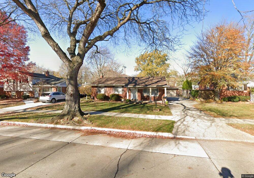
31024 Grennada St Livonia, MI 48154
Estimated Value: $273,231 - $302,000
--
Bed
1
Bath
990
Sq Ft
$291/Sq Ft
Est. Value
About This Home
This home is located at 31024 Grennada St, Livonia, MI 48154 and is currently estimated at $288,058, approximately $290 per square foot. 31024 Grennada St is a home located in Wayne County with nearby schools including Roosevelt Elementary School, Emerson Middle School, and Cooper Upper Elementary School.
Ownership History
Date
Name
Owned For
Owner Type
Purchase Details
Closed on
May 28, 2002
Sold by
Plowman Charles F
Bought by
Berger Steven F
Current Estimated Value
Home Financials for this Owner
Home Financials are based on the most recent Mortgage that was taken out on this home.
Original Mortgage
$113,000
Interest Rate
6.7%
Mortgage Type
Purchase Money Mortgage
Purchase Details
Closed on
Apr 22, 2002
Sold by
Plowman Diane
Bought by
Plowman Charles F
Home Financials for this Owner
Home Financials are based on the most recent Mortgage that was taken out on this home.
Original Mortgage
$113,000
Interest Rate
6.7%
Mortgage Type
Purchase Money Mortgage
Create a Home Valuation Report for This Property
The Home Valuation Report is an in-depth analysis detailing your home's value as well as a comparison with similar homes in the area
Home Values in the Area
Average Home Value in this Area
Purchase History
| Date | Buyer | Sale Price | Title Company |
|---|---|---|---|
| Berger Steven F | $178,000 | -- | |
| Plowman Charles F | -- | -- |
Source: Public Records
Mortgage History
| Date | Status | Borrower | Loan Amount |
|---|---|---|---|
| Previous Owner | Berger Steven F | $113,000 |
Source: Public Records
Tax History Compared to Growth
Tax History
| Year | Tax Paid | Tax Assessment Tax Assessment Total Assessment is a certain percentage of the fair market value that is determined by local assessors to be the total taxable value of land and additions on the property. | Land | Improvement |
|---|---|---|---|---|
| 2025 | $1,437 | $117,100 | $0 | $0 |
| 2024 | $1,437 | $109,500 | $0 | $0 |
| 2023 | $1,371 | $97,800 | $0 | $0 |
| 2022 | $2,408 | $90,500 | $0 | $0 |
| 2021 | $2,339 | $86,300 | $0 | $0 |
| 2019 | $2,244 | $74,800 | $0 | $0 |
| 2018 | $1,159 | $68,400 | $0 | $0 |
| 2017 | $2,052 | $64,500 | $0 | $0 |
| 2016 | $2,157 | $64,500 | $0 | $0 |
| 2015 | $5,008 | $57,400 | $0 | $0 |
| 2012 | -- | $49,530 | $15,630 | $33,900 |
Source: Public Records
Map
Nearby Homes
- 31221 Lyndon St
- 31126 Grennada St
- 14292 Hubbell St
- 30831 Lyndon St
- 14164 Bainbridge St
- 14327 Arden St
- 14154 Hubbell St
- 14563 Melrose St
- 14127 Hillcrest St
- 14109 Arden St
- 14677 Auburndale St
- 30261 Buckingham St
- 32136 Lyndon St
- 15040 Berwick St
- 15345 Bainbridge St
- 29831 Oakley St
- 31005 Roycroft St
- 14214 Cranston St
- 29631 Lyndon St
- 29760 Hoy St
- 31036 Grennada St
- 31012 Grennada St
- 31125 Lyndon St
- 31050 Grennada St
- 31137 Lyndon St
- 31111 Lyndon St
- 31149 Lyndon St
- 31023 Grennada St
- 31062 Grennada St
- 31035 Grennada St
- 31011 Grennada St
- 31161 Lyndon St
- 31049 Grennada St
- 14428 Sunset St
- 14412 Sunset St
- 31074 Grennada St
- 14396 Sunset St
- 14446 Sunset St
- 31061 Grennada St
- 31173 Lyndon St