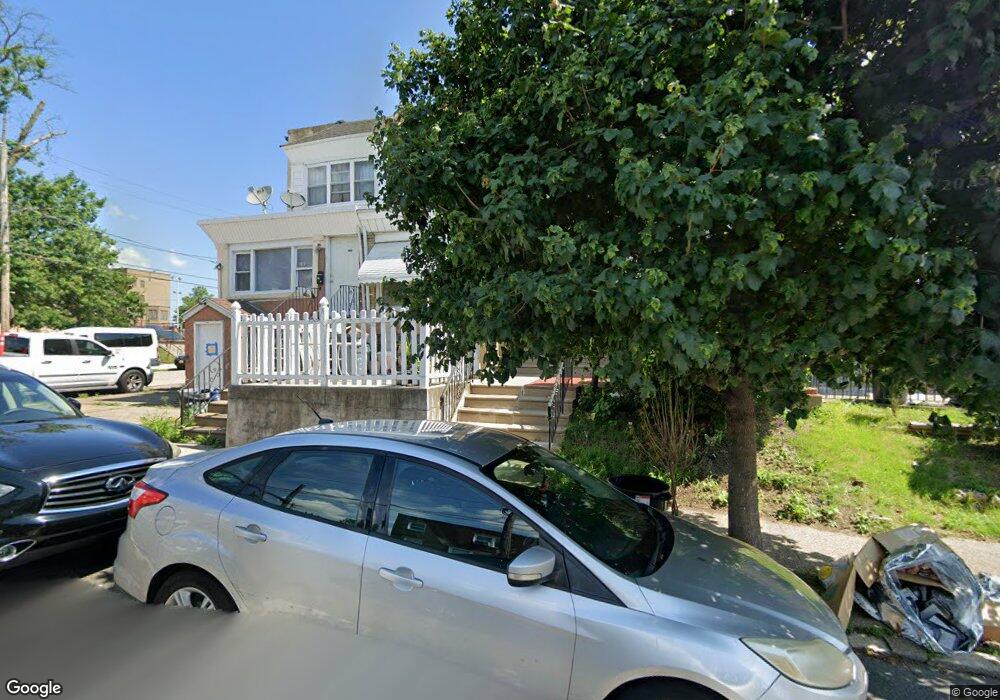
3103 Robbins Ave Philadelphia, PA 19149
Mayfair NeighborhoodEstimated Value: $168,000 - $193,545
3
Beds
1
Bath
1,068
Sq Ft
$173/Sq Ft
Est. Value
About This Home
This home is located at 3103 Robbins Ave, Philadelphia, PA 19149 and is currently estimated at $184,886, approximately $173 per square foot. 3103 Robbins Ave is a home located in Philadelphia County with nearby schools including Lincoln High School, Ethan Allen School, and Blessed Trinity Regional Catholic School.
Ownership History
Date
Name
Owned For
Owner Type
Purchase Details
Closed on
May 18, 2007
Sold by
Altilia Carl and Altilia Antonia
Bought by
Victor Claire I
Current Estimated Value
Home Financials for this Owner
Home Financials are based on the most recent Mortgage that was taken out on this home.
Original Mortgage
$89,200
Outstanding Balance
$54,287
Interest Rate
6.18%
Mortgage Type
Purchase Money Mortgage
Estimated Equity
$130,599
Create a Home Valuation Report for This Property
The Home Valuation Report is an in-depth analysis detailing your home's value as well as a comparison with similar homes in the area
Home Values in the Area
Average Home Value in this Area
Purchase History
| Date | Buyer | Sale Price | Title Company |
|---|---|---|---|
| Victor Claire I | $92,000 | First American Title Ins Co |
Source: Public Records
Mortgage History
| Date | Status | Borrower | Loan Amount |
|---|---|---|---|
| Open | Victor Claire I | $89,200 |
Source: Public Records
Tax History Compared to Growth
Tax History
| Year | Tax Paid | Tax Assessment Tax Assessment Total Assessment is a certain percentage of the fair market value that is determined by local assessors to be the total taxable value of land and additions on the property. | Land | Improvement |
|---|---|---|---|---|
| 2025 | $2,156 | $181,900 | $36,380 | $145,520 |
| 2024 | $2,156 | $181,900 | $36,380 | $145,520 |
| 2023 | $2,156 | $154,000 | $30,800 | $123,200 |
| 2022 | $1,802 | $154,000 | $30,800 | $123,200 |
| 2021 | $1,802 | $0 | $0 | $0 |
| 2020 | $1,802 | $0 | $0 | $0 |
| 2019 | $1,729 | $0 | $0 | $0 |
| 2018 | $1,425 | $0 | $0 | $0 |
| 2017 | $1,425 | $0 | $0 | $0 |
| 2016 | $1,425 | $0 | $0 | $0 |
| 2015 | $1,364 | $0 | $0 | $0 |
| 2014 | -- | $101,800 | $15,008 | $86,792 |
| 2012 | -- | $12,864 | $1,052 | $11,812 |
Source: Public Records
Map
Nearby Homes
- 3134 Stirling St
- 3148 Barnett St
- 3153 Barnett St
- 6241 Frankford Ave
- 6239 Frankford Ave
- 3007 Mckinley St
- 4014 Barnett St
- 6219 Mulberry St
- 4116 Stirling St
- 3118 Hellerman St
- 3038 Hellerman St
- 2916 Levick St
- 6143 Hawthorne St
- 4623 Hawthorne St
- 4152 Barnett St
- 6164 Tackawanna St
- 4154 Robbins St
- 2910 Passmore St
- 6333 Mershon St
- 3111 Gilham St
- 3105 Robbins Ave
- 3101 Robbins St
- 3107 Robbins Ave
- 3109 Robbins Ave
- 3111 Robbins Ave
- 3102 Stirling St
- 3104 Stirling St
- 3113 Robbins Ave
- 3100 Stirling St
- 3106 Stirling St
- 3110 Stirling St
- 3108 Stirling St
- 3117 Robbins Ave
- 3114 Stirling St
- 3119 Robbins Ave
- 3116 Stirling St
- 3121 Robbins Ave
- 3118 Stirling St
- 3106 Robbins Ave
- 3123 Robbins Ave