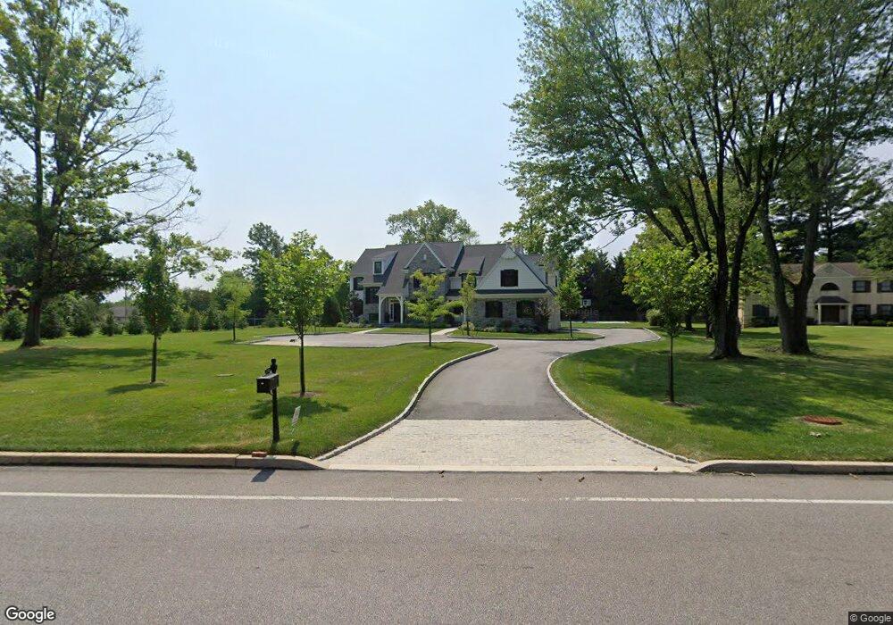
3104-B Darby Rd Ardmore, PA 19003
Estimated Value: $1,026,000 - $2,181,000
4
Beds
5
Baths
3,759
Sq Ft
$493/Sq Ft
Est. Value
About This Home
This home is located at 3104-B Darby Rd, Ardmore, PA 19003 and is currently estimated at $1,851,332, approximately $492 per square foot. 3104-B Darby Rd is a home located in Delaware County with nearby schools including Coopertown Elementary School, Haverford Middle School, and Haverford Senior High School.
Ownership History
Date
Name
Owned For
Owner Type
Purchase Details
Closed on
Jan 26, 2022
Sold by
Hellings Land Development Llc
Bought by
Pio Philip C and Pio Staci L
Current Estimated Value
Home Financials for this Owner
Home Financials are based on the most recent Mortgage that was taken out on this home.
Original Mortgage
$1,382,880
Outstanding Balance
$1,278,884
Interest Rate
3.22%
Mortgage Type
New Conventional
Estimated Equity
$572,448
Purchase Details
Closed on
Jul 15, 2020
Sold by
Difulvio Giuliano and Difulvio Theresa
Bought by
Hellings Land Development Llc
Home Financials for this Owner
Home Financials are based on the most recent Mortgage that was taken out on this home.
Original Mortgage
$805,000
Interest Rate
3.2%
Mortgage Type
Construction
Purchase Details
Closed on
Apr 12, 1983
Sold by
Dougherty Hannum
Bought by
Difulvio Guiliano and Difulvio Theresa
Create a Home Valuation Report for This Property
The Home Valuation Report is an in-depth analysis detailing your home's value as well as a comparison with similar homes in the area
Home Values in the Area
Average Home Value in this Area
Purchase History
| Date | Buyer | Sale Price | Title Company |
|---|---|---|---|
| Pio Philip C | $1,728,600 | Land Services Usa | |
| Hellings Land Development Llc | $300,000 | Land Services Usa Inc | |
| Hellings Land Development Llc | $300,000 | Land Services Usa | |
| Difulvio Guiliano | $40,800 | -- |
Source: Public Records
Mortgage History
| Date | Status | Borrower | Loan Amount |
|---|---|---|---|
| Open | Pio Philip C | $1,382,880 | |
| Previous Owner | Hellings Land Development Llc | $805,000 |
Source: Public Records
Tax History Compared to Growth
Tax History
| Year | Tax Paid | Tax Assessment Tax Assessment Total Assessment is a certain percentage of the fair market value that is determined by local assessors to be the total taxable value of land and additions on the property. | Land | Improvement |
|---|---|---|---|---|
| 2025 | $38,829 | $1,510,130 | $211,220 | $1,298,910 |
| 2024 | $38,829 | $1,510,130 | $211,220 | $1,298,910 |
| 2023 | $37,726 | $1,510,130 | $211,220 | $1,298,910 |
| 2022 | $5,153 | $211,220 | $211,220 | $0 |
| 2021 | $8,395 | $211,220 | $211,220 | $0 |
| 2020 | $3,895 | $83,800 | $83,800 | $0 |
| 2019 | $3,823 | $83,800 | $83,800 | $0 |
| 2018 | $3,757 | $83,800 | $0 | $0 |
| 2017 | $3,678 | $83,800 | $0 | $0 |
| 2016 | $469 | $83,800 | $0 | $0 |
| 2015 | $469 | $83,800 | $0 | $0 |
| 2014 | $469 | $83,800 | $0 | $0 |
Source: Public Records
Map
Nearby Homes
- 133 Quaker Ln
- 345 Ellis Rd
- 201 Golf Hills Rd
- 210 218 David Dr
- 200 Marple Rd
- 1901 Pennview Ave
- 6205 Parkview Dr
- 1741 Lawrence Rd
- 14 Westview Rd
- 62 Parkridge Dr Unit 62
- 128 Campbell Ave
- 67 Parkridge Dr
- 139 Campbell Ave
- 633 Foxfields Rd
- 5 W Turnbull Ave
- 128 Clemson Rd
- 26 E Turnbull Ave
- 1702 Melrose Ave
- 202 Summit Dr Unit B
- 307 B B000 Summit Dr Unit B
- 3104 Darby Rd
- 3104D Darby Rd
- 3104B Darby Rd
- 3104-D Darby Rd
- 3104C Darby Rd
- 3104A Darby Rd
- 3110 Darby Rd
- 3108 Darby Rd
- 3215 Darby Rd
- 3209 Darby Rd
- 3104 Darby Rd
- 10 W Ardmore Ave
- 101 Quaker Ln
- 40 Coopertown Rd
- 25 Dartmouth Ln
- 300 Ardmore Ave
- 21 Dartmouth Ln
- 17 Dartmouth Ln
- 310 Ardmore Ave
- 109 Quaker Ln