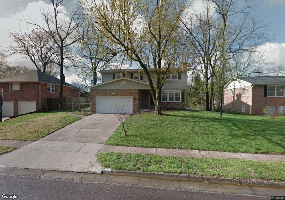
3104 W Rollins Rd Columbia, MO 65203
Estimated Value: $337,000 - $371,000
5
Beds
3
Baths
2,565
Sq Ft
$136/Sq Ft
Est. Value
About This Home
This home is located at 3104 W Rollins Rd, Columbia, MO 65203 and is currently estimated at $348,368, approximately $135 per square foot. 3104 W Rollins Rd is a home located in Boone County with nearby schools including Fairview Elementary School, West Middle School, and David H. Hickman High School.
Ownership History
Date
Name
Owned For
Owner Type
Purchase Details
Closed on
Sep 21, 2011
Sold by
Ball Austin C and Ball Elizabeth Q
Bought by
Wilson Nicole S and Wilson Timothy O
Current Estimated Value
Home Financials for this Owner
Home Financials are based on the most recent Mortgage that was taken out on this home.
Original Mortgage
$172,710
Outstanding Balance
$116,734
Interest Rate
3.99%
Mortgage Type
FHA
Estimated Equity
$231,634
Purchase Details
Closed on
Dec 22, 2010
Sold by
The Bank Of New York Mellon
Bought by
Ball Austin C and Ball Elizabeth Q
Purchase Details
Closed on
Jun 18, 2010
Sold by
Akins Guy Z and Akins Dorothy A
Bought by
The Bank Of New York Mellon
Create a Home Valuation Report for This Property
The Home Valuation Report is an in-depth analysis detailing your home's value as well as a comparison with similar homes in the area
Home Values in the Area
Average Home Value in this Area
Purchase History
| Date | Buyer | Sale Price | Title Company |
|---|---|---|---|
| Wilson Nicole S | -- | None Available | |
| Ball Austin C | -- | None Available | |
| The Bank Of New York Mellon | $141,927 | None Available |
Source: Public Records
Mortgage History
| Date | Status | Borrower | Loan Amount |
|---|---|---|---|
| Open | Wilson Nicole S | $172,710 |
Source: Public Records
Tax History Compared to Growth
Tax History
| Year | Tax Paid | Tax Assessment Tax Assessment Total Assessment is a certain percentage of the fair market value that is determined by local assessors to be the total taxable value of land and additions on the property. | Land | Improvement |
|---|---|---|---|---|
| 2025 | $2,220 | $37,677 | $3,819 | $33,858 |
| 2024 | $2,220 | $32,908 | $3,819 | $29,089 |
| 2023 | $2,202 | $32,908 | $3,819 | $29,089 |
| 2022 | $2,037 | $30,476 | $3,819 | $26,657 |
| 2021 | $2,041 | $30,476 | $3,819 | $26,657 |
| 2020 | $2,011 | $28,215 | $3,819 | $24,396 |
| 2019 | $2,011 | $28,215 | $3,819 | $24,396 |
| 2018 | $1,875 | $0 | $0 | $0 |
| 2017 | $1,901 | $26,125 | $3,819 | $22,306 |
| 2016 | $1,901 | $26,125 | $3,819 | $22,306 |
| 2015 | $1,754 | $26,125 | $3,819 | $22,306 |
| 2014 | -- | $26,125 | $3,819 | $22,306 |
Source: Public Records
Map
Nearby Homes
- 3005 W Rollins Rd
- 811 Cambridge Dr
- 503 Himalayas Dr
- 804 S Fairview Rd Unit B7
- 908 S Fairview Rd
- 401 Hulen Dr
- 1300 Longwell Dr
- 3808 Faurot Dr
- 2802 W Broadway
- 2505 Highland Dr
- 1305 Jake Ln
- 2708 W Broadway
- 2304 Braemore Rd
- 504 Loch Ln
- 3817 Bray Ct
- 108 Defoe Ct
- 1416 Subella Dr
- 3211 Kohler Cir
- 2801 W Broadway Unit G-1
- 208 Bourn Ave
- 3100 W Rollins Rd
- 3108 W Rollins Rd
- 3105 Yorktown Dr
- 3008 W Rollins Rd
- 3109 Yorktown Dr
- 3103 Yorktown Dr
- 3105 W Rollins Rd
- 3101 W Rollins Rd
- 3007 Yorktown Dr
- 3109 W Rollins Rd
- 801 Westport Dr
- 805 Westport Dr
- 3004 W Rollins Rd
- 3009 W Rollins Rd
- 809 Westport Dr
- 3005 Yorktown Dr
- 813 Westport Dr
- 3000 W Rollins Rd
- 717 Westport Dr
- 3104 Yorktown Dr