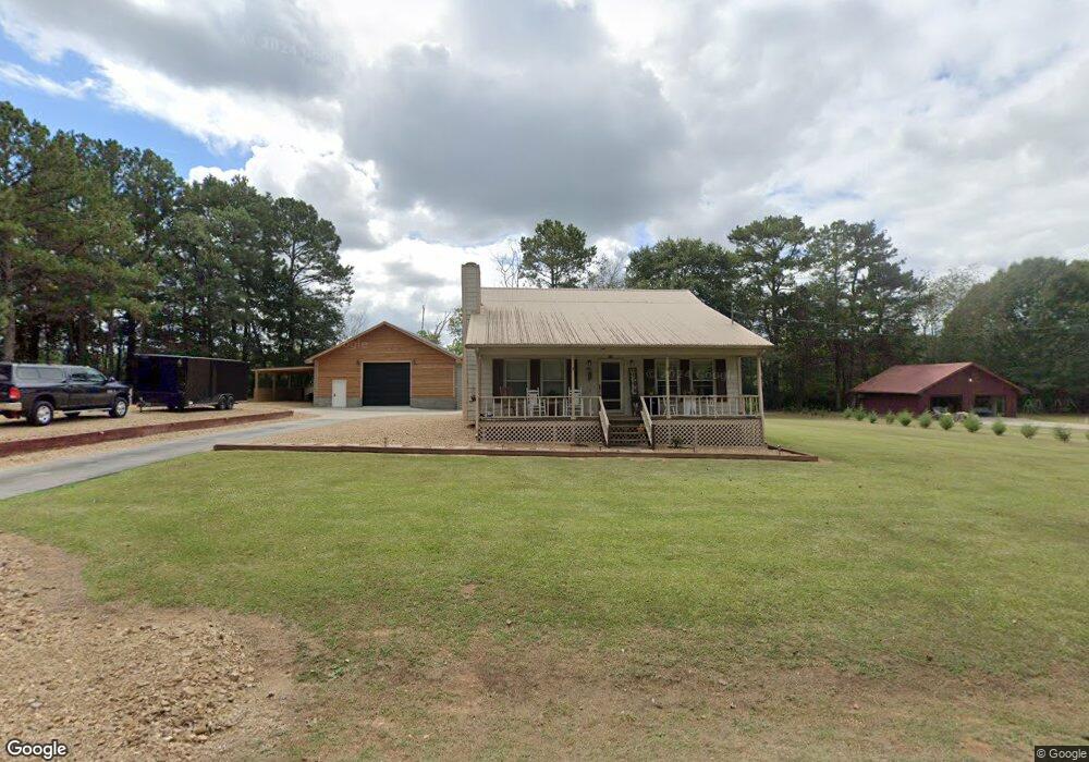
311 Cedar Hill Dr SW Calhoun, GA 30701
Estimated Value: $203,000 - $269,000
3
Beds
2
Baths
1,386
Sq Ft
$168/Sq Ft
Est. Value
About This Home
This home is located at 311 Cedar Hill Dr SW, Calhoun, GA 30701 and is currently estimated at $232,804, approximately $167 per square foot. 311 Cedar Hill Dr SW is a home located in Gordon County with nearby schools including Swain Elementary School, Ashworth Middle School, and Gordon Central High School.
Ownership History
Date
Name
Owned For
Owner Type
Purchase Details
Closed on
Jul 13, 2020
Sold by
Bagwell William Keith
Bought by
Grogan David Aspen
Current Estimated Value
Home Financials for this Owner
Home Financials are based on the most recent Mortgage that was taken out on this home.
Original Mortgage
$85,000
Interest Rate
3.2%
Mortgage Type
Commercial
Purchase Details
Closed on
Jun 30, 2011
Sold by
Defoor Sara
Bought by
Bagwell William Keith
Home Financials for this Owner
Home Financials are based on the most recent Mortgage that was taken out on this home.
Original Mortgage
$79,600
Interest Rate
4.57%
Mortgage Type
New Conventional
Purchase Details
Closed on
Nov 3, 1989
Bought by
Defoor Defoor R and Defoor Sara
Create a Home Valuation Report for This Property
The Home Valuation Report is an in-depth analysis detailing your home's value as well as a comparison with similar homes in the area
Home Values in the Area
Average Home Value in this Area
Purchase History
| Date | Buyer | Sale Price | Title Company |
|---|---|---|---|
| Grogan David Aspen | $100,000 | -- | |
| Bagwell William Keith | $99,500 | -- | |
| Defoor Sarah C | -- | -- | |
| Defoor Defoor R | $63,000 | -- |
Source: Public Records
Mortgage History
| Date | Status | Borrower | Loan Amount |
|---|---|---|---|
| Closed | Grogan David Aspen | $85,000 | |
| Previous Owner | Bagwell William Keith | $79,600 |
Source: Public Records
Tax History Compared to Growth
Tax History
| Year | Tax Paid | Tax Assessment Tax Assessment Total Assessment is a certain percentage of the fair market value that is determined by local assessors to be the total taxable value of land and additions on the property. | Land | Improvement |
|---|---|---|---|---|
| 2024 | $1,539 | $62,560 | $1,760 | $60,800 |
| 2023 | $1,435 | $58,480 | $1,760 | $56,720 |
| 2022 | $1,422 | $54,640 | $1,760 | $52,880 |
| 2021 | $1,065 | $44,040 | $1,760 | $42,280 |
| 2020 | $1,249 | $43,600 | $1,760 | $41,840 |
| 2019 | $1,256 | $43,600 | $1,760 | $41,840 |
| 2018 | $1,168 | $40,560 | $1,760 | $38,800 |
| 2017 | $1,139 | $38,440 | $1,760 | $36,680 |
| 2016 | $1,142 | $38,440 | $1,760 | $36,680 |
| 2015 | $1,114 | $37,160 | $1,760 | $35,400 |
| 2014 | $1,060 | $36,384 | $1,789 | $34,594 |
Source: Public Records
Map
Nearby Homes
- 215 Wilson St
- 227 Mcconnell Rd
- 100 Neal St
- 210 Madison Dr SW
- 404 Mcginnis Cir
- 153 Riverview Dr
- 413 Beamer Rd SW
- 207 N River St
- 137 Regency Row SW
- 130 Brookstone Dr SW
- 85 Professional Place Unit 14
- 110 Boston Rd
- 201 King St N
- 200 Ridgeview Trail
- 108 Mac Ave
- 0 N Dale Ave Unit 7622794
- 0 N Dale Ave Unit 10572875
- 291 Cedar Hill Dr SW
- 316 Cedar Hill Dr SW
- 321 Cedar Hill Dr SW
- 275 Cedar Hill Dr SW
- 274 Cedar Hill Dr SW
- 320 Cedar Hill Dr SW
- 242 Cedar Hill Dr SW
- 226 Cedar Hill Dr SW
- 228 Cedar Hill Dr SW
- 280 New Zion Rd SW
- 213 Cedar Hill Dr SW
- 191 Cedar Hill Dr SW
- 332 Roland Hayes Pkwy SW
- 192 Cedar Hill Dr SW
- 174 Cedar Hill Dr SW
- 169 Cedar Hill Dr SW
- 105 Crest Dr
- 149 Cedar Hill Dr SW
- 156 Cedar Hill Dr SW
- 292 New Zion Rd SW