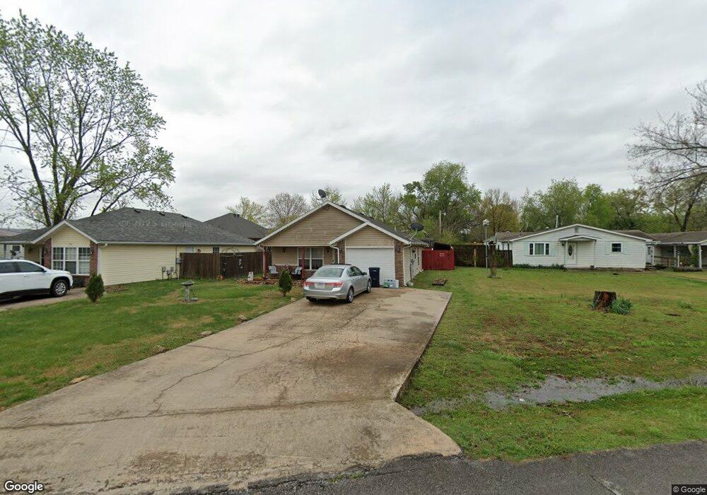
311 Commercial St Prairie Grove, AR 72753
Estimated Value: $150,000 - $208,000
--
Bed
--
Bath
1,026
Sq Ft
$179/Sq Ft
Est. Value
About This Home
This home is located at 311 Commercial St, Prairie Grove, AR 72753 and is currently estimated at $183,868, approximately $179 per square foot. 311 Commercial St is a home located in Washington County with nearby schools including Prairie Grove Elementary School, Prairie Grove Middle School, and Prairie Grove Junior High School.
Ownership History
Date
Name
Owned For
Owner Type
Purchase Details
Closed on
May 10, 2005
Sold by
Pergeson Jack and Pergeson Trina Dawn
Bought by
Aman Ron
Current Estimated Value
Home Financials for this Owner
Home Financials are based on the most recent Mortgage that was taken out on this home.
Original Mortgage
$67,000
Outstanding Balance
$35,134
Interest Rate
6.03%
Mortgage Type
Fannie Mae Freddie Mac
Estimated Equity
$148,734
Purchase Details
Closed on
May 7, 2003
Sold by
Bowman Bonita R and Bowman Robert
Bought by
Pergeson Jack
Home Financials for this Owner
Home Financials are based on the most recent Mortgage that was taken out on this home.
Original Mortgage
$65,000
Interest Rate
5.87%
Mortgage Type
Purchase Money Mortgage
Purchase Details
Closed on
Oct 3, 1994
Bought by
Bowman Bonita R
Purchase Details
Closed on
May 12, 1983
Bought by
Pierson Betty J and Hoskins Darlene
Create a Home Valuation Report for This Property
The Home Valuation Report is an in-depth analysis detailing your home's value as well as a comparison with similar homes in the area
Home Values in the Area
Average Home Value in this Area
Purchase History
| Date | Buyer | Sale Price | Title Company |
|---|---|---|---|
| Aman Ron | $67,000 | Landtrust Title & Closing In | |
| Pergeson Jack | $65,000 | Lenders Title Company | |
| Bowman Bonita R | -- | -- | |
| Pierson Betty J | -- | -- |
Source: Public Records
Mortgage History
| Date | Status | Borrower | Loan Amount |
|---|---|---|---|
| Open | Aman Ron | $67,000 | |
| Previous Owner | Pergeson Jack | $65,000 |
Source: Public Records
Tax History Compared to Growth
Tax History
| Year | Tax Paid | Tax Assessment Tax Assessment Total Assessment is a certain percentage of the fair market value that is determined by local assessors to be the total taxable value of land and additions on the property. | Land | Improvement |
|---|---|---|---|---|
| 2025 | $974 | $25,310 | $9,100 | $16,210 |
| 2024 | $913 | $25,310 | $9,100 | $16,210 |
| 2023 | $869 | $25,310 | $9,100 | $16,210 |
| 2022 | $790 | $15,350 | $2,800 | $12,550 |
| 2021 | $7 | $15,350 | $2,800 | $12,550 |
| 2020 | $666 | $15,350 | $2,800 | $12,550 |
| 2019 | $612 | $11,250 | $3,400 | $7,850 |
| 2018 | $612 | $11,250 | $3,400 | $7,850 |
| 2017 | $256 | $11,250 | $3,400 | $7,850 |
| 2016 | $256 | $11,250 | $3,400 | $7,850 |
| 2015 | $256 | $11,250 | $3,400 | $7,850 |
| 2014 | $263 | $11,380 | $3,400 | $7,980 |
Source: Public Records
Map
Nearby Homes
- 211 Boston St
- 308 S Summit St
- 304 S Summit St
- 106 S Ozark St
- TBD Butler St
- 107 S Ozark St
- 600 Kendra St
- 621 Kendra St
- 740 Kendra St
- 610 Kendra St
- 4.66 +/- AC Tract 5 Hwy 62 & S Mock St
- 700 Marcella St
- 661 Marcella St
- 611 Marcella St
- 651 Marcella St
- 630 Marcella St
- 621 Marcella St
- 620 Marcella St
- 311 S Mock St
- 901 E Buchanan St
- 311 Commercial St
- 307 Commercial St
- 313 Commercial St
- 408 S Pittman St
- 412 S Pittman St
- 404 S Pittman St
- 413 S Neal St
- 310 Commercial St
- 416 S Pittman St
- 306 Commercial St
- 310 S Pittman St
- 312 Commercial St
- 401 S Pittman St
- 321 S Neal St
- 417 S Neal St
- 418 S Pittman St
- 412 S Neal St
- 306 S Pittman St
- 306 S Pittman St Unit 1 & 2
- 507 S Neal St