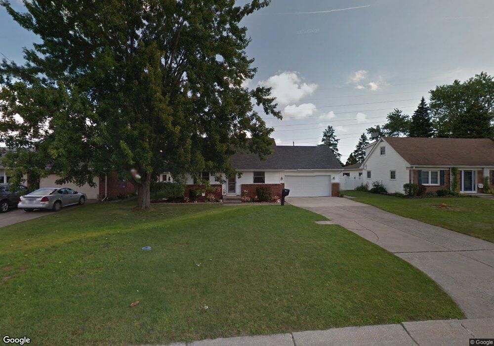
311 Elm St Walbridge, OH 43465
Estimated Value: $227,000 - $287,000
3
Beds
2
Baths
1,845
Sq Ft
$139/Sq Ft
Est. Value
About This Home
This home is located at 311 Elm St, Walbridge, OH 43465 and is currently estimated at $256,671, approximately $139 per square foot. 311 Elm St is a home located in Wood County with nearby schools including Lake Elementary School, Lake Middle School, and Lake High School.
Ownership History
Date
Name
Owned For
Owner Type
Purchase Details
Closed on
Feb 17, 2006
Sold by
Prudential Relocation Inc
Bought by
Marchetto Timothy A and Marchetto Michelle M
Current Estimated Value
Home Financials for this Owner
Home Financials are based on the most recent Mortgage that was taken out on this home.
Original Mortgage
$109,600
Outstanding Balance
$61,700
Interest Rate
6.2%
Mortgage Type
Fannie Mae Freddie Mac
Estimated Equity
$194,971
Purchase Details
Closed on
Jun 28, 2005
Sold by
Pasqualone Eric L and Martin Tina M
Bought by
Prudential Residential Services Lp and Prudential Homes Corp
Purchase Details
Closed on
Jun 27, 1996
Sold by
Defalco Karla
Bought by
Lowell Michael and Lowell Cynthia
Purchase Details
Closed on
Mar 10, 1981
Bought by
Defalco Ralph J
Create a Home Valuation Report for This Property
The Home Valuation Report is an in-depth analysis detailing your home's value as well as a comparison with similar homes in the area
Home Values in the Area
Average Home Value in this Area
Purchase History
| Date | Buyer | Sale Price | Title Company |
|---|---|---|---|
| Marchetto Timothy A | $137,000 | None Available | |
| Prudential Residential Services Lp | $151,000 | -- | |
| Lowell Michael | $69,000 | -- | |
| Defalco Ralph J | -- | -- |
Source: Public Records
Mortgage History
| Date | Status | Borrower | Loan Amount |
|---|---|---|---|
| Open | Marchetto Timothy A | $109,600 |
Source: Public Records
Tax History Compared to Growth
Tax History
| Year | Tax Paid | Tax Assessment Tax Assessment Total Assessment is a certain percentage of the fair market value that is determined by local assessors to be the total taxable value of land and additions on the property. | Land | Improvement |
|---|---|---|---|---|
| 2024 | $2,873 | $64,855 | $13,090 | $51,765 |
| 2023 | $2,873 | $64,860 | $13,090 | $51,770 |
| 2021 | $2,833 | $54,500 | $12,950 | $41,550 |
| 2020 | $2,721 | $54,500 | $12,950 | $41,550 |
| 2019 | $2,515 | $46,410 | $12,950 | $33,460 |
| 2018 | $2,509 | $46,410 | $12,950 | $33,460 |
| 2017 | $2,558 | $46,410 | $12,950 | $33,460 |
| 2016 | $2,534 | $48,200 | $12,950 | $35,250 |
| 2015 | $2,534 | $48,200 | $12,950 | $35,250 |
| 2014 | $2,679 | $48,200 | $12,950 | $35,250 |
| 2013 | $2,796 | $48,200 | $12,950 | $35,250 |
Source: Public Records
Map
Nearby Homes
- 242 S Bridge Rd
- 241 S Bridge Rd
- 237 S Bridge Rd
- 238 S Bridge Rd
- 236 S Bridge Rd
- 232 S Bridge Rd
- 224 S Bridge Rd
- 215 Earl St
- 0 Drouillard Rd Lot 6 Unit 6136601
- 30643 Drouillard Rd
- 30619 Drouillard Rd
- 507 N Main St
- Integrity 2000 Plan at Meadowgate
- Integrity 1605 Plan at Meadowgate
- Integrity 2080 Plan at Meadowgate
- Integrity 1750 Plan at Meadowgate
- Integrity 1830 Plan at Meadowgate
- Integrity 2190 Plan at Meadowgate
- Integrity 2060 Plan at Meadowgate
- Integrity 1910 Plan at Meadowgate