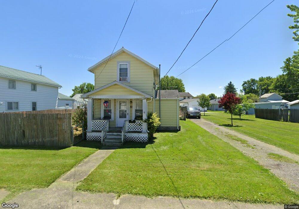
311 Emerson St Bucyrus, OH 44820
Estimated Value: $78,000 - $90,000
2
Beds
1
Bath
986
Sq Ft
$84/Sq Ft
Est. Value
About This Home
This home is located at 311 Emerson St, Bucyrus, OH 44820 and is currently estimated at $83,061, approximately $84 per square foot. 311 Emerson St is a home located in Crawford County with nearby schools including Bucyrus Elementary School, Bucyrus Secondary School, and Holy Trinity School.
Ownership History
Date
Name
Owned For
Owner Type
Purchase Details
Closed on
Dec 27, 2018
Sold by
Hook Joseph A
Bought by
Hook Joseph A
Current Estimated Value
Purchase Details
Closed on
Oct 10, 2018
Sold by
Rupert Charles A
Bought by
Hook Joseph A
Purchase Details
Closed on
May 23, 2011
Sold by
Brown Kenneth M
Bought by
Rupert Charles A
Purchase Details
Closed on
Oct 9, 2001
Sold by
Brown Kenneth M
Bought by
Rupert Charles A
Create a Home Valuation Report for This Property
The Home Valuation Report is an in-depth analysis detailing your home's value as well as a comparison with similar homes in the area
Home Values in the Area
Average Home Value in this Area
Purchase History
| Date | Buyer | Sale Price | Title Company |
|---|---|---|---|
| Hook Joseph A | -- | None Available | |
| Hook Joseph A | $5,800 | None Available | |
| Rupert Charles A | $21,000 | -- | |
| Rupert Charles A | $21,000 | None Available |
Source: Public Records
Tax History Compared to Growth
Tax History
| Year | Tax Paid | Tax Assessment Tax Assessment Total Assessment is a certain percentage of the fair market value that is determined by local assessors to be the total taxable value of land and additions on the property. | Land | Improvement |
|---|---|---|---|---|
| 2024 | $1,006 | $22,600 | $5,900 | $16,700 |
| 2023 | $501 | $9,370 | $4,610 | $4,760 |
| 2022 | $500 | $9,370 | $4,610 | $4,760 |
| 2021 | $499 | $9,370 | $4,610 | $4,760 |
| 2020 | $457 | $8,140 | $4,610 | $3,530 |
| 2019 | $467 | $8,140 | $4,610 | $3,530 |
| 2018 | $330 | $5,770 | $2,240 | $3,530 |
| 2017 | $373 | $6,300 | $2,240 | $4,060 |
| 2016 | $362 | $6,300 | $2,240 | $4,060 |
| 2015 | $357 | $6,300 | $2,240 | $4,060 |
| 2014 | $355 | $6,300 | $2,240 | $4,060 |
| 2013 | $355 | $6,300 | $2,240 | $4,060 |
Source: Public Records
Map
Nearby Homes
- 1200 N Sandusky Ave
- 926 Maple St
- 517 Plymouth St
- 1575 N Sandusky Ave
- 800 High St
- 1023 Tiffin St Unit Lot 5
- 1023 Tiffin St Unit 17
- 1023 Tiffin St Unit 30
- 231 E Mary St
- 210 N Walnut St
- 1792 Tiffin Rd
- 407 E Mansfield St
- 412 E Rensselaer St
- 609 W Perry St
- 231 E Rensselaer St
- 223 E Rensselaer St
- 1201 Reid St
- 400 W Mansfield St
- 885 W Perry St
- 444 Woodlawn Ave