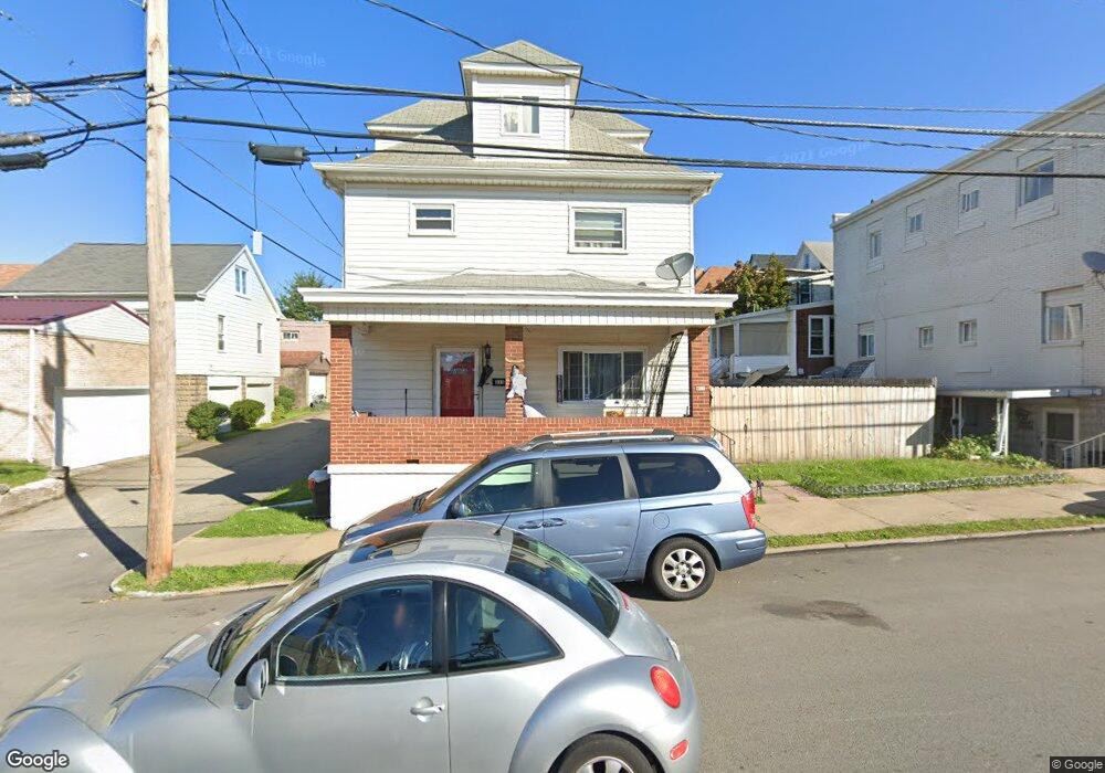
311 Locust St New Kensington, PA 15068
Estimated Value: $58,000 - $96,000
3
Beds
1
Bath
--
Sq Ft
2,091
Sq Ft Lot
About This Home
This home is located at 311 Locust St, New Kensington, PA 15068 and is currently estimated at $73,139. 311 Locust St is a home located in Westmoreland County with nearby schools including Mary Queen of Apostles School.
Ownership History
Date
Name
Owned For
Owner Type
Purchase Details
Closed on
Mar 2, 2018
Sold by
George Bethany
Bought by
Pelican Megan Rose
Current Estimated Value
Purchase Details
Closed on
Jan 27, 2017
Sold by
The Huntingon Nationalbank
Bought by
George Bethany
Purchase Details
Closed on
Dec 21, 2015
Sold by
Graham Harold
Bought by
The Huntington National Bank
Purchase Details
Closed on
Jun 1, 2007
Sold by
Davis Ervin T and Davis Katherine
Bought by
Graham Harold R and Graham Beverley D
Create a Home Valuation Report for This Property
The Home Valuation Report is an in-depth analysis detailing your home's value as well as a comparison with similar homes in the area
Home Values in the Area
Average Home Value in this Area
Purchase History
| Date | Buyer | Sale Price | Title Company |
|---|---|---|---|
| Pelican Megan Rose | $27,500 | None Available | |
| George Bethany | $11,550 | None Available | |
| The Huntington National Bank | $2,834 | None Available | |
| Graham Harold R | $38,750 | None Available |
Source: Public Records
Tax History Compared to Growth
Tax History
| Year | Tax Paid | Tax Assessment Tax Assessment Total Assessment is a certain percentage of the fair market value that is determined by local assessors to be the total taxable value of land and additions on the property. | Land | Improvement |
|---|---|---|---|---|
| 2025 | $1,718 | $10,760 | $2,150 | $8,610 |
| 2024 | $1,702 | $10,760 | $2,150 | $8,610 |
| 2023 | $1,610 | $10,760 | $2,150 | $8,610 |
| 2022 | $1,561 | $10,760 | $2,150 | $8,610 |
| 2021 | $1,526 | $10,760 | $2,150 | $8,610 |
| 2020 | $1,493 | $10,760 | $2,150 | $8,610 |
| 2019 | $1,456 | $10,760 | $2,150 | $8,610 |
| 2018 | $1,434 | $10,760 | $2,150 | $8,610 |
| 2017 | $1,413 | $10,760 | $2,150 | $8,610 |
| 2016 | $1,413 | $10,760 | $2,150 | $8,610 |
| 2015 | $1,413 | $10,760 | $2,150 | $8,610 |
| 2014 | $1,357 | $10,760 | $2,150 | $8,610 |
Source: Public Records
Map
Nearby Homes
- 1134 Leishman Ave
- 201 Locust St
- 105 Locust St
- 1233 Kenneth Ave
- 1240 Victoria Ave
- 1218 Woodmont Ave
- 1025 Kenneth Ave
- 318 Ridge Ave
- 486 McCargo St
- 1312 Woodmont Ave
- 327 Charles Ave
- 254 Ridge Ave
- 1308 Taylor Ave
- 125 North St
- 533 Freeport Rd
- 1512 Kenneth Ave
- 1506 Victoria Ave
- 1521 Victoria Ave
- 1515 Woodmont Ave
- 225 Highland Ave
- 1207 Victoria Ave
- 1209 Victoria Ave
- 1200 Leishman Ave
- 1200 Leishman Ave Unit 17
- 1206 Leishman Ave
- 1206 Leishman Ave
- 1211 Victoria Ave
- 1208 Leishman Ave
- 1210 Leishman Ave
- 1210 Leishman Ave
- 1215 Victoria Ave
- 1212 Leishman Ave
- 1214 Leishman Ave
- 1219 Victoria Ave
- 1210 Victoria Ave
- 1216 Leishman Ave
- 1144 Victoria Ave
- 1136 Leishman Ave
- 1221 Victoria Ave
- 1200 Victoria Ave