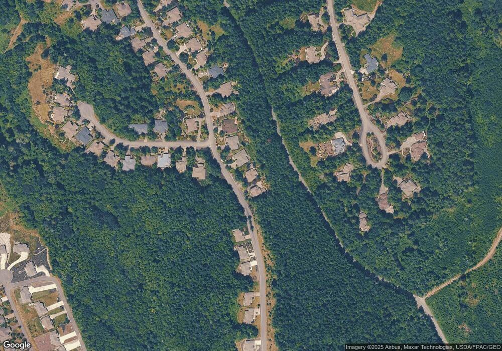
311 Mount Constance Way Port Ludlow, WA 98365
Port Ludlow NeighborhoodEstimated Value: $781,819 - $884,000
2
Beds
3
Baths
2,624
Sq Ft
$321/Sq Ft
Est. Value
About This Home
This home is located at 311 Mount Constance Way, Port Ludlow, WA 98365 and is currently estimated at $843,455, approximately $321 per square foot. 311 Mount Constance Way is a home located in Jefferson County with nearby schools including Chimacum Creek Primary School, Chimacum School Pi Program, and Chimacum Elementary School.
Ownership History
Date
Name
Owned For
Owner Type
Purchase Details
Closed on
May 22, 2006
Sold by
Port Ludlow Associates Llc
Bought by
Simmons Vernon Dale and Simmons Shusan L
Current Estimated Value
Home Financials for this Owner
Home Financials are based on the most recent Mortgage that was taken out on this home.
Original Mortgage
$200,000
Outstanding Balance
$116,229
Interest Rate
6.46%
Mortgage Type
New Conventional
Estimated Equity
$727,226
Create a Home Valuation Report for This Property
The Home Valuation Report is an in-depth analysis detailing your home's value as well as a comparison with similar homes in the area
Home Values in the Area
Average Home Value in this Area
Purchase History
| Date | Buyer | Sale Price | Title Company |
|---|---|---|---|
| Simmons Vernon Dale | -- | None Available |
Source: Public Records
Mortgage History
| Date | Status | Borrower | Loan Amount |
|---|---|---|---|
| Open | Simmons Vernon Dale | $200,000 |
Source: Public Records
Tax History Compared to Growth
Tax History
| Year | Tax Paid | Tax Assessment Tax Assessment Total Assessment is a certain percentage of the fair market value that is determined by local assessors to be the total taxable value of land and additions on the property. | Land | Improvement |
|---|---|---|---|---|
| 2024 | $5,574 | $750,439 | $131,250 | $619,189 |
| 2023 | $5,574 | $712,268 | $120,000 | $592,268 |
| 2022 | $4,602 | $707,268 | $115,000 | $592,268 |
| 2021 | $4,742 | $507,739 | $100,000 | $407,739 |
| 2020 | $4,513 | $492,056 | $100,000 | $392,056 |
| 2019 | $4,245 | $452,692 | $92,000 | $360,692 |
| 2018 | $4,346 | $429,010 | $84,000 | $345,010 |
| 2017 | $4,239 | $388,645 | $75,000 | $313,645 |
| 2016 | $3,962 | $388,645 | $75,000 | $313,645 |
| 2015 | $3,907 | $356,104 | $102,375 | $253,729 |
| 2014 | -- | $356,104 | $102,375 | $253,729 |
| 2013 | -- | $339,145 | $97,500 | $241,645 |
Source: Public Records
Map
Nearby Homes
- 490 Mount Constance Way
- 61 McCartney Peak Ln
- 61 McCartney Peak Ln Unit 73
- 11 McCartney Peak Ln Unit 78
- 83 Pelton Ct
- 81 Mccartney Ln
- 71 Mccartney Ln
- 90 Mccartney Ln
- 63 Red Cedar Ln
- 51 McCartney Peak Ln Unit 74
- 310 Cameron Dr
- 250 Cameron Dr
- 184 Dogleg Ln
- 71 McCartney Peak Ln Unit 72
- 81 McCartney Peak Ln Unit 71
- 80 McCartney Peak Ln Unit 69
- 90 McCartney Peak Ln Unit 70
- 23 Seaway Place
- 211 Greenview Ln
- 999 Highland Dr
- 291 Mount Constance Way
- 331 Mount Constance Way
- 271 Mount Constance Way
- 21 Mount Christie Ct
- 241 Mount Constance Way
- 231 Mount Constance Way
- 31 Mount Christie Ct
- 240 Mount Constance Way
- 504 Woodridge Dr
- 221 Mount Constance Way
- 221 Mt Constance Way
- 376 Mount Constance Way
- 51 Mount Christie Ct
- 532 Woodridge Dr
- 454 Woodridge Dr
- 472 Mount Constance Way
- 61 Mount Christie Ct
- 40 Mount Christie Ct
- 201 Mount Constance Way
