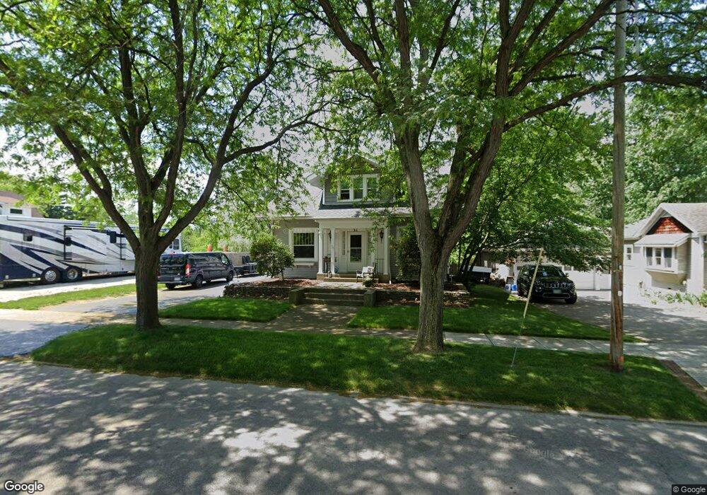
311 N Main St Swanton, OH 43558
Estimated Value: $203,000 - $247,000
3
Beds
2
Baths
2,884
Sq Ft
$80/Sq Ft
Est. Value
About This Home
This home is located at 311 N Main St, Swanton, OH 43558 and is currently estimated at $230,182, approximately $79 per square foot. 311 N Main St is a home located in Fulton County with nearby schools including Swanton High School, Swanton Middle School, and St. Richard School.
Ownership History
Date
Name
Owned For
Owner Type
Purchase Details
Closed on
Sep 29, 2005
Sold by
Schmidt Robert Vaughn and Schmidt Deborah J
Bought by
Terteling Ryan J and Terteling Courtney J
Current Estimated Value
Home Financials for this Owner
Home Financials are based on the most recent Mortgage that was taken out on this home.
Original Mortgage
$154,400
Outstanding Balance
$83,784
Interest Rate
5.98%
Mortgage Type
Purchase Money Mortgage
Estimated Equity
$146,398
Purchase Details
Closed on
Jan 1, 1990
Bought by
Schmidt Robert V -Deborah
Create a Home Valuation Report for This Property
The Home Valuation Report is an in-depth analysis detailing your home's value as well as a comparison with similar homes in the area
Home Values in the Area
Average Home Value in this Area
Purchase History
| Date | Buyer | Sale Price | Title Company |
|---|---|---|---|
| Terteling Ryan J | $193,000 | -- | |
| Schmidt Robert V -Deborah | -- | -- |
Source: Public Records
Mortgage History
| Date | Status | Borrower | Loan Amount |
|---|---|---|---|
| Open | Terteling Ryan J | $154,400 |
Source: Public Records
Tax History Compared to Growth
Tax History
| Year | Tax Paid | Tax Assessment Tax Assessment Total Assessment is a certain percentage of the fair market value that is determined by local assessors to be the total taxable value of land and additions on the property. | Land | Improvement |
|---|---|---|---|---|
| 2024 | $2,774 | $67,690 | $6,020 | $61,670 |
| 2023 | $2,798 | $67,690 | $6,020 | $61,670 |
| 2022 | $2,465 | $52,440 | $5,010 | $47,430 |
| 2021 | $2,608 | $52,440 | $5,010 | $47,430 |
| 2020 | $2,577 | $52,440 | $5,010 | $47,430 |
| 2019 | $1,926 | $38,090 | $5,010 | $33,080 |
| 2018 | $1,919 | $38,090 | $5,010 | $33,080 |
| 2017 | $1,891 | $38,090 | $5,010 | $33,080 |
| 2016 | $2,003 | $38,090 | $5,010 | $33,080 |
| 2015 | $1,903 | $38,090 | $5,010 | $33,080 |
| 2014 | $1,925 | $38,090 | $5,010 | $33,080 |
| 2013 | $1,962 | $38,400 | $4,620 | $33,780 |
Source: Public Records
Map
Nearby Homes
- 227 Kierra Ln
- 203 Cherry St
- 103 Cherry St
- 502 Brookside Dr
- 0 Waterwood Dr
- 113 West St
- 433 Church St
- 214 Franklin Ave
- 215 Hickory St
- 407 E Garfield Ave
- 404 E Garfield Ave
- 510 S Main St
- 7893 County Road 2
- 225 Kierra Ln
- 2121 Holiday Dr
- 4303 S Berkey Southern Rd
- 13645 Shaffer Rd
- 6854 County Road 3
- 13560 Old State Line Rd
- 12922 Airport Hwy