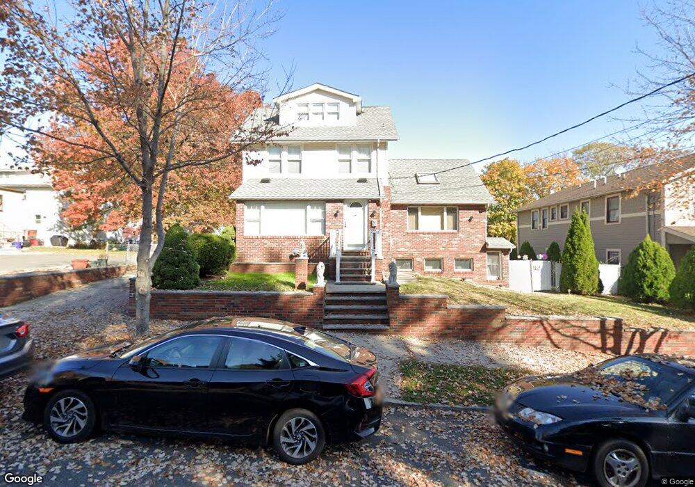
311 Post Ave Lyndhurst, NJ 07071
Estimated Value: $665,071 - $752,000
Studio
--
Bath
1,652
Sq Ft
$437/Sq Ft
Est. Value
About This Home
This home is located at 311 Post Ave, Lyndhurst, NJ 07071 and is currently estimated at $721,768, approximately $436 per square foot. 311 Post Ave is a home located in Bergen County with nearby schools including Lyndhurst High School and Sacred Heart School.
Ownership History
Date
Name
Owned For
Owner Type
Purchase Details
Closed on
Jul 1, 2003
Sold by
Simpson Romina
Bought by
Dasler Robert and Dasler Patricia
Current Estimated Value
Home Financials for this Owner
Home Financials are based on the most recent Mortgage that was taken out on this home.
Original Mortgage
$308,000
Outstanding Balance
$132,820
Interest Rate
5.45%
Estimated Equity
$588,948
Create a Home Valuation Report for This Property
The Home Valuation Report is an in-depth analysis detailing your home's value as well as a comparison with similar homes in the area
Home Values in the Area
Average Home Value in this Area
Purchase History
| Date | Buyer | Sale Price | Title Company |
|---|---|---|---|
| Dasler Robert | $385,000 | -- |
Source: Public Records
Mortgage History
| Date | Status | Borrower | Loan Amount |
|---|---|---|---|
| Open | Dasler Robert | $308,000 |
Source: Public Records
Tax History
| Year | Tax Paid | Tax Assessment Tax Assessment Total Assessment is a certain percentage of the fair market value that is determined by local assessors to be the total taxable value of land and additions on the property. | Land | Improvement |
|---|---|---|---|---|
| 2025 | $11,992 | $580,900 | $302,400 | $278,500 |
| 2024 | $11,560 | $574,900 | $299,500 | $275,400 |
| 2023 | $11,375 | $568,900 | $296,700 | $272,200 |
| 2022 | $11,375 | $358,600 | $212,500 | $146,100 |
| 2021 | $10,901 | $358,600 | $212,500 | $146,100 |
| 2020 | $10,665 | $358,600 | $212,500 | $146,100 |
| 2019 | $10,586 | $358,600 | $212,500 | $146,100 |
| 2018 | $10,672 | $358,600 | $212,500 | $146,100 |
| 2017 | $10,403 | $358,600 | $212,500 | $146,100 |
| 2016 | $10,170 | $358,600 | $212,500 | $146,100 |
| 2015 | $9,851 | $358,600 | $212,500 | $146,100 |
| 2014 | $9,722 | $358,600 | $212,500 | $146,100 |
Source: Public Records
Map
Nearby Homes
- 521 Weart Ave
- 179 Fern Ave
- 433 Chase Ave
- 200 Page Ave
- 230 New St
- 167 Valley Brook Ave
- 271 Travers Place
- 320 Watson Ave
- 232 Stuyvesant Ave
- 252 Oriental Place
- 609 Chase Ave
- 712 Meyer Ave
- 715 Stuyvesant Ave
- 715 Tyler St
- 220 Webster Ave
- 245 Court Ave Unit 7
- 249 Court Ave Unit 51
- 319 Ridge Rd
- 539 Freeman St
- 651 Riverside Ave Unit A7
- 319 Post Ave
- 321 Post Ave
- 422 Stuyvesant Ave
- 422 Stuyvesant Ave Unit 2
- 325 Post Ave
- 308 Post Ave
- 327 Post Ave
- 318 Post Ave
- 326 Fern Ave
- 432 Stuyvesant Ave
- 432 Stuyvesant Ave Unit 2
- 331 Post Ave
- 324 Post Ave
- 438 Stuyvesant Ave
- 330 Fern Ave
- 330 Fern Ave Unit 2
- 328 Post Ave
- 333 Post Ave
- 442 Stuyvesant Ave
- 330 Post Ave
Your Personal Tour Guide
Ask me questions while you tour the home.