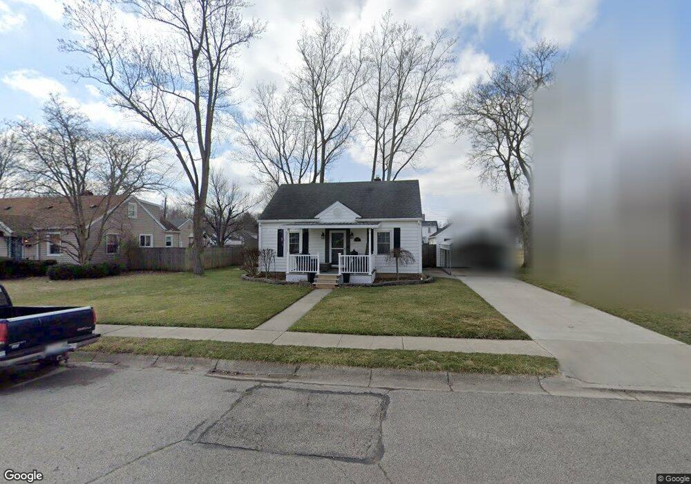
311 S Adams St New Carlisle, OH 45344
Estimated Value: $131,000 - $168,000
2
Beds
1
Bath
1,092
Sq Ft
$140/Sq Ft
Est. Value
About This Home
This home is located at 311 S Adams St, New Carlisle, OH 45344 and is currently estimated at $152,769, approximately $139 per square foot. 311 S Adams St is a home located in Clark County with nearby schools including New Carlisle Elementary School, Park Layne Elementary School, and Donnelsville Elementary School.
Ownership History
Date
Name
Owned For
Owner Type
Purchase Details
Closed on
Oct 29, 1999
Sold by
Schubert Charles W
Bought by
Roach Michael A and Roach Tamara L
Current Estimated Value
Home Financials for this Owner
Home Financials are based on the most recent Mortgage that was taken out on this home.
Original Mortgage
$70,779
Interest Rate
7.87%
Mortgage Type
FHA
Purchase Details
Closed on
Mar 1, 1990
Create a Home Valuation Report for This Property
The Home Valuation Report is an in-depth analysis detailing your home's value as well as a comparison with similar homes in the area
Home Values in the Area
Average Home Value in this Area
Purchase History
| Date | Buyer | Sale Price | Title Company |
|---|---|---|---|
| Roach Michael A | $70,900 | -- | |
| -- | -- | -- |
Source: Public Records
Mortgage History
| Date | Status | Borrower | Loan Amount |
|---|---|---|---|
| Open | Roach Michael A | $103,373 | |
| Closed | Roach Michael A | $14,900 | |
| Closed | Roach Michael | $118,436 | |
| Closed | Roach Michael A | $92,047 | |
| Closed | Roach Michael A | $25,000 | |
| Closed | Roach Michael A | $97,500 | |
| Closed | Roach Michael A | $15,274 | |
| Closed | Roach Michael A | $70,779 |
Source: Public Records
Tax History Compared to Growth
Tax History
| Year | Tax Paid | Tax Assessment Tax Assessment Total Assessment is a certain percentage of the fair market value that is determined by local assessors to be the total taxable value of land and additions on the property. | Land | Improvement |
|---|---|---|---|---|
| 2024 | -- | $41,370 | $7,840 | $33,530 |
| 2023 | $2,074 | $41,370 | $7,840 | $33,530 |
| 2022 | $596 | $41,370 | $7,840 | $33,530 |
| 2021 | $1,866 | $32,190 | $6,640 | $25,550 |
| 2020 | $1,870 | $32,190 | $6,640 | $25,550 |
| 2019 | $1,901 | $32,190 | $6,640 | $25,550 |
| 2018 | $1,151 | $17,920 | $6,300 | $11,620 |
| 2017 | $1,074 | $21,490 | $6,300 | $15,190 |
| 2016 | $1,068 | $21,490 | $6,300 | $15,190 |
| 2015 | $1,191 | $21,490 | $6,300 | $15,190 |
| 2014 | $1,181 | $21,490 | $6,300 | $15,190 |
| 2013 | $1,184 | $21,490 | $6,300 | $15,190 |
Source: Public Records
Map
Nearby Homes
- 312 Jefferson St
- 514 W Jefferson St
- 110 E Lincoln St
- 210 Zimmerman St
- 224 Orth Dr
- 1101 Cambridge Ct Unit 1103
- 225 Prentice Dr
- 202 Fenwick Dr
- 222 Rawson Dr
- 315 Fenwick Dr
- 212 Lightfoot Ct
- 214 Lightfoot Ct
- 201 Lightfoot Ct
- 211 Lightfoot Ct
- 1204 N Scott St
- 1211 N Scott St
- 1207 N Scott St
- 10850 Musselman Rd
- 203 Monroe Way
- 214 Meadow Dr
- 313 S Adams St
- 309 S Adams St
- 305 S Adams St
- 315 S Adams St
- 310 S Scott St
- 310 S Scott St
- 312 S Scott St
- 308 S Scott St
- 312 S Adams St
- 316 1/2 S Scott St
- 316 S Scott St
- 317 S Adams St
- 310 S Adams St
- 314 S Adams St
- 308 S Adams St
- 318 S Adams St
- 304 S Scott St
- 319 S Adams St
- 320 S Scott St
- 304 W Madison St