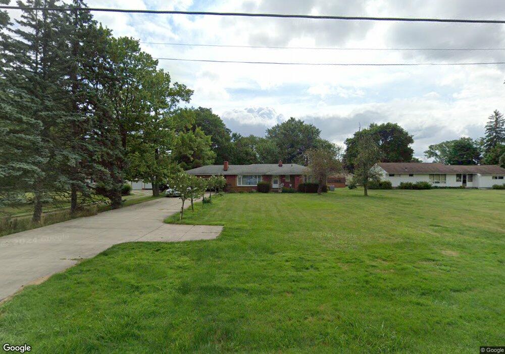
311 S Munroe Rd Tallmadge, OH 44278
Estimated Value: $246,000 - $299,000
3
Beds
2
Baths
1,398
Sq Ft
$200/Sq Ft
Est. Value
About This Home
This home is located at 311 S Munroe Rd, Tallmadge, OH 44278 and is currently estimated at $280,249, approximately $200 per square foot. 311 S Munroe Rd is a home located in Summit County with nearby schools including Tallmadge Middle School, Tallmadge High School, and Cornerstone Community School.
Ownership History
Date
Name
Owned For
Owner Type
Purchase Details
Closed on
Mar 20, 2020
Sold by
Kever Thomas J and Kever Nancy L
Bought by
Kever Peter B and The Kever Irrevocable Trust
Current Estimated Value
Purchase Details
Closed on
Jul 7, 2008
Sold by
Smith Trudy and Smith Larry
Bought by
Kever Thomas J and Kever Nancy L
Purchase Details
Closed on
Dec 7, 1999
Sold by
Galambos Andrew
Bought by
Smith Trudy and Galambos Ed
Purchase Details
Closed on
Sep 23, 1999
Sold by
Estate Of Elizabeth Galambos
Bought by
Galambos Andrew
Create a Home Valuation Report for This Property
The Home Valuation Report is an in-depth analysis detailing your home's value as well as a comparison with similar homes in the area
Home Values in the Area
Average Home Value in this Area
Purchase History
| Date | Buyer | Sale Price | Title Company |
|---|---|---|---|
| Kever Peter B | -- | None Available | |
| Kever Thomas J | $130,000 | Attorney | |
| Smith Trudy | -- | -- | |
| Galambos Andrew | -- | -- |
Source: Public Records
Tax History Compared to Growth
Tax History
| Year | Tax Paid | Tax Assessment Tax Assessment Total Assessment is a certain percentage of the fair market value that is determined by local assessors to be the total taxable value of land and additions on the property. | Land | Improvement |
|---|---|---|---|---|
| 2025 | $3,892 | $85,992 | $16,272 | $69,720 |
| 2024 | $3,892 | $85,992 | $16,272 | $69,720 |
| 2023 | $3,892 | $85,992 | $16,272 | $69,720 |
| 2022 | $3,096 | $58,500 | $11,071 | $47,429 |
| 2021 | $3,109 | $58,500 | $11,071 | $47,429 |
| 2020 | $3,085 | $58,500 | $11,070 | $47,430 |
| 2019 | $2,209 | $40,350 | $10,290 | $30,060 |
| 2018 | $1,953 | $40,350 | $10,290 | $30,060 |
| 2017 | $1,970 | $40,350 | $10,290 | $30,060 |
| 2016 | $2,120 | $40,350 | $10,290 | $30,060 |
| 2015 | $1,970 | $40,350 | $10,290 | $30,060 |
| 2014 | $1,957 | $40,350 | $10,290 | $30,060 |
| 2013 | $2,041 | $42,350 | $10,290 | $32,060 |
Source: Public Records
Map
Nearby Homes
- 288 S Munroe Rd
- 243 S Munroe Rd
- 810 Norton Dr
- 821 Olde Orchard Dr
- 206 Fawnwood Dr
- 523 S Munroe Rd
- 549 S Munroe Rd
- 213 Green Hill Dr
- 786 Southeast Ave
- 185 Reserve Dr
- 988 Beechwood Dr
- 0 East Ave
- 1029 Maple St
- 353 Southeast Ave
- 1034 Southeast Ave
- 1075 Amy Trail
- 330 Hanna Dr
- 750 Danner Rd
- 313 Southeast Ave
- 758 Humble Rd
- 321 S Munroe Rd
- 291 S Munroe Rd
- 709 Norton Dr
- 320 S Munroe Rd
- 719 Norton Dr
- 304 S Munroe Rd
- 279 S Munroe Rd
- 330 S Munroe Rd
- 710 Norton Dr
- 363 S Munroe Rd
- 720 Norton Dr
- 346 S Munroe Rd
- 739 Norton Dr
- 730 Norton Dr
- 373 S Munroe Rd
- 360 S Munroe Rd
- 263 S Munroe Rd
- 723 Olde Orchard Dr
- 740 Norton Dr
- 383 S Munroe Rd