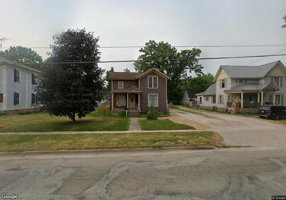
311 W Capital Ave Bellevue, MI 49021
Estimated Value: $152,000 - $176,000
4
Beds
2
Baths
1,822
Sq Ft
$93/Sq Ft
Est. Value
About This Home
This home is located at 311 W Capital Ave, Bellevue, MI 49021 and is currently estimated at $168,678, approximately $92 per square foot. 311 W Capital Ave is a home located in Eaton County with nearby schools including Bellevue Elementary School, Bellevue Junior/Senior High School, and Mt. Olivet Christian School.
Ownership History
Date
Name
Owned For
Owner Type
Purchase Details
Closed on
Mar 19, 2008
Sold by
Waldo E Frankenstein Pour Over Trust
Bought by
Living Trust Of Bridgett Mary Frankenste
Current Estimated Value
Purchase Details
Closed on
May 2, 2006
Sold by
Frankenstein Waldo E
Bought by
Frankenstein Bridgett Mary
Purchase Details
Closed on
Mar 10, 2004
Sold by
Campbell Joseph R and Campbell Terri L
Bought by
Waldo E Frankenstein Pour Over Trust
Home Financials for this Owner
Home Financials are based on the most recent Mortgage that was taken out on this home.
Original Mortgage
$65,000
Interest Rate
5.78%
Mortgage Type
Purchase Money Mortgage
Create a Home Valuation Report for This Property
The Home Valuation Report is an in-depth analysis detailing your home's value as well as a comparison with similar homes in the area
Home Values in the Area
Average Home Value in this Area
Purchase History
| Date | Buyer | Sale Price | Title Company |
|---|---|---|---|
| Living Trust Of Bridgett Mary Frankenste | -- | First American Title Ins Co | |
| Frankenstein Bridgett Mary | -- | None Available | |
| Waldo E Frankenstein Pour Over Trust | $98,500 | Chicago Title |
Source: Public Records
Mortgage History
| Date | Status | Borrower | Loan Amount |
|---|---|---|---|
| Previous Owner | Waldo E Frankenstein Pour Over Trust | $65,000 |
Source: Public Records
Tax History
| Year | Tax Paid | Tax Assessment Tax Assessment Total Assessment is a certain percentage of the fair market value that is determined by local assessors to be the total taxable value of land and additions on the property. | Land | Improvement |
|---|---|---|---|---|
| 2025 | $1,279 | $83,892 | $14,391 | $69,501 |
| 2024 | $452 | $78,301 | $0 | $0 |
| 2023 | $431 | $62,396 | $0 | $0 |
| 2022 | $1,160 | $61,898 | $0 | $0 |
| 2021 | $1,106 | $42,047 | $0 | $0 |
| 2020 | $1,532 | $41,361 | $0 | $0 |
| 2019 | $1,071 | $35,643 | $0 | $0 |
| 2018 | $1,046 | $35,197 | $0 | $0 |
| 2017 | $1,024 | $32,972 | $0 | $0 |
| 2016 | -- | $32,367 | $0 | $0 |
| 2015 | -- | $33,780 | $0 | $0 |
| 2014 | -- | $31,586 | $0 | $0 |
| 2013 | -- | $31,089 | $0 | $0 |
Source: Public Records
Map
Nearby Homes
- 426 S Webster St
- 0 Spaulding Ct
- 408 Lake St
- 423 E Ellsworth St
- 710 Madison St
- 9321 S Ionia Rd
- 8590 Greenfield Hwy
- 9325 Burton Hwy
- 7169 Sherwood Hwy
- 7407 Baseline Rd
- 7362 S Lacey Lake Rd
- 6322 Sherwood Hwy
- 23667 17 Mile Rd
- 0 S Lacey Lake Rd Unit 293299
- 0 Burrows T Dr N Unit 20261014481
- 11150 W Dr N
- 10195 Cox Rd
- VL 0000 Michigan 78
- 9820 W 5 Point Hwy
- 22092 Clear Lake Rd
- 319 W Capital Ave
- 303 W Capital Ave
- 121 S Williams St
- 325 W Capital Ave
- 127 S Williams St
- 310 W Capital Ave
- 318 W Capital Ave
- 304 W Capital Ave
- 120 S Williams St
- 324 W Capital Ave
- 403 W Capital Ave
- 222 W Caroline St
- 222 W Capital Ave
- 404 W Capital Ave
- 212 W Caroline St
- 203 S Williams St
- 119 N Williams St
- 207 W Capital Ave
- 210 W Caroline St
- 120 N Williams St
Your Personal Tour Guide
Ask me questions while you tour the home.