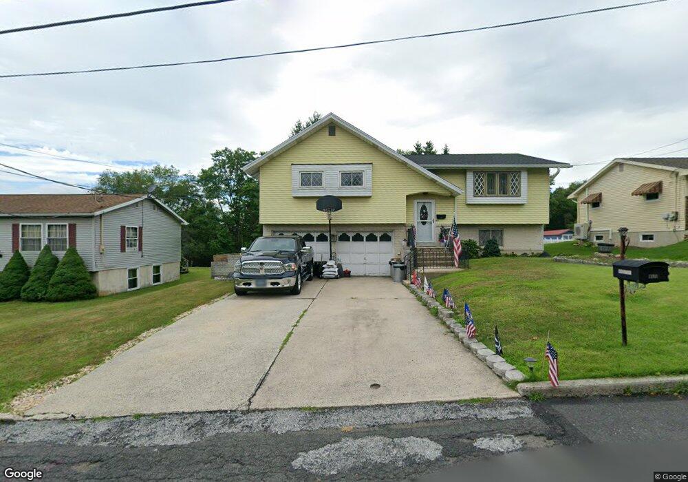
311 Wilson Ave Port Carbon, PA 17965
Estimated Value: $176,000 - $262,000
3
Beds
2
Baths
1,814
Sq Ft
$117/Sq Ft
Est. Value
About This Home
This home is located at 311 Wilson Ave, Port Carbon, PA 17965 and is currently estimated at $211,793, approximately $116 per square foot. 311 Wilson Ave is a home located in Schuylkill County with nearby schools including Clarke Elementary Center, Lengel Middle School, and Pottsville Area High School.
Create a Home Valuation Report for This Property
The Home Valuation Report is an in-depth analysis detailing your home's value as well as a comparison with similar homes in the area
Home Values in the Area
Average Home Value in this Area
Mortgage History
| Date | Status | Borrower | Loan Amount |
|---|---|---|---|
| Closed | Brennan Kathleen M | $104,000 | |
| Closed | Brennan Kathleen M | $10,000 |
Source: Public Records
Tax History Compared to Growth
Tax History
| Year | Tax Paid | Tax Assessment Tax Assessment Total Assessment is a certain percentage of the fair market value that is determined by local assessors to be the total taxable value of land and additions on the property. | Land | Improvement |
|---|---|---|---|---|
| 2025 | $4,292 | $52,865 | $6,650 | $46,215 |
| 2024 | $3,908 | $52,865 | $6,650 | $46,215 |
| 2023 | $3,908 | $52,865 | $6,650 | $46,215 |
| 2022 | $3,862 | $52,865 | $6,650 | $46,215 |
| 2021 | $3,894 | $52,865 | $6,650 | $46,215 |
| 2020 | $3,810 | $52,865 | $6,650 | $46,215 |
| 2018 | $3,632 | $52,865 | $6,650 | $46,215 |
| 2017 | $3,398 | $52,865 | $6,650 | $46,215 |
| 2015 | -- | $52,865 | $6,650 | $46,215 |
| 2011 | -- | $52,865 | $0 | $0 |
Source: Public Records
Map
Nearby Homes
- 308 Wilson Ave
- 337 Coal St
- 103 Market St
- 219 Pike St
- 25 N Coal St
- 542 3rd St
- 5 E Washington St
- 2 Ridgeside Dr
- 0 Port Carbon Saint Clair Hwy
- 806 Park Ave
- 10 Tuscarora St
- 1407 E Norwegian St
- 344 E Bacon St
- 211 E Bacon St
- 665 Port Carbon Saint Clair Hwy
- 702 & 698 Port Carbon St Clair Hwy
- 111 Fox St
- 29 E Savory St
- 21 Park St
- 714 Port Carbon Saint Clair Hwy