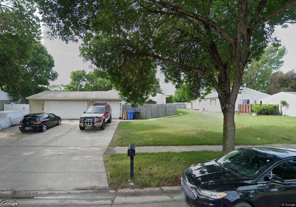
3110 Westgate Dr S Fargo, ND 58103
Westgate NeighborhoodEstimated Value: $209,897 - $255,000
--
Bed
--
Bath
1,028
Sq Ft
$233/Sq Ft
Est. Value
About This Home
This home is located at 3110 Westgate Dr S, Fargo, ND 58103 and is currently estimated at $239,724, approximately $233 per square foot. 3110 Westgate Dr S is a home located in Cass County with nearby schools including Lewis & Clark Elementary School, Carl Ben Eielson Middle School, and South High School.
Ownership History
Date
Name
Owned For
Owner Type
Purchase Details
Closed on
Nov 6, 2020
Sold by
Marty Maryjo and Olander Lisa M
Bought by
Olander Lisa M and Lisa Olander Living Trust
Current Estimated Value
Purchase Details
Closed on
Sep 28, 2011
Sold by
Markovic Dolores
Bought by
Dolores Markonic Living Trust
Create a Home Valuation Report for This Property
The Home Valuation Report is an in-depth analysis detailing your home's value as well as a comparison with similar homes in the area
Home Values in the Area
Average Home Value in this Area
Purchase History
| Date | Buyer | Sale Price | Title Company |
|---|---|---|---|
| Olander Lisa M | -- | None Available | |
| Dolores Markonic Living Trust | -- | -- |
Source: Public Records
Tax History Compared to Growth
Tax History
| Year | Tax Paid | Tax Assessment Tax Assessment Total Assessment is a certain percentage of the fair market value that is determined by local assessors to be the total taxable value of land and additions on the property. | Land | Improvement |
|---|---|---|---|---|
| 2024 | $2,824 | $98,350 | $23,150 | $75,200 |
| 2023 | $2,810 | $98,350 | $23,150 | $75,200 |
| 2022 | $2,725 | $93,650 | $23,150 | $70,500 |
| 2021 | $2,337 | $80,800 | $22,300 | $58,500 |
| 2020 | $2,081 | $72,150 | $22,300 | $49,850 |
| 2019 | $2,083 | $72,150 | $12,400 | $59,750 |
| 2018 | $2,058 | $72,150 | $12,400 | $59,750 |
| 2017 | $1,949 | $68,700 | $12,400 | $56,300 |
| 2016 | $1,853 | $66,700 | $12,400 | $54,300 |
| 2015 | $1,931 | $64,100 | $9,300 | $54,800 |
| 2014 | $1,736 | $55,750 | $9,300 | $46,450 |
| 2013 | $1,740 | $55,750 | $9,300 | $46,450 |
Source: Public Records
Map
Nearby Homes
- 3211 15th Ave S Unit B
- 3210 15th Ave S
- 3217 15th Ave S
- 3208 16th Ave S
- 3250 15th Ave S Unit 2
- 3237 17th Ave S Unit 101
- 3253 17th Ave S Unit 101
- 2719 Cobblestone Ct S
- 1402 E Gateway Cir S Unit M
- 3420 17th Ave S Unit B
- 311 Prairiewood Cir S Unit 307
- 1725 Prairie Ln S
- 2202 15th Ave S
- 1427 23rd St S
- 71 Prairiewood Crossing S Unit B
- 1129 22nd St S Unit B09
- 3108 Westgate Dr S Unit 292
- 3114 Westgate Dr S
- 3116 Westgate Dr S
- 3120 Westgate Dr S
- 2909 Southgate Dr S
- 2913 Southgate Dr S
- 3122 Westgate Dr S
- 2901 Southgate Dr S
- 3107 Westgate Dr S
- 2905 Southgate Dr S
- 3109 Westgate Dr S
- 3103 Westgate Dr S
- 3101 Westgate Dr S
- 3113 Westgate Dr S
- 3115 Westgate Dr S
- 2919 Southgate Dr S
- 3119 Westgate Dr S
- 1502 W Gateway Cir S
- 3121 Westgate Dr S
- 1477 W Gateway Cir S