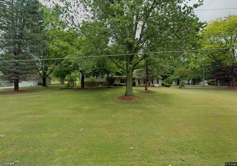
3111 N 350 E Rolling Prairie, IN 46371
Estimated Value: $305,000 - $361,000
3
Beds
3
Baths
2,656
Sq Ft
$126/Sq Ft
Est. Value
About This Home
This home is located at 3111 N 350 E, Rolling Prairie, IN 46371 and is currently estimated at $334,231, approximately $125 per square foot. 3111 N 350 E is a home located in LaPorte County with nearby schools including New Prairie High School and Sacred Heart Apostolic School.
Ownership History
Date
Name
Owned For
Owner Type
Purchase Details
Closed on
Oct 24, 2005
Sold by
Cox Kevin M and Clark Cox Kay
Bought by
Newcomb Scott A and Newcomb Amanda L
Current Estimated Value
Home Financials for this Owner
Home Financials are based on the most recent Mortgage that was taken out on this home.
Original Mortgage
$152,000
Outstanding Balance
$121,219
Interest Rate
6.97%
Mortgage Type
Fannie Mae Freddie Mac
Estimated Equity
$213,012
Create a Home Valuation Report for This Property
The Home Valuation Report is an in-depth analysis detailing your home's value as well as a comparison with similar homes in the area
Purchase History
| Date | Buyer | Sale Price | Title Company |
|---|---|---|---|
| Newcomb Scott A | -- | Metropolitan Title In Llc |
Source: Public Records
Mortgage History
| Date | Status | Borrower | Loan Amount |
|---|---|---|---|
| Open | Newcomb Scott A | $152,000 |
Source: Public Records
Tax History
| Year | Tax Paid | Tax Assessment Tax Assessment Total Assessment is a certain percentage of the fair market value that is determined by local assessors to be the total taxable value of land and additions on the property. | Land | Improvement |
|---|---|---|---|---|
| 2025 | $2,251 | $221,000 | $30,500 | $190,500 |
| 2024 | $2,079 | $217,200 | $30,500 | $186,700 |
| 2022 | $2,055 | $195,700 | $30,500 | $165,200 |
| 2021 | $1,975 | $184,300 | $30,500 | $153,800 |
| 2020 | $2,057 | $184,300 | $30,500 | $153,800 |
| 2019 | $1,988 | $179,400 | $30,500 | $148,900 |
| 2018 | $1,948 | $179,400 | $30,500 | $148,900 |
| 2017 | $1,842 | $170,900 | $25,400 | $145,500 |
| 2016 | $1,988 | $171,700 | $25,400 | $146,300 |
| 2014 | $1,667 | $169,200 | $21,600 | $147,600 |
Source: Public Records
Map
Nearby Homes
- 3099 N 350 E
- 3429 E Sand Ridge Rd
- 2897 N Morning Glory Ave
- 2898 N 350 E
- 2945 N Morning Glory Ave Unit 73
- 2983 N Morning Glory Ave Unit 72
- 2979 N Morning Glory Ave
- 2893 N Morning Glory Ave
- 3202 N 300 E
- 4404 N 350 E
- 306 W Michigan St
- 2248 E State Road 2
- 67 Acres E 300 N
- 6798 E 350 N
- 3812 N 600 E
- 2027 N Coachlight Dr
- 1083 Indiana 2 Unit 18
- 1083 Indiana 2 Unit 405
- 1083 Indiana 2
- 842 E Sportsman Ln
- 3203 N 350 E
- 3077 N 350 E
- 3222 N 350 E
- 3551 Mulligan Meadow
- 3088 N 350 E
- 3551 Mulligans Meadow
- 3074 N 350 E
- 0-Lot 20 Mulligans Meadow
- 0-Lot 16 Mulligans Meadow
- Fairway Av Mulligans Meadow Lt 24 Unit 24
- Fairway Av Mulligans Meadow Lt 23 Unit 23
- Fairway Av Mulligans Meadows Lt 22 Unit 22
- Fairway Av Mulligans Meadows Lt 21 Unit 21
- Fairway Av Mulligans Meadows Lt 19 Unit 19
- Fairway Av Mulligans Meadows Lt 17 Unit 17
- Fairway Av Mulligans Meadow Lt 11
- Fairway Av Mulligans Meadow Lt 12 Unit 12
- Fairway Av Mulligans Meadow Lt 14 Unit 14
- Fairway Av Mulligans Meadow Lt 15 Unit 15
- Fairway Av Mulligans Meadows Lt 16 Unit 16
Your Personal Tour Guide
Ask me questions while you tour the home.