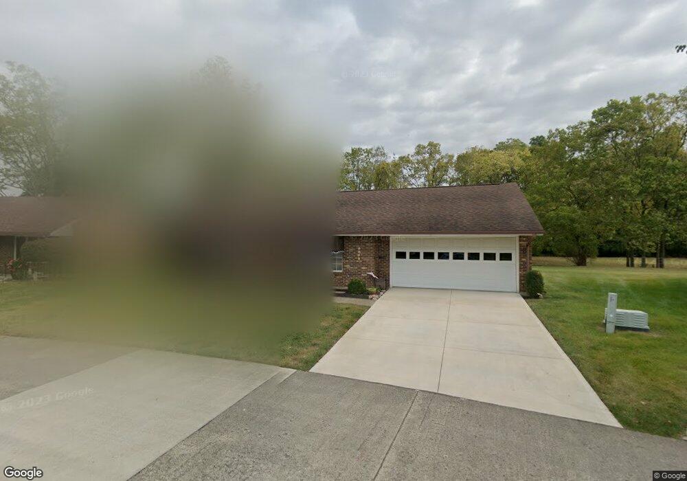
3112 Brixton Dr E Unit 103 Springfield, OH 45503
Estimated Value: $192,000 - $197,000
2
Beds
2
Baths
1,300
Sq Ft
$150/Sq Ft
Est. Value
About This Home
This home is located at 3112 Brixton Dr E Unit 103, Springfield, OH 45503 and is currently estimated at $195,557, approximately $150 per square foot. 3112 Brixton Dr E Unit 103 is a home located in Clark County with nearby schools including Northridge Elementary School, Kenton Ridge Middle & High School, and Emmanuel Christian Academy.
Ownership History
Date
Name
Owned For
Owner Type
Purchase Details
Closed on
Mar 28, 2002
Sold by
Prather Calvin C and Prather Juanita G
Bought by
Stone Richard M and Stone Roberta M
Current Estimated Value
Purchase Details
Closed on
Jun 7, 2001
Sold by
Farmer Fred A and Farmer Mary E
Bought by
Prather Calvin C and Prather Juanita G
Purchase Details
Closed on
Apr 5, 2001
Sold by
Farmer Fred A and Farmer Howard C
Bought by
Farmer Mary E
Create a Home Valuation Report for This Property
The Home Valuation Report is an in-depth analysis detailing your home's value as well as a comparison with similar homes in the area
Home Values in the Area
Average Home Value in this Area
Purchase History
| Date | Buyer | Sale Price | Title Company |
|---|---|---|---|
| Stone Richard M | $100,000 | -- | |
| Prather Calvin C | $98,000 | -- | |
| Farmer Mary E | -- | -- |
Source: Public Records
Tax History
| Year | Tax Paid | Tax Assessment Tax Assessment Total Assessment is a certain percentage of the fair market value that is determined by local assessors to be the total taxable value of land and additions on the property. | Land | Improvement |
|---|---|---|---|---|
| 2025 | $1,319 | $54,010 | $7,350 | $46,660 |
| 2024 | $1,300 | $40,850 | $6,300 | $34,550 |
| 2023 | $1,300 | $40,850 | $6,300 | $34,550 |
| 2022 | $419 | $40,850 | $6,300 | $34,550 |
| 2021 | $1,309 | $35,980 | $5,250 | $30,730 |
| 2020 | $1,310 | $35,980 | $5,250 | $30,730 |
| 2019 | $1,337 | $35,980 | $5,250 | $30,730 |
| 2018 | $1,171 | $31,840 | $5,570 | $26,270 |
| 2017 | $995 | $30,366 | $5,565 | $24,801 |
| 2016 | $988 | $30,366 | $5,565 | $24,801 |
| 2015 | $839 | $30,051 | $5,250 | $24,801 |
| 2014 | $839 | $30,051 | $5,250 | $24,801 |
| 2013 | $837 | $30,051 | $5,250 | $24,801 |
Source: Public Records
Map
Nearby Homes
- 1136 Foxboro Rd Unit 202
- 3052 Brixton Dr E
- 1139 Bradford Dr
- 1201 Kingsgate Rd
- 1039 Bradford Dr Unit 42
- 1162 Kingsgate Rd
- 3631 Kingsgate Ln
- 1500 Kingsgate Rd Unit 19430
- 1502 Kingsgate Rd Unit 19432
- 1500 Kingsgate Rd
- 1502 Kingsgate Rd
- 1503 Kingsgate Rd
- 1505 Kingsgate Rd
- 1507 Kingsgate Rd
- 1415 Montego Dr
- 1811 Saint Andrews Ct
- 3124 El Camino Dr
- 3135 Imperial Blvd
- 2022 Westboro Ave
- 1525 Providence Ave
- 1150 Brixton Dr N Unit 104
- 1150 Brixton Dr N
- 3108 Brixton Dr E Unit 102
- 3113 Brixton Dr E
- 3113 Brixton Dr E Unit 234
- 3104 Brixton Dr E
- 1148 Brixton Dr N
- 1150 Lindsey Rd
- 1147 Brixton Dr N Unit 235
- 1147 Brixton Dr N
- 1213 Ryan Rd
- 1203 Ryan Rd
- 1146 Brixton Dr N Unit 106
- 1148 Lindsey Rd
- 3100 Brixton Dr E
- 1223 Ryan Rd
- 1145 Brixton Dr N Unit 236
- 1183 Ryan Rd
- 1144 Brixton Dr N
- 3097 Brixton Dr E
Your Personal Tour Guide
Ask me questions while you tour the home.