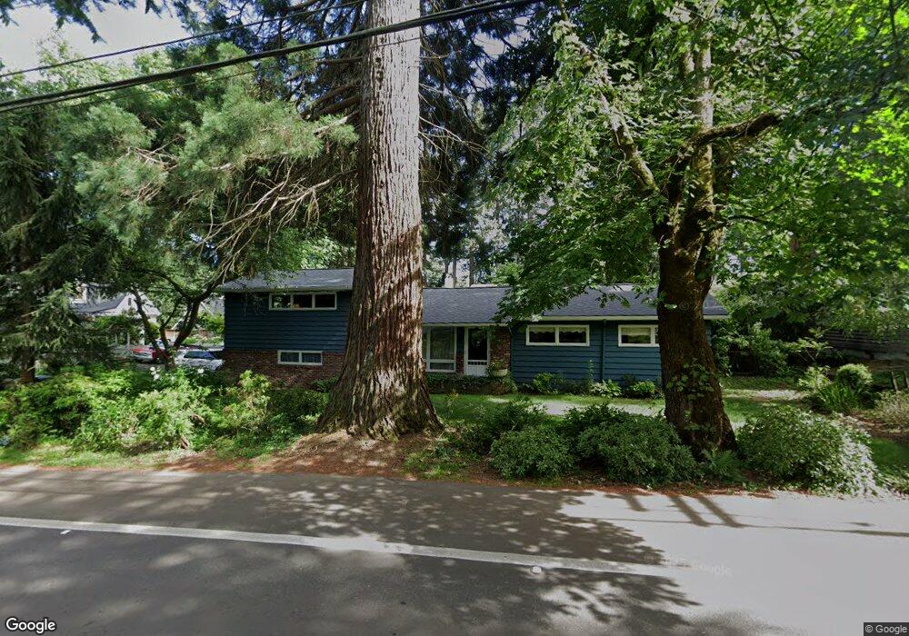
3112 Upper Dr Lake Oswego, OR 97035
Lake Grove NeighborhoodEstimated Value: $657,000 - $908,000
3
Beds
2
Baths
1,620
Sq Ft
$487/Sq Ft
Est. Value
About This Home
This home is located at 3112 Upper Dr, Lake Oswego, OR 97035 and is currently estimated at $789,523, approximately $487 per square foot. 3112 Upper Dr is a home located in Clackamas County with nearby schools including Lake Grove Elementary School, Lake Oswego Junior High School, and Lake Oswego Senior High School.
Ownership History
Date
Name
Owned For
Owner Type
Purchase Details
Closed on
Jul 22, 1998
Sold by
Dickinson William G and Dickinson Anne Marie C
Bought by
Bentley Walter M and Bentley Kristen J
Current Estimated Value
Home Financials for this Owner
Home Financials are based on the most recent Mortgage that was taken out on this home.
Original Mortgage
$168,610
Outstanding Balance
$33,292
Interest Rate
6.9%
Mortgage Type
FHA
Estimated Equity
$756,231
Create a Home Valuation Report for This Property
The Home Valuation Report is an in-depth analysis detailing your home's value as well as a comparison with similar homes in the area
Home Values in the Area
Average Home Value in this Area
Purchase History
| Date | Buyer | Sale Price | Title Company |
|---|---|---|---|
| Bentley Walter M | $173,000 | Fidelity National Title Co |
Source: Public Records
Mortgage History
| Date | Status | Borrower | Loan Amount |
|---|---|---|---|
| Open | Bentley Walter M | $168,610 |
Source: Public Records
Tax History Compared to Growth
Tax History
| Year | Tax Paid | Tax Assessment Tax Assessment Total Assessment is a certain percentage of the fair market value that is determined by local assessors to be the total taxable value of land and additions on the property. | Land | Improvement |
|---|---|---|---|---|
| 2025 | $5,319 | $276,968 | -- | -- |
| 2024 | $5,177 | $268,901 | -- | -- |
| 2023 | $5,177 | $261,069 | $0 | $0 |
| 2022 | $4,876 | $253,466 | $0 | $0 |
| 2021 | $4,504 | $246,084 | $0 | $0 |
| 2020 | $4,390 | $238,917 | $0 | $0 |
| 2019 | $4,282 | $231,959 | $0 | $0 |
| 2018 | $4,072 | $225,203 | $0 | $0 |
| 2017 | $3,929 | $218,644 | $0 | $0 |
| 2016 | $3,577 | $212,276 | $0 | $0 |
| 2015 | $3,456 | $206,093 | $0 | $0 |
| 2014 | $3,412 | $200,090 | $0 | $0 |
Source: Public Records
Map
Nearby Homes
- 15947 Twin Fir Rd
- 15948 Twin Fir Rd
- 3525 Lake Grove Ave
- 3537 Lake Grove Ave
- 3548 Lakeview Blvd
- 15370 Twin Fir Rd
- 3600 Lakeview Blvd
- 3730 Upper Dr
- 3850 Lake Grove Ave
- 3884 Lake Grove Ave
- 2240 Summit Ct
- 2703 Glen Eagles Rd
- 3676 Spring Ln
- 15003 Twin Fir Rd
- 2560 Glen Eagles Place
- 16636 Maple Cir
- 1990 Indian Trail
- 16878 Canyon Dr
- 4225 Oakridge Rd
- 4284 Oakridge Rd
- 15923 Twin Fir Rd
- 3122 Upper Dr
- 3115 Upper Dr
- 3070 Upper Dr
- 3127 Upper Dr
- 15939 Twin Fir Rd
- 15930 Twin Fir Rd
- 15900 Twin Fir Rd
- 3120 Upper Dr
- 15821 Twin Fir Rd
- 3150 Upper Dr
- 3000 Upper Dr
- 3010 Upper Dr
- 3155 Upper Dr
- 15870 Twin Fir Rd
- 15949 Twin Fir Rd
- 3017 Upper Dr
- 15950 Twin Fir Rd
- 3124 Upper Dr
- 15805 Twin Fir Rd