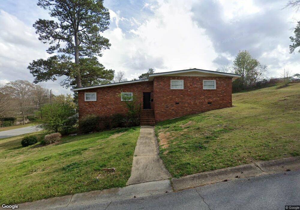
3114 Clairmont Rd Columbus, GA 31906
Lindsey Creek Park-Boxwood Estates NeighborhoodEstimated Value: $127,000 - $214,000
4
Beds
3
Baths
2,377
Sq Ft
$67/Sq Ft
Est. Value
About This Home
This home is located at 3114 Clairmont Rd, Columbus, GA 31906 and is currently estimated at $160,156, approximately $67 per square foot. 3114 Clairmont Rd is a home located in Muscogee County with nearby schools including Rigdon Road Elementary School, Richards Middle School, and Carver High School.
Ownership History
Date
Name
Owned For
Owner Type
Purchase Details
Closed on
May 28, 2021
Sold by
Jackson Anthony
Bought by
Sfr3 030 Llc
Current Estimated Value
Purchase Details
Closed on
Mar 28, 2018
Sold by
Shumpert Anthony
Bought by
Jackson Anthony
Home Financials for this Owner
Home Financials are based on the most recent Mortgage that was taken out on this home.
Original Mortgage
$34,650
Interest Rate
4.43%
Mortgage Type
New Conventional
Purchase Details
Closed on
Jul 20, 2017
Bought by
Shumpert Anthony
Purchase Details
Closed on
Sep 30, 2015
Sold by
Us Bank National Associati
Bought by
Tradewinds Development Grp Llc
Purchase Details
Closed on
Mar 3, 2015
Sold by
Kimbrough Mamie E
Bought by
Us Bank National Association T
Purchase Details
Closed on
Jun 30, 2012
Sold by
Kimbrough Mamie E
Bought by
King Dorothy A and Kimbrough Benjamin James
Create a Home Valuation Report for This Property
The Home Valuation Report is an in-depth analysis detailing your home's value as well as a comparison with similar homes in the area
Home Values in the Area
Average Home Value in this Area
Purchase History
| Date | Buyer | Sale Price | Title Company |
|---|---|---|---|
| Sfr3 030 Llc | $90,355 | -- | |
| Jackson Anthony | $39,650 | -- | |
| Shumpert Anthony | $25,000 | -- | |
| Tradewinds Development Grp Llc | $25,046 | -- | |
| Us Bank National Association T | -- | -- | |
| King Dorothy A | -- | -- | |
| Mccant Alecstir | -- | -- |
Source: Public Records
Mortgage History
| Date | Status | Borrower | Loan Amount |
|---|---|---|---|
| Previous Owner | Jackson Anthony | $34,650 |
Source: Public Records
Tax History Compared to Growth
Tax History
| Year | Tax Paid | Tax Assessment Tax Assessment Total Assessment is a certain percentage of the fair market value that is determined by local assessors to be the total taxable value of land and additions on the property. | Land | Improvement |
|---|---|---|---|---|
| 2025 | $2,036 | $52,000 | $9,136 | $42,864 |
| 2024 | $2,036 | $52,000 | $9,136 | $42,864 |
| 2023 | $2,048 | $52,000 | $9,136 | $42,864 |
| 2022 | $1,475 | $36,120 | $7,120 | $29,000 |
| 2021 | $1,759 | $43,088 | $9,136 | $33,952 |
| 2020 | $1,760 | $43,088 | $9,136 | $33,952 |
| 2019 | $649 | $15,840 | $4,680 | $11,160 |
| 2018 | $410 | $10,000 | $2,040 | $7,960 |
| 2017 | $2,034 | $44,028 | $9,136 | $34,892 |
| 2016 | $413 | $10,000 | $1,649 | $8,351 |
| 2015 | $633 | $38,346 | $6,322 | $32,024 |
| 2014 | $1,586 | $38,346 | $6,322 | $32,024 |
| 2013 | -- | $38,346 | $6,322 | $32,024 |
Source: Public Records
Map
Nearby Homes
- 1301 Rigdon Rd
- 1061 Dunbar Ave
- 3122 Glenwood Dr
- 1312 Glenwood Rd
- 1047 Fisk Ave
- 2916 Gardenia St
- 2726 Marion St
- 1310 S Dixon Dr
- 2911 Gardenia St
- 2902 Hood St
- 1500 Preston Dr
- 2925 Colorado St
- 1513 Wells Dr
- 1164 Tate Dr
- 2937 Thomas St
- 937 Diggs Ave
- 2911 Thomas St
- 3319 Decatur St
- 1054 Lawyers Ln
- 2533 15th St
- 1227 W Lindsay Dr
- 1242 Dunbar Ave
- 1234 Dunbar Ave
- 1219 W Lindsay Dr
- 1226 Dunbar Ave
- 1218 Dunbar Ave
- 1211 W Lindsay Dr
- 1231 Dunbar Ct
- 3014 Clairmont Rd
- 1241 Dunbar Ave
- 1212 Dunbar Ave
- 1222 E Lindsay Dr
- 1218 E Lindsay Dr
- 1213 Dunbar Ave
- 3215 Melrose Dr
- 1312 E Lindsay Dr
- 1204 Dunbar Ave
- 1227 Dunbar Ct
- 1206 E Lindsay Dr
- 3004 Clairmont Rd