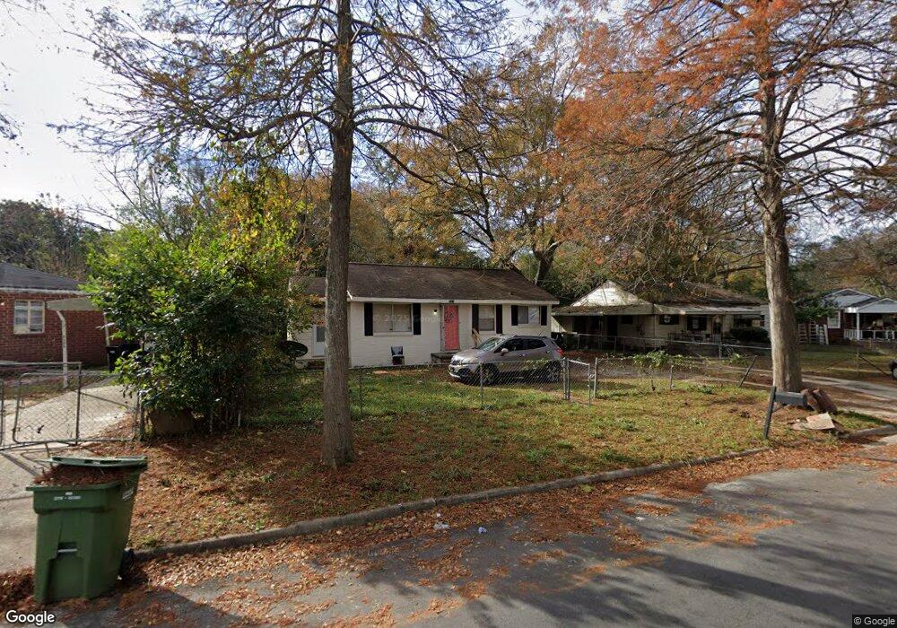
3114 Clay St Columbus, GA 31903
Estimated Value: $32,000 - $67,000
2
Beds
2
Baths
942
Sq Ft
$54/Sq Ft
Est. Value
About This Home
This home is located at 3114 Clay St, Columbus, GA 31903 and is currently estimated at $50,941, approximately $54 per square foot. 3114 Clay St is a home located in Muscogee County with nearby schools including Dorothy Height Elementary School, Baker Middle School, and Spencer High School.
Ownership History
Date
Name
Owned For
Owner Type
Purchase Details
Closed on
Mar 22, 2021
Sold by
Mnm Properties Llc
Bought by
Mnm Properties Llc
Current Estimated Value
Purchase Details
Closed on
Mar 18, 2021
Sold by
Mallory Kathleen
Bought by
M-N-M Properties Llc
Purchase Details
Closed on
Feb 29, 2016
Sold by
Monroe Jerry
Bought by
Mnm Properties Llc
Create a Home Valuation Report for This Property
The Home Valuation Report is an in-depth analysis detailing your home's value as well as a comparison with similar homes in the area
Home Values in the Area
Average Home Value in this Area
Purchase History
| Date | Buyer | Sale Price | Title Company |
|---|---|---|---|
| Mnm Properties Llc | -- | None Listed On Document | |
| M-N-M Properties Llc | $48,603 | None Listed On Document | |
| M-N-M Properties Llc | -- | None Listed On Document | |
| Mnm Properties Llc | $14,000 | -- | |
| Monroe Jerry | $14,000 | -- |
Source: Public Records
Tax History Compared to Growth
Tax History
| Year | Tax Paid | Tax Assessment Tax Assessment Total Assessment is a certain percentage of the fair market value that is determined by local assessors to be the total taxable value of land and additions on the property. | Land | Improvement |
|---|---|---|---|---|
| 2025 | $417 | $18,220 | $3,888 | $14,332 |
| 2024 | $417 | $10,652 | $3,324 | $7,328 |
| 2023 | $420 | $10,652 | $3,324 | $7,328 |
| 2022 | $283 | $10,652 | $3,324 | $7,328 |
| 2021 | $283 | $6,940 | $3,324 | $3,616 |
| 2020 | $245 | $6,000 | $2,000 | $4,000 |
| 2019 | $246 | $6,000 | $2,000 | $4,000 |
| 2018 | $229 | $13,348 | $3,324 | $10,024 |
| 2017 | $230 | $5,600 | $1,400 | $4,200 |
| 2016 | $466 | $11,286 | $1,704 | $9,582 |
| 2015 | $186 | $11,286 | $1,704 | $9,582 |
| 2014 | $187 | $11,286 | $1,704 | $9,582 |
| 2013 | -- | $11,286 | $1,704 | $9,582 |
Source: Public Records
Map
Nearby Homes
- 1029 Harbison Dr
- 920 Brooks Rd
- 3135 Baker Cir
- 3111 Baker Cir
- 903 Winston Rd
- 906 Winston Rd
- 824 Winston Rd
- 1025 Fletcher Ave
- 917 Fletcher Ave
- 750 Winston Rd
- 812 Benning Dr
- 716 Benning Dr
- 3223 Lee St
- 1274 Providence Ln
- 2459 Brownie Ln
- 2463 Brownie Ln
- 2451 Brownie Ln
- 2463 Brownie St
- 1401 Clark Ave
- 184 30th Ave
- 3110 Clay St
- 3120 Clay St
- 1009 Brooks Rd
- 1004 Harbison Dr
- 1010 Harbison Dr
- 1013 Brooks Rd
- 1014 Harbison Dr
- 1019 Brooks Rd
- 3113 Clay St
- 3119 Clay St
- 3109 Clay St
- 1018 Harbison Dr
- 3204 Clay St
- 3103 Clay St
- 0 Harbison Dr Unit 8869170
- 0 Harbison Dr Unit 8821053
- 0 Harbison Dr
- 1010 Brooks Rd
- 1025 Brooks Rd
- 1024 Harbison Dr