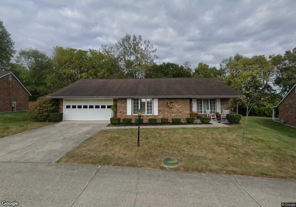
3115 Brixton Dr W Springfield, OH 45503
Estimated Value: $169,000 - $205,000
2
Beds
2
Baths
1,300
Sq Ft
$149/Sq Ft
Est. Value
About This Home
This home is located at 3115 Brixton Dr W, Springfield, OH 45503 and is currently estimated at $194,264, approximately $149 per square foot. 3115 Brixton Dr W is a home located in Clark County with nearby schools including Rolling Hills Elementary School, Northridge Middle School, and Kenton Ridge Middle & High School.
Ownership History
Date
Name
Owned For
Owner Type
Purchase Details
Closed on
Dec 16, 2011
Sold by
Irie Janet R
Bought by
Lenze Jacqueline J
Current Estimated Value
Home Financials for this Owner
Home Financials are based on the most recent Mortgage that was taken out on this home.
Original Mortgage
$40,000
Outstanding Balance
$27,363
Interest Rate
4.01%
Mortgage Type
New Conventional
Estimated Equity
$166,901
Purchase Details
Closed on
Mar 24, 2011
Sold by
Irie Janet R
Bought by
Irie Janet R and Janet R Irie Trust
Create a Home Valuation Report for This Property
The Home Valuation Report is an in-depth analysis detailing your home's value as well as a comparison with similar homes in the area
Home Values in the Area
Average Home Value in this Area
Purchase History
| Date | Buyer | Sale Price | Title Company |
|---|---|---|---|
| Lenze Jacqueline J | $82,000 | Attorney | |
| Irie Janet R | -- | Attorney |
Source: Public Records
Mortgage History
| Date | Status | Borrower | Loan Amount |
|---|---|---|---|
| Open | Lenze Jacqueline J | $40,000 |
Source: Public Records
Tax History Compared to Growth
Tax History
| Year | Tax Paid | Tax Assessment Tax Assessment Total Assessment is a certain percentage of the fair market value that is determined by local assessors to be the total taxable value of land and additions on the property. | Land | Improvement |
|---|---|---|---|---|
| 2024 | $1,292 | $40,670 | $6,300 | $34,370 |
| 2023 | $1,292 | $40,670 | $6,300 | $34,370 |
| 2022 | $1,314 | $40,670 | $6,300 | $34,370 |
| 2021 | $1,382 | $37,470 | $5,250 | $32,220 |
| 2020 | $1,803 | $37,470 | $5,250 | $32,220 |
| 2019 | $1,840 | $37,470 | $5,250 | $32,220 |
| 2018 | $1,577 | $31,150 | $5,570 | $25,580 |
| 2017 | $1,341 | $31,059 | $5,565 | $25,494 |
| 2016 | $1,331 | $31,059 | $5,565 | $25,494 |
| 2015 | $1,251 | $30,744 | $5,250 | $25,494 |
| 2014 | $1,251 | $30,744 | $5,250 | $25,494 |
| 2013 | $1,248 | $30,744 | $5,250 | $25,494 |
Source: Public Records
Map
Nearby Homes
- 1148 Foxboro Rd
- 1162 Kingsgate Rd
- 3032 Armsgate Rd Unit 25
- 3029 Bradford Dr Unit 46
- 3631 Kingsgate Ln
- 1509 Kingsgate Rd
- 1501 Kingsgate Rd
- 1503 Kingsgate Rd
- 1505 Kingsgate Rd
- 1507 Kingsgate Rd
- 1139 Greenoak Ct
- 1732 Falmouth Ave
- 4109 Derr Rd
- 647 Villa Rd Unit A
- 542 Villa Rd
- 1781 Pinehurst Dr
- 4133 Willowbrook Dr
- 1225 Vester Ave
- 3500 Oakmont Ct
- 3229 Bristol Dr
- 3115 Brixton Dr W
- 1136 Brixton Dr N
- 3111 Brixton Dr W
- 3106 Brixton Dr W
- 3106 Brixton Dr W
- 1137 Brixton Dr N
- 1137 Brixton Dr N Unit 249
- 3107 Brixton Dr W
- 3107 Brixton Dr W Unit 114
- 1138 Brixton Dr N Unit 110
- 1138 Brixton Dr N
- 3102 Brixton Dr W
- 1139 Brixton Dr N
- 1139 Brixton Dr N Unit 248
- 1155 Scanlon Ln
- 3448 Derr Rd
- 3440 Derr Rd
- 1140 Brixton Dr N Unit 109
- 3103 Brixton Dr W Unit 115
- 1140 Derby Rd