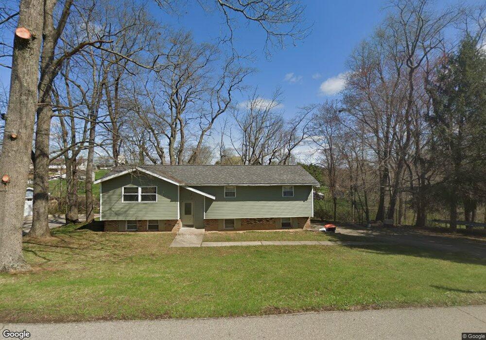
3115 Lisa Ln Zanesville, OH 43701
Estimated Value: $253,000 - $358,000
3
Beds
2
Baths
1,681
Sq Ft
$183/Sq Ft
Est. Value
About This Home
This home is located at 3115 Lisa Ln, Zanesville, OH 43701 and is currently estimated at $306,930, approximately $182 per square foot. 3115 Lisa Ln is a home located in Muskingum County with nearby schools including National Road Elementary School, Zanesville Middle School, and Zanesville High School.
Ownership History
Date
Name
Owned For
Owner Type
Purchase Details
Closed on
Oct 28, 2005
Sold by
The Community Bank and Steen Michael R
Bought by
Durant John M
Current Estimated Value
Home Financials for this Owner
Home Financials are based on the most recent Mortgage that was taken out on this home.
Original Mortgage
$103,500
Outstanding Balance
$56,188
Interest Rate
5.89%
Mortgage Type
Fannie Mae Freddie Mac
Estimated Equity
$250,742
Purchase Details
Closed on
Apr 23, 2004
Sold by
Lowe Todd A and Lowe Amy N
Bought by
The Community Bank
Purchase Details
Closed on
Jul 24, 2000
Sold by
Clark John C
Bought by
Lowe Todd A and Kirsch Amy N
Home Financials for this Owner
Home Financials are based on the most recent Mortgage that was taken out on this home.
Original Mortgage
$92,000
Interest Rate
8.31%
Mortgage Type
New Conventional
Create a Home Valuation Report for This Property
The Home Valuation Report is an in-depth analysis detailing your home's value as well as a comparison with similar homes in the area
Home Values in the Area
Average Home Value in this Area
Purchase History
| Date | Buyer | Sale Price | Title Company |
|---|---|---|---|
| Durant John M | $115,000 | -- | |
| The Community Bank | -- | -- | |
| Lowe Todd A | $89,000 | -- |
Source: Public Records
Mortgage History
| Date | Status | Borrower | Loan Amount |
|---|---|---|---|
| Open | Durant John M | $103,500 | |
| Previous Owner | Lowe Todd A | $92,000 |
Source: Public Records
Tax History Compared to Growth
Tax History
| Year | Tax Paid | Tax Assessment Tax Assessment Total Assessment is a certain percentage of the fair market value that is determined by local assessors to be the total taxable value of land and additions on the property. | Land | Improvement |
|---|---|---|---|---|
| 2024 | $2,349 | $60,935 | $7,840 | $53,095 |
| 2023 | $1,977 | $47,600 | $6,545 | $41,055 |
| 2022 | $1,941 | $47,600 | $6,545 | $41,055 |
| 2021 | $1,925 | $47,600 | $6,545 | $41,055 |
| 2020 | $1,729 | $41,265 | $5,670 | $35,595 |
| 2019 | $1,728 | $41,265 | $5,670 | $35,595 |
| 2018 | $1,588 | $41,265 | $5,670 | $35,595 |
| 2017 | $1,516 | $35,175 | $5,670 | $29,505 |
| 2016 | $1,485 | $35,180 | $5,670 | $29,510 |
| 2015 | $1,485 | $35,180 | $5,670 | $29,510 |
| 2013 | $1,464 | $31,260 | $5,670 | $25,590 |
Source: Public Records
Map
Nearby Homes
- 240 Mockingbird Hill
- 2850 Watson Way
- 2425 S Pleasant Grove Rd
- 2465 Clay Pike
- 2870 Cody Dr
- 2755 N Lawndale Place
- 496 Pleasant Grove Rd
- 0 East Pike Unit 5163133
- 440 Stardust Cir
- 2397 Adamsville Rd
- 2230 Adamsville Rd
- 2383 Chandlersville Rd
- 1605 Jackson Rd
- 1636 Sharon Ave
- 330 Jordan Ave
- 360 Walters Way
- 365 Walters Way
- 2835 Adamsville Rd
- 27 Cemetery Ave
- 1328 Pallas Ave