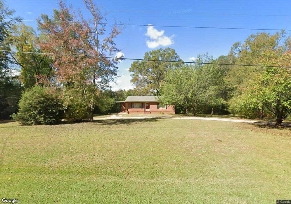
3116 W Point Rd Lagrange, GA 30240
Estimated Value: $169,000 - $210,000
2
Beds
1
Bath
1,327
Sq Ft
$146/Sq Ft
Est. Value
About This Home
This home is located at 3116 W Point Rd, Lagrange, GA 30240 and is currently estimated at $193,789, approximately $146 per square foot. 3116 W Point Rd is a home located in Troup County with nearby schools including Berta Weathersbee Elementary School, Long Cane Elementary School, and Whitesville Road Elementary School.
Ownership History
Date
Name
Owned For
Owner Type
Purchase Details
Closed on
Jan 26, 1996
Sold by
Margaret Catherine Day By Ex
Bought by
Heflin James G
Current Estimated Value
Purchase Details
Closed on
Jan 28, 1991
Sold by
James Arthur Day
Bought by
Margaret Catherine Day By Ex
Purchase Details
Closed on
Jan 1, 1965
Sold by
Doris Willie B and Doris Davis
Bought by
James Arthur Day
Create a Home Valuation Report for This Property
The Home Valuation Report is an in-depth analysis detailing your home's value as well as a comparison with similar homes in the area
Home Values in the Area
Average Home Value in this Area
Purchase History
| Date | Buyer | Sale Price | Title Company |
|---|---|---|---|
| Heflin James G | $63,800 | -- | |
| Margaret Catherine Day By Ex | -- | -- | |
| James Arthur Day | -- | -- |
Source: Public Records
Tax History Compared to Growth
Tax History
| Year | Tax Paid | Tax Assessment Tax Assessment Total Assessment is a certain percentage of the fair market value that is determined by local assessors to be the total taxable value of land and additions on the property. | Land | Improvement |
|---|---|---|---|---|
| 2024 | $1,520 | $55,736 | $11,280 | $44,456 |
| 2023 | $1,215 | $44,536 | $11,280 | $33,256 |
| 2022 | $1,196 | $42,856 | $11,280 | $31,576 |
| 2021 | $811 | $26,880 | $11,480 | $15,400 |
| 2020 | $811 | $26,880 | $11,480 | $15,400 |
| 2019 | $813 | $26,960 | $11,480 | $15,480 |
| 2018 | $695 | $23,056 | $9,000 | $14,056 |
| 2017 | $695 | $23,056 | $9,000 | $14,056 |
| 2016 | $691 | $22,898 | $9,000 | $13,898 |
| 2015 | $692 | $22,898 | $9,000 | $13,898 |
| 2014 | $671 | $22,167 | $9,000 | $13,167 |
| 2013 | -- | $23,292 | $9,000 | $14,292 |
Source: Public Records
Map
Nearby Homes
- 808 S Fling Rd
- 509 Connie Dr
- 110 Hawthorne Cir
- 103 Hawthorne Cir
- 105 Hawthorne Cir
- 37 Overbrook Dr
- 190 Hill Rd
- 0 Bradfield Dr Unit 10568803
- 124 Foxdale Dr
- 100 Huntcliff Ct
- 22 Freeman Rd
- 61 Freeman Rd
- 141 Plymouth Dr
- 135 Planters Ridge Dr
- 102 Franklin Place
- 146 Whitaker Rd
- 119 Plymouth Dr
- 141 Avery Dr
- 0 Deming St Unit 10550189
- LOT 4 Angela Dr
- 3116 West Point Rd
- 3140 W Point Rd
- 3140 West Point Rd
- 3092 West Point Rd
- 3097 West Point Rd
- 11 Pop Reeses Rd
- 10 Pop Reeses Rd
- 3153 West Point Rd
- 3159 West Point Rd
- 3176 West Point Rd
- 69 Pop Reeses Rd
- 0 Martin Dr Unit 7500334
- 0 Martin Dr Unit 7500343
- 0 Martin Dr Unit 7500339
- 0 Martin Dr Unit 7500337
- 0 Martin Dr Unit 7500314
- 0 Martin Dr Unit 7500309
- 0 Martin Dr Unit 7377664
- 0 Martin Dr
- 3055 West Point Rd