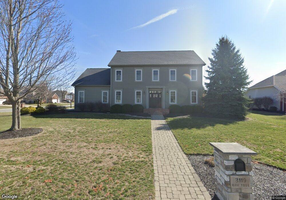
3119 Bay Tree Dr Findlay, OH 45840
Estimated Value: $515,000 - $669,000
4
Beds
3
Baths
3,108
Sq Ft
$185/Sq Ft
Est. Value
About This Home
This home is located at 3119 Bay Tree Dr, Findlay, OH 45840 and is currently estimated at $574,760, approximately $184 per square foot. 3119 Bay Tree Dr is a home located in Hancock County with nearby schools including Liberty-Benton Elementary School, Liberty-Benton Middle School, and Liberty-Benton High School.
Ownership History
Date
Name
Owned For
Owner Type
Purchase Details
Closed on
Jul 15, 2021
Sold by
Eirckson Scott M and Eirckson Jill A
Bought by
Paul Family Trust
Current Estimated Value
Home Financials for this Owner
Home Financials are based on the most recent Mortgage that was taken out on this home.
Original Mortgage
$400,000
Outstanding Balance
$362,938
Interest Rate
2.9%
Mortgage Type
New Conventional
Estimated Equity
$211,822
Create a Home Valuation Report for This Property
The Home Valuation Report is an in-depth analysis detailing your home's value as well as a comparison with similar homes in the area
Purchase History
| Date | Buyer | Sale Price | Title Company |
|---|---|---|---|
| Paul Family Trust | $500,000 | Legacy Title |
Source: Public Records
Mortgage History
| Date | Status | Borrower | Loan Amount |
|---|---|---|---|
| Open | Paul Family Trust | $400,000 |
Source: Public Records
Tax History
| Year | Tax Paid | Tax Assessment Tax Assessment Total Assessment is a certain percentage of the fair market value that is determined by local assessors to be the total taxable value of land and additions on the property. | Land | Improvement |
|---|---|---|---|---|
| 2024 | $4,596 | $123,630 | $18,360 | $105,270 |
| 2023 | $4,487 | $123,630 | $18,360 | $105,270 |
| 2022 | $4,443 | $123,630 | $18,360 | $105,270 |
| 2021 | $4,126 | $101,330 | $17,120 | $84,210 |
| 2020 | $4,161 | $101,330 | $17,120 | $84,210 |
| 2019 | $3,992 | $101,330 | $17,120 | $84,210 |
| 2018 | $3,144 | $88,100 | $14,880 | $73,220 |
| 2017 | $3,244 | $88,100 | $14,880 | $73,220 |
| 2016 | $3,145 | $88,100 | $14,880 | $73,220 |
| 2015 | $3,075 | $83,990 | $15,270 | $68,720 |
| 2014 | $2,931 | $79,310 | $15,270 | $64,040 |
| 2012 | $2,697 | $69,880 | $15,270 | $54,610 |
Source: Public Records
Map
Nearby Homes
- 9894 Smokies Way
- 0 County Road 95 Unit 6097574
- 3106 Saddlebrook
- 6535 Silver Lake Dr
- 0 Rock Candy Rd Or Bushwillow Dr Unit Lot 173
- 0 Rock Candy Rd Unit Lot 159
- 0 Rock Candy Rd Unit Lot 170
- 0 Rock Candy Rd Unit Lot 172 206819
- 0 Rock Candy Rd Unit Lot 162
- 0 Rock Candy Rd Unit Lot 171
- 0 Rock Candy Rd Unit Lot 168
- 3018 Gleneagle Dr
- 0 Bushwillow Dr Or Rock Candy Rd Unit Lot 157
- 0 Bearcat Way Or Rock Candy Rd Unit Lot 167
- 3237 Gleneagle Dr
- 0 County Road 140
- 0 Allen Township 142
- 925 W Melrose Ave
- 0 Township Highway 99
- 12325 Township Highway 99
- 3113 Bay Tree Dr
- 1817 Forest Park
- 1824 Forest Park
- 1830 Forest Park
- 3118 Bay Tree Dr
- 3107 Bay Tree Dr
- 1816 Forest Park
- 10284 Wheatfield Dr
- 10257 Wheatfield Dr
- 1809 Forest Park
- 3112 Bay Tree Dr
- 1904 Forest Park
- 1808 Forest Park
- 3106 Bay Tree Dr
- 3221 Jurnee Dr
- 3101 Bay Tree Dr
- 1818 Lakeland Dr
- 1801 Forest Park
- 3311 Jurnee Dr
- 1812 Lakeland Dr
Your Personal Tour Guide
Ask me questions while you tour the home.