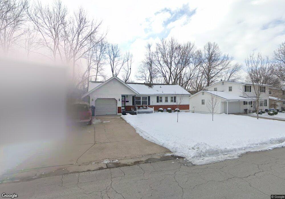
3119 S Linwood Ave Independence, MO 64055
Glendale NeighborhoodEstimated Value: $233,000 - $246,000
3
Beds
2
Baths
1,170
Sq Ft
$204/Sq Ft
Est. Value
About This Home
This home is located at 3119 S Linwood Ave, Independence, MO 64055 and is currently estimated at $238,260, approximately $203 per square foot. 3119 S Linwood Ave is a home located in Jackson County with nearby schools including Glendale Elementary School, Bridger Middle School, and Pioneer Ridge Middle School.
Ownership History
Date
Name
Owned For
Owner Type
Purchase Details
Closed on
Oct 7, 2008
Sold by
Helm Donald L
Bought by
Rugg Shirley Ann and Helm Donald L
Current Estimated Value
Purchase Details
Closed on
Jul 19, 2007
Sold by
Main Lorene
Bought by
Helm Donald L
Home Financials for this Owner
Home Financials are based on the most recent Mortgage that was taken out on this home.
Original Mortgage
$20,000
Outstanding Balance
$3,134
Interest Rate
6.73%
Mortgage Type
Purchase Money Mortgage
Estimated Equity
$235,126
Create a Home Valuation Report for This Property
The Home Valuation Report is an in-depth analysis detailing your home's value as well as a comparison with similar homes in the area
Home Values in the Area
Average Home Value in this Area
Purchase History
| Date | Buyer | Sale Price | Title Company |
|---|---|---|---|
| Rugg Shirley Ann | -- | None Available | |
| Helm Donald L | -- | Chicago Title Insurance Co |
Source: Public Records
Mortgage History
| Date | Status | Borrower | Loan Amount |
|---|---|---|---|
| Open | Helm Donald L | $20,000 |
Source: Public Records
Tax History Compared to Growth
Tax History
| Year | Tax Paid | Tax Assessment Tax Assessment Total Assessment is a certain percentage of the fair market value that is determined by local assessors to be the total taxable value of land and additions on the property. | Land | Improvement |
|---|---|---|---|---|
| 2025 | $2,071 | $26,885 | $5,335 | $21,550 |
| 2024 | $2,024 | $29,887 | $4,142 | $25,745 |
| 2023 | $2,024 | $29,887 | $3,992 | $25,895 |
| 2022 | $1,502 | $20,330 | $4,218 | $16,112 |
| 2021 | $1,501 | $20,330 | $4,218 | $16,112 |
| 2020 | $1,551 | $20,412 | $4,218 | $16,194 |
| 2019 | $1,526 | $20,412 | $4,218 | $16,194 |
| 2018 | $1,587 | $20,268 | $3,952 | $16,316 |
| 2017 | $1,587 | $20,268 | $3,952 | $16,316 |
| 2016 | $1,563 | $19,760 | $3,131 | $16,629 |
| 2014 | $1,485 | $19,184 | $3,040 | $16,144 |
Source: Public Records
Map
Nearby Homes
- 3219 Vest St
- 16800 E 31st St S
- 3209 S Mark Cir
- 16400 E Crackerneck Rd
- 16409 E 31st St S
- 17201 E 32nd St S
- 3232 Queen Ridge Dr
- 3013 S Taylor Dr
- 16809 E 29th St S
- 16600 E 29th Terrace S
- 16808 E 29th St S
- 16206 E 35th St S
- 17410 E 34th Terrace S
- 16001 E 30th Terrace S
- 16424 E George Franklyn Dr
- 3509 S Maybrook Ave
- 16121 E 36th St S
- 2928 S Brentwood Ct
- 3618 S Bolger Ct
- 3609 S Bolger Ct
- 3117 S Linwood Ave
- 3201 S Linwood Ave
- 3205 S Linwood Ave
- 3113 S Linwood Ave
- 3118 S Linwood Ave
- 3209 S Linwood Ave
- 3200 S Linwood Ave
- 16724 E 31st Terrace S
- 3109 S Linwood Ave
- 3213 S Linwood Ave
- 3204 S Linwood Ave
- 16720 E 31st Terrace S
- 3105 S Linwood Ave
- 16623 E 32nd St S
- 16619 E 32nd St S
- 16716 E 31st Terrace S
- 3205 Vest Ave
- 3217 S Linwood Ave
- 16821 E 31st St S
- 16615 E 32nd St S