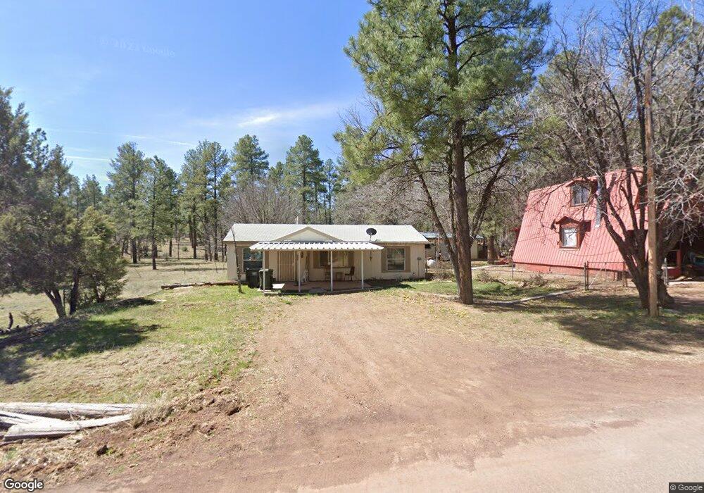
3119 Stardust Dr Show Low, AZ 85901
Estimated Value: $214,000 - $268,000
--
Bed
--
Bath
758
Sq Ft
$306/Sq Ft
Est. Value
About This Home
This home is located at 3119 Stardust Dr, Show Low, AZ 85901 and is currently estimated at $232,041, approximately $306 per square foot. 3119 Stardust Dr is a home located in Navajo County with nearby schools including Nikolaus Homestead Elementary School, Show Low High School, and Show Low Junior High School.
Ownership History
Date
Name
Owned For
Owner Type
Purchase Details
Closed on
Jun 21, 2024
Sold by
Blaich Jamie D
Bought by
Bigcorp Properties Llc
Current Estimated Value
Home Financials for this Owner
Home Financials are based on the most recent Mortgage that was taken out on this home.
Original Mortgage
$160,000
Outstanding Balance
$157,985
Interest Rate
7.09%
Mortgage Type
New Conventional
Estimated Equity
$74,056
Purchase Details
Closed on
Jul 10, 2012
Sold by
Mccarty James Dean
Bought by
Edwards Zachary Michael and Mccarty James D
Create a Home Valuation Report for This Property
The Home Valuation Report is an in-depth analysis detailing your home's value as well as a comparison with similar homes in the area
Home Values in the Area
Average Home Value in this Area
Purchase History
| Date | Buyer | Sale Price | Title Company |
|---|---|---|---|
| Bigcorp Properties Llc | $130,000 | Fidelity National Title | |
| Edwards Zachary Michael | -- | None Available |
Source: Public Records
Mortgage History
| Date | Status | Borrower | Loan Amount |
|---|---|---|---|
| Open | Bigcorp Properties Llc | $160,000 |
Source: Public Records
Tax History Compared to Growth
Tax History
| Year | Tax Paid | Tax Assessment Tax Assessment Total Assessment is a certain percentage of the fair market value that is determined by local assessors to be the total taxable value of land and additions on the property. | Land | Improvement |
|---|---|---|---|---|
| 2026 | $468 | -- | -- | -- |
| 2025 | $230 | $11,383 | $2,350 | $9,033 |
| 2024 | $216 | $11,217 | $2,350 | $8,867 |
| 2023 | $230 | $8,659 | $2,280 | $6,379 |
| 2022 | $216 | $0 | $0 | $0 |
| 2021 | $219 | $0 | $0 | $0 |
| 2020 | $204 | $0 | $0 | $0 |
| 2019 | $204 | $0 | $0 | $0 |
| 2018 | $43 | $0 | $0 | $0 |
| 2017 | $27 | $0 | $0 | $0 |
| 2016 | $0 | $0 | $0 | $0 |
| 2015 | $16 | $4,298 | $900 | $3,398 |
Source: Public Records
Map
Nearby Homes
- 4195 Adamson St
- 4328 Forest Glade Dr
- 4041 Gold Dust Trail
- 2822 Gold Dust Trail
- 2842 Gold Dust Trail
- 3680 Sage Ln Unit 260
- 1760 S Monkshood Rd
- 4251 W Acer Ln
- 1791 W Snow Creek Loop
- 2540 W Pinegrass Rd
- 1761 S Alder Leaf Ln
- 1491 W Snow Creek Trail
- 1661 S Gambel Oak Rd
- 4051 W Falling Leaf Rd
- 2080 S High Sierra Ct
- 2080 S High Sierra Ct Unit 86A
- 1300 W Sugar Creek Ct
- 1601 S Spruce Ln
- 1820 S Rockwood Cir
- 2221 W Edgewater Unit Lot 57
- 2957 Stardust Dr
- 4339 Adamson St
- 3092 Stardust Dr
- 0 Stardust Dr Unit 443 6594307
- 0 Stardust Dr Unit 443
- 4340 Quail Ave
- 4316 Quail Ave
- 4279 Adamson St
- 3011 Stardust Dr
- 4304 Quail Ave
- 4255 Adamson St
- 2992 Stardust Dr
- 4422 Larkspur Rd
- 4268 Quail Ave
- 4398 Larkspur Dr
- 4269 Quail Ave
- 4518 Larkspur Rd
- 4244 Quail Ave
- 2814 Feather Ln
- 4395 Larkspur Dr