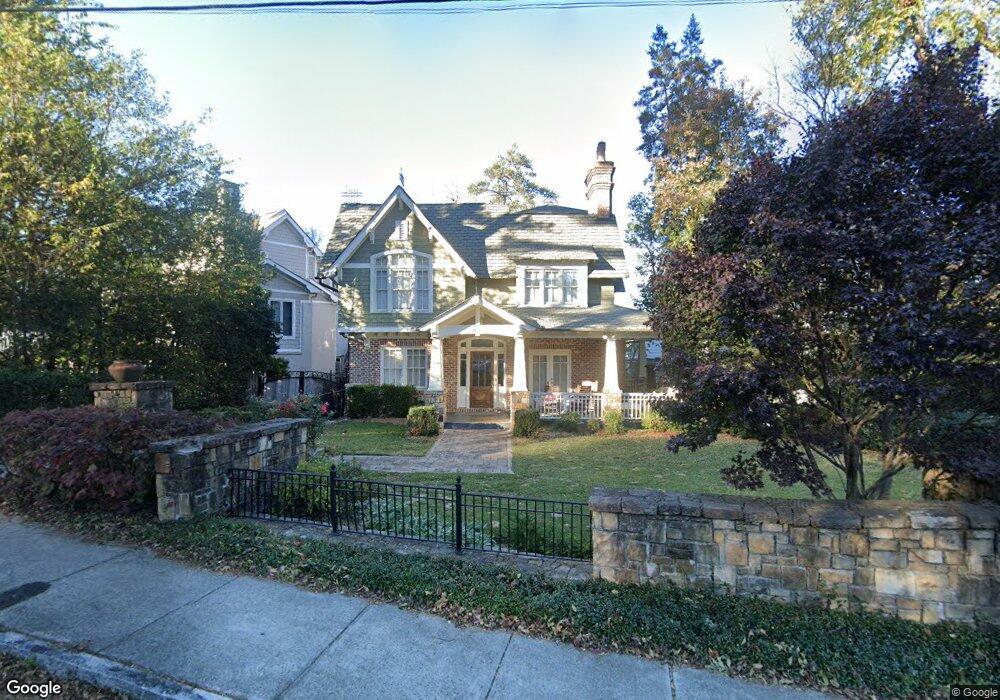
312 Beverly Rd NE Atlanta, GA 30309
Ansley Park NeighborhoodEstimated Value: $1,671,000 - $2,115,000
3
Beds
4
Baths
3,682
Sq Ft
$509/Sq Ft
Est. Value
About This Home
This home is located at 312 Beverly Rd NE, Atlanta, GA 30309 and is currently estimated at $1,875,106, approximately $509 per square foot. 312 Beverly Rd NE is a home located in Fulton County with nearby schools including Midtown High School, Dar Un-Noor School, and Heritage Preparatory Academy.
Ownership History
Date
Name
Owned For
Owner Type
Purchase Details
Closed on
Jun 25, 2009
Sold by
Branch Banking & Trust
Bought by
Fleske Wendy
Current Estimated Value
Home Financials for this Owner
Home Financials are based on the most recent Mortgage that was taken out on this home.
Original Mortgage
$417,000
Outstanding Balance
$266,151
Interest Rate
4.88%
Mortgage Type
New Conventional
Estimated Equity
$1,608,955
Purchase Details
Closed on
Aug 29, 2008
Sold by
Pirrone Arturo G
Bought by
Branch Banking & Trust Co
Purchase Details
Closed on
Feb 16, 2001
Sold by
Monger Emily M
Bought by
Pirrone Arturo G
Home Financials for this Owner
Home Financials are based on the most recent Mortgage that was taken out on this home.
Original Mortgage
$317,600
Interest Rate
7.09%
Mortgage Type
New Conventional
Create a Home Valuation Report for This Property
The Home Valuation Report is an in-depth analysis detailing your home's value as well as a comparison with similar homes in the area
Home Values in the Area
Average Home Value in this Area
Purchase History
| Date | Buyer | Sale Price | Title Company |
|---|---|---|---|
| Fleske Wendy | $775,000 | -- | |
| Branch Banking & Trust Co | -- | -- | |
| Pirrone Arturo G | $397,000 | -- |
Source: Public Records
Mortgage History
| Date | Status | Borrower | Loan Amount |
|---|---|---|---|
| Open | Fleske Wendy | $417,000 | |
| Previous Owner | Pirrone Arturo G | $317,600 |
Source: Public Records
Tax History Compared to Growth
Tax History
| Year | Tax Paid | Tax Assessment Tax Assessment Total Assessment is a certain percentage of the fair market value that is determined by local assessors to be the total taxable value of land and additions on the property. | Land | Improvement |
|---|---|---|---|---|
| 2025 | $16,581 | $562,000 | $130,280 | $431,720 |
| 2023 | $27,986 | $676,000 | $130,280 | $545,720 |
| 2022 | $13,724 | $416,000 | $150,360 | $265,640 |
| 2021 | $13,805 | $416,000 | $150,360 | $265,640 |
| 2020 | $12,209 | $600,000 | $150,360 | $449,640 |
| 2019 | $493 | $342,200 | $88,880 | $253,320 |
| 2018 | $12,988 | $342,200 | $88,880 | $253,320 |
| 2017 | $15,168 | $380,000 | $88,880 | $291,120 |
| 2016 | $15,208 | $380,000 | $88,880 | $291,120 |
| 2015 | $15,751 | $380,000 | $88,880 | $291,120 |
| 2014 | $12,745 | $426,480 | $88,880 | $337,600 |
Source: Public Records
Map
Nearby Homes
- 18 Polo Dr NE
- 98 Maddox Dr NE
- 71 Maddox Dr NE Unit C
- 251 Beverly Rd NE
- 388 Beverly Rd NE
- 27 Maddox Dr NE
- 221 Robin Hood Rd NE
- 203 Westminster Dr NE
- 213 Westminster Dr NE
- 171 Westminster Dr NE
- 3 Park Ln NE Unit H
- 1705 Monroe Dr NE Unit C05
- 1705 Monroe Dr NE Unit B4
- 121 17th St NE
- 36 S Prado NE
- 21 Barksdale Dr NE
- 1600 Nottingham Way NE
- 32 Polo Dr NE
- 306 Beverly Rd NE
- 96 Polo Dr NE
- 36 Polo Dr NE
- 71 Montgomery Ferry Dr NE
- 44 Polo Dr NE
- 75 Montgomery Ferry Dr NE
- 317 Beverly Rd NE
- 311 Beverly Rd NE
- 50 Polo Dr NE
- 11 Polo Dr NE
- 301 Beverly Rd NE
- 325 Beverly Rd NE
- 85 Montgomery Ferry Dr NE
- 331 Beverly Rd NE
- 84 Polo Dr NE
- 59 Montgomery Ferry Dr NE
- 339 Beverly Rd NE
- 87 Montgomery Ferry Dr NE
- 70 Montgomery Ferry Dr NE