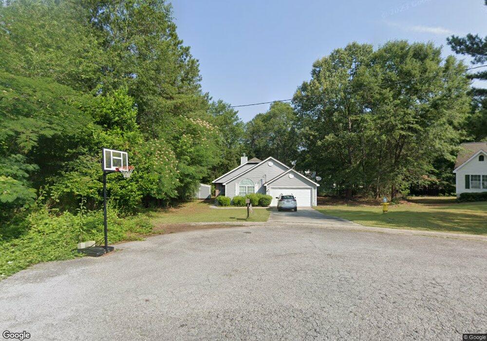
312 Bradstone Ct Macon, GA 31217
Estimated Value: $106,000 - $194,000
3
Beds
2
Baths
1,314
Sq Ft
$114/Sq Ft
Est. Value
About This Home
This home is located at 312 Bradstone Ct, Macon, GA 31217 and is currently estimated at $149,159, approximately $113 per square foot. 312 Bradstone Ct is a home located in Bibb County with nearby schools including Martin Luther King Jr. Elementary School, Appling Middle School, and Northeast High School.
Ownership History
Date
Name
Owned For
Owner Type
Purchase Details
Closed on
Aug 9, 2005
Sold by
Multi Prop Services Inc
Bought by
Fairfax Tqameka
Current Estimated Value
Home Financials for this Owner
Home Financials are based on the most recent Mortgage that was taken out on this home.
Original Mortgage
$101,700
Outstanding Balance
$61,498
Interest Rate
8.32%
Mortgage Type
Adjustable Rate Mortgage/ARM
Estimated Equity
$87,661
Create a Home Valuation Report for This Property
The Home Valuation Report is an in-depth analysis detailing your home's value as well as a comparison with similar homes in the area
Home Values in the Area
Average Home Value in this Area
Purchase History
| Date | Buyer | Sale Price | Title Company |
|---|---|---|---|
| Fairfax Tqameka | $113,000 | None Avilebel |
Source: Public Records
Mortgage History
| Date | Status | Borrower | Loan Amount |
|---|---|---|---|
| Open | Fairfax Tqameka | $101,700 |
Source: Public Records
Tax History Compared to Growth
Tax History
| Year | Tax Paid | Tax Assessment Tax Assessment Total Assessment is a certain percentage of the fair market value that is determined by local assessors to be the total taxable value of land and additions on the property. | Land | Improvement |
|---|---|---|---|---|
| 2025 | $1,011 | $48,126 | $5,200 | $42,926 |
| 2024 | $1,044 | $48,126 | $5,200 | $42,926 |
| 2023 | $587 | $48,126 | $5,200 | $42,926 |
| 2022 | $1,401 | $47,480 | $5,200 | $42,280 |
| 2021 | $957 | $32,186 | $4,000 | $28,186 |
| 2020 | $978 | $32,186 | $4,000 | $28,186 |
| 2019 | $986 | $32,186 | $4,000 | $28,186 |
| 2018 | $1,690 | $32,186 | $4,000 | $28,186 |
| 2017 | $944 | $32,186 | $4,000 | $28,186 |
| 2016 | $1,305 | $44,733 | $6,480 | $38,253 |
| 2015 | $1,848 | $44,733 | $6,480 | $38,253 |
| 2014 | $2,177 | $44,733 | $6,480 | $38,253 |
Source: Public Records
Map
Nearby Homes
- 2130 New Clinton Rd
- 2229 New Clinton Rd
- 2066 Melton Ave
- 2146 Melton Ave
- 1840 Kinder Kare Dr
- 875 Artic Cir
- 1818 Kinder Kare Dr
- 2370 Recreation Rd
- 837 Artic Cir
- 875 Artic Place
- 4436 Jeffersonville Rd
- 2675 Andy Dr
- 860 Morningside Dr
- 909 Johnson St
- 2720 Jordan Ave
- 1008 Sunnydale Dr
- 2954 Tyler Place
- 2371 Kensington Rd
- 2458 Tredway Dr
- 1030 Forsyth Ave
- 308 Bradstone Ct
- 105 Bradstone Cir
- 109 Bradstone Cir
- 235 Bradstone Cir
- 229 Bradstone Cir
- 113 Bradstone Cir
- 225 Bradstone Cir
- 0 Bradstone Cir Unit 7444111
- 0 Bradstone Cir Unit 8011788
- 0 Bradstone Cir
- 304 Bradstone Ct
- 157 Bradstone Cir
- 151 Bradstone Cir
- 151 Bradstone Cir Unit 40
- 163 Bradstone Cir
- 221 Bradstone Cir
- 119 Bradstone Cir
- 175 Bradstone Cir
- 175 Bradstone Cir Unit 57
- 217 Bradstone Cir