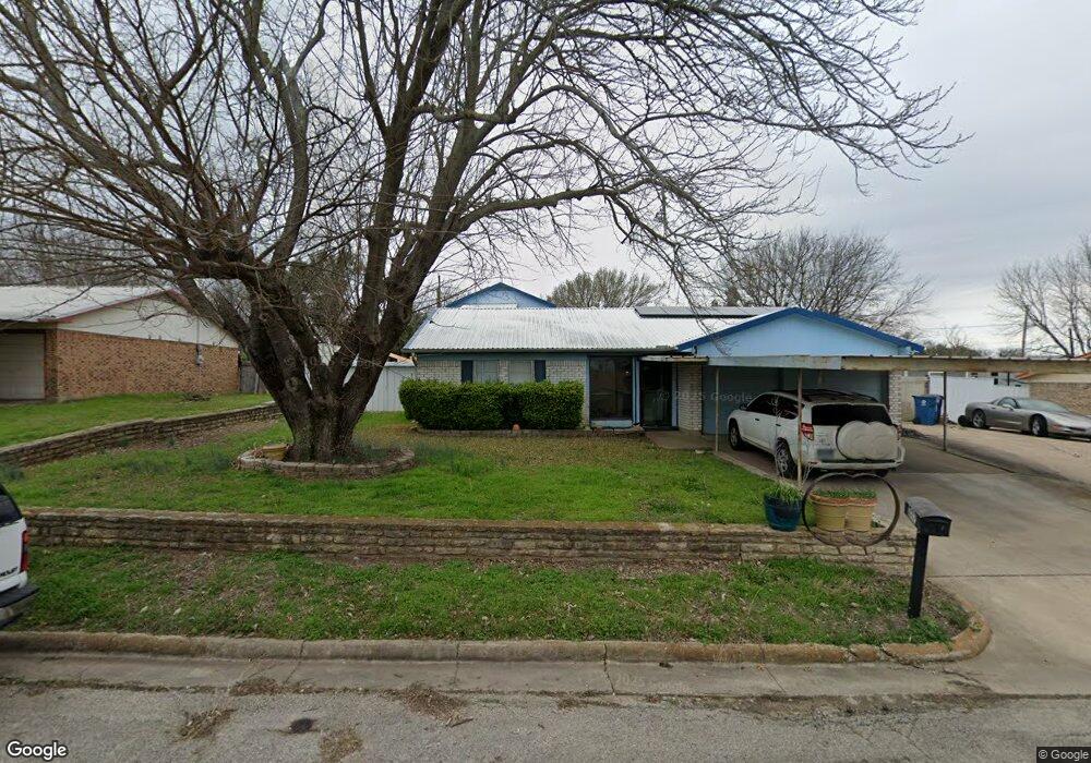
312 Clearwood Dr Fort Worth, TX 76108
Far West Fort Worth NeighborhoodEstimated Value: $268,970 - $392,000
--
Bed
--
Bath
2,008
Sq Ft
$167/Sq Ft
Est. Value
About This Home
This home is located at 312 Clearwood Dr, Fort Worth, TX 76108 and is currently estimated at $335,493, approximately $167 per square foot. 312 Clearwood Dr is a home located in Parker County with nearby schools including McCall Elementary School, Don R Daniel Ninth Grade Campus, and McAnally Intermediate School.
Ownership History
Date
Name
Owned For
Owner Type
Purchase Details
Closed on
Apr 20, 2018
Sold by
Mckinney Judy
Bought by
Mckinney Michael
Current Estimated Value
Home Financials for this Owner
Home Financials are based on the most recent Mortgage that was taken out on this home.
Original Mortgage
$131,945
Outstanding Balance
$113,523
Interest Rate
4.46%
Mortgage Type
New Conventional
Estimated Equity
$221,970
Purchase Details
Closed on
Oct 9, 2006
Sold by
Mckinney Don J and Mckinney Patricia Y
Bought by
Mckinney Judy
Home Financials for this Owner
Home Financials are based on the most recent Mortgage that was taken out on this home.
Original Mortgage
$120,000
Interest Rate
6.44%
Mortgage Type
New Conventional
Purchase Details
Closed on
Dec 16, 1982
Bought by
Mckinney Judy
Create a Home Valuation Report for This Property
The Home Valuation Report is an in-depth analysis detailing your home's value as well as a comparison with similar homes in the area
Home Values in the Area
Average Home Value in this Area
Purchase History
| Date | Buyer | Sale Price | Title Company |
|---|---|---|---|
| Mckinney Michael | -- | None Available | |
| Mckinney Judy | -- | Stnt | |
| Mckinney Judy | -- | -- |
Source: Public Records
Mortgage History
| Date | Status | Borrower | Loan Amount |
|---|---|---|---|
| Open | Mckinney Michael | $131,945 | |
| Closed | Mckinney Judy | $120,000 |
Source: Public Records
Tax History Compared to Growth
Tax History
| Year | Tax Paid | Tax Assessment Tax Assessment Total Assessment is a certain percentage of the fair market value that is determined by local assessors to be the total taxable value of land and additions on the property. | Land | Improvement |
|---|---|---|---|---|
| 2025 | $3,739 | $274,660 | $70,000 | $204,660 |
| 2024 | $3,739 | $207,720 | $46,000 | $161,720 |
| 2023 | $3,739 | $207,720 | $46,000 | $161,720 |
| 2022 | $4,100 | $204,200 | $17,000 | $187,200 |
| 2021 | $4,433 | $204,200 | $17,000 | $187,200 |
| 2020 | $4,126 | $189,770 | $17,000 | $172,770 |
| 2019 | $4,383 | $189,770 | $17,000 | $172,770 |
| 2018 | $2,856 | $123,320 | $15,000 | $108,320 |
| 2017 | $2,893 | $123,320 | $15,000 | $108,320 |
| 2016 | $2,893 | $123,320 | $15,000 | $108,320 |
| 2015 | $1,897 | $123,320 | $15,000 | $108,320 |
| 2014 | $1,906 | $109,320 | $15,000 | $94,320 |
Source: Public Records
Map
Nearby Homes
- 321 Hillcroft Rd
- 11956 Yarmouth Ln
- 233 Alta Mesa Dr
- 11925 Joplin Ln
- 11925 Hathaway Dr
- 11805 Inkberry Dr
- 11752 Pistachio Trail
- 11741 Pistachio Trail
- 109 Arroyo Ct
- 118 Corona Ct
- 11729 Wax Myrtle Trail
- 11900 Carlin Dr
- 11880 Carlin Dr
- 11757 Elko Ln
- 11740 Elko Ln
- 328 Tiara Trail
- 11705 Tuscarora Dr
- 332 Tiara Trail
- 329 Bayonet Dr
- 317 Bayonet Dr
- 314 Clearwood Dr
- 308 Clearwood Dr
- 303 Oakdale Dr
- 304 Clearwood Dr
- 316 Clearwood Dr
- 130 Hillgard Dr
- 313 Oakdale Dr
- 305 Clearwood Dr Unit A
- 309 Clearwood Dr
- 00 Oakdale Dr
- 317 Clearwood Dr
- 301 Oakdale Dr
- 224 Clearwood Dr
- 104 Hillgard Dr
- 125 Hillgard Dr
- 121 Hillgard Dr
- 316 Oakdale Dr
- 220 Clearwood Dr
- 117 Hillgard Dr
- 129 Hillgard Dr