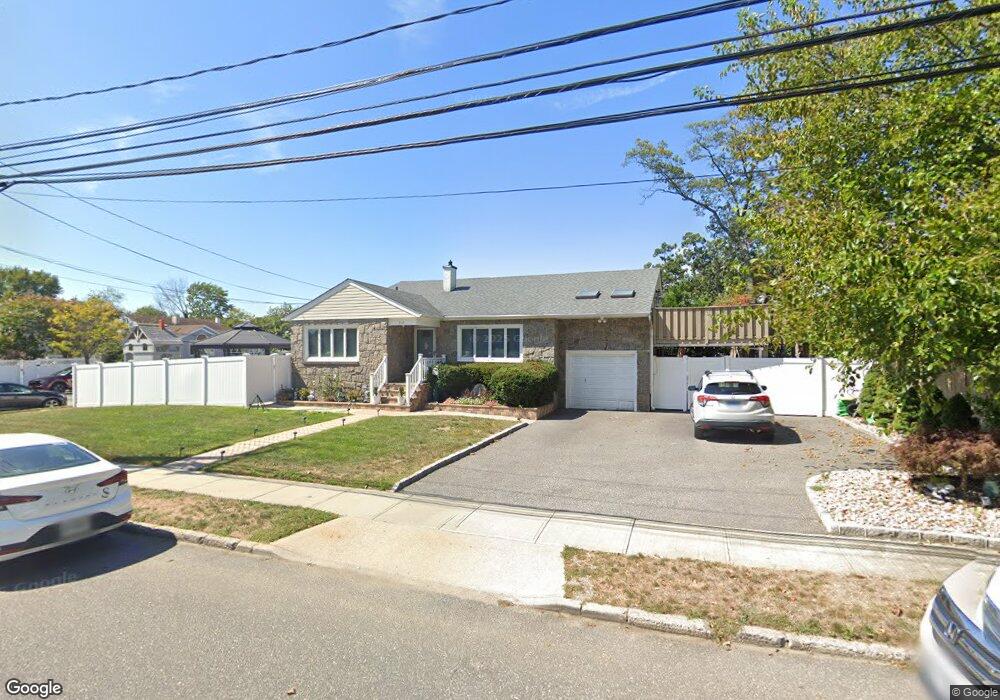
312 Daniel St Lindenhurst, NY 11757
Estimated Value: $634,469 - $712,000
5
Beds
2
Baths
1,761
Sq Ft
$386/Sq Ft
Est. Value
About This Home
This home is located at 312 Daniel St, Lindenhurst, NY 11757 and is currently estimated at $680,367, approximately $386 per square foot. 312 Daniel St is a home located in Suffolk County with nearby schools including Daniel Street School, Lindenhurst Middle School, and Lindenhurst Senior High School.
Ownership History
Date
Name
Owned For
Owner Type
Purchase Details
Closed on
Mar 10, 2023
Sold by
Diaz-Leyton Diana C and Leyton-Diaz Patricia
Bought by
Diaz-Leyton Diana C
Current Estimated Value
Purchase Details
Closed on
Sep 21, 2016
Sold by
Maher Ralph and Maher Mary Ann
Bought by
Diaz Leyton Diana C and Leyton Diaz Patncia
Home Financials for this Owner
Home Financials are based on the most recent Mortgage that was taken out on this home.
Original Mortgage
$366,208
Interest Rate
3.25%
Mortgage Type
FHA
Create a Home Valuation Report for This Property
The Home Valuation Report is an in-depth analysis detailing your home's value as well as a comparison with similar homes in the area
Home Values in the Area
Average Home Value in this Area
Purchase History
| Date | Buyer | Sale Price | Title Company |
|---|---|---|---|
| Diaz-Leyton Diana C | -- | None Available | |
| Diaz Leyton Diana C | $380,000 | None Available |
Source: Public Records
Mortgage History
| Date | Status | Borrower | Loan Amount |
|---|---|---|---|
| Previous Owner | Diaz Leyton Diana C | $366,208 |
Source: Public Records
Tax History Compared to Growth
Tax History
| Year | Tax Paid | Tax Assessment Tax Assessment Total Assessment is a certain percentage of the fair market value that is determined by local assessors to be the total taxable value of land and additions on the property. | Land | Improvement |
|---|---|---|---|---|
| 2024 | $14,309 | $3,700 | $340 | $3,360 |
| 2023 | $12,575 | $3,700 | $340 | $3,360 |
| 2022 | $11,247 | $3,700 | $340 | $3,360 |
| 2021 | $11,247 | $3,700 | $340 | $3,360 |
| 2020 | $11,643 | $3,700 | $340 | $3,360 |
| 2019 | $13,187 | $0 | $0 | $0 |
| 2018 | $11,280 | $3,700 | $340 | $3,360 |
| 2017 | $11,280 | $3,700 | $340 | $3,360 |
| 2016 | $11,307 | $3,700 | $340 | $3,360 |
| 2015 | -- | $3,700 | $340 | $3,360 |
| 2014 | -- | $3,700 | $340 | $3,360 |
Source: Public Records
Map
Nearby Homes
- 465 N Monroe Ave
- 457 N Monroe Ave
- 557 N Kings Ave
- 417 N Monroe Ave
- 475 N Putnam Ave
- 436 N Ontario Ave
- 449 N Indiana Ave
- 404 N Putnam Ave
- 480 N Greene Ave
- 468 N Greene Ave
- 656 N Greene Ave
- 697 N Fulton Ave
- 380 N Delaware Ave
- 833 Bermuda Rd
- 405 N Clinton Ave
- 247 N Greene Ave
- 1701 Alto St
- 681 N Clinton Ave
- 805 Arlington Rd
- 166 & 170 Woodrow Pkwy
- 510 N Lewis Ave
- 503 N Monroe Ave
- 509 N Monroe Ave
- 302 Daniel St
- 520 N Lewis Ave
- 517 N Monroe Ave
- 497 N Monroe Ave
- 509 N Lewis Ave
- 525 N Monroe Ave
- 521 N Lewis Ave
- 493 N Monroe Ave
- 532 N Lewis Ave
- 533 N Monroe Ave
- 504 N Kings Ave
- 489 N Monroe Ave
- 510 N Kings Ave
- 533 N Lewis Ave
- 496 N Monroe Ave
- 541 N Monroe Ave
- 520 N Kings Ave