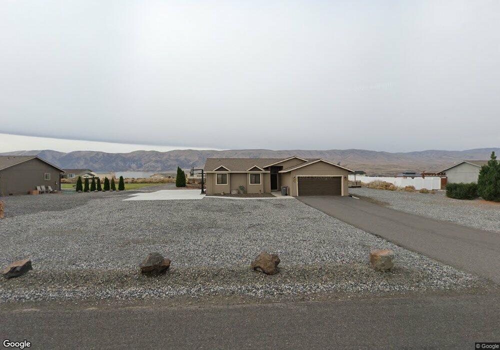
312 Davidson Blvd N Mattawa, WA 99349
Estimated Value: $531,956 - $571,000
3
Beds
2
Baths
1,310
Sq Ft
$420/Sq Ft
Est. Value
About This Home
This home is located at 312 Davidson Blvd N, Mattawa, WA 99349 and is currently estimated at $550,239, approximately $420 per square foot. 312 Davidson Blvd N is a home located in Grant County with nearby schools including Wahluke High School.
Ownership History
Date
Name
Owned For
Owner Type
Purchase Details
Closed on
Apr 18, 2006
Sold by
M D Jackson Co Llc
Bought by
King Warren M and King Jessica A
Current Estimated Value
Home Financials for this Owner
Home Financials are based on the most recent Mortgage that was taken out on this home.
Original Mortgage
$131,600
Outstanding Balance
$72,071
Interest Rate
5.65%
Mortgage Type
Fannie Mae Freddie Mac
Estimated Equity
$478,168
Purchase Details
Closed on
May 25, 2005
Sold by
Desert Aire Associates
Bought by
M D Jackson Co Llc
Create a Home Valuation Report for This Property
The Home Valuation Report is an in-depth analysis detailing your home's value as well as a comparison with similar homes in the area
Home Values in the Area
Average Home Value in this Area
Purchase History
| Date | Buyer | Sale Price | Title Company |
|---|---|---|---|
| King Warren M | $164,500 | Chicago Title Ins Co | |
| M D Jackson Co Llc | $650,608 | Security Title Guara |
Source: Public Records
Mortgage History
| Date | Status | Borrower | Loan Amount |
|---|---|---|---|
| Open | King Warren M | $131,600 |
Source: Public Records
Tax History Compared to Growth
Tax History
| Year | Tax Paid | Tax Assessment Tax Assessment Total Assessment is a certain percentage of the fair market value that is determined by local assessors to be the total taxable value of land and additions on the property. | Land | Improvement |
|---|---|---|---|---|
| 2025 | $4,687 | $480,013 | -- | -- |
| 2024 | $4,166 | $434,750 | $133,000 | $301,750 |
| 2023 | $3,865 | $359,525 | $55,750 | $303,775 |
| 2022 | $3,857 | $359,525 | $55,750 | $303,775 |
| 2021 | $3,147 | $359,525 | $55,750 | $303,775 |
| 2020 | $2,883 | $283,570 | $55,750 | $227,820 |
| 2019 | $2,741 | $235,195 | $30,000 | $205,195 |
| 2018 | $2,975 | $232,280 | $30,000 | $202,280 |
| 2017 | $2,488 | $206,995 | $30,000 | $176,995 |
| 2016 | $2,356 | $196,450 | $30,000 | $166,450 |
| 2013 | -- | $213,180 | $45,000 | $168,180 |
Source: Public Records
Map
Nearby Homes
- 894 Desert Aire Dr SW
- 207 Clayton Place SW
- 851 Desert Aire Dr SW
- 208 Moon River View SW
- 206 Moon River View
- 509B Clubhouse Way Unit A
- 113 Airport Way N Unit 3
- 101 Wren Loop
- 447 Airport Way SW
- 910 Columbia Blvd SW
- 304 Airport Way SW
- 449 Airport Way SW
- 615 Sunset Blvd SW
- 313 Airport Way SW
- 206 Cherry Ln W
- 204 Cherry Ln W
- 453 Airport Way SW
- 412 Apple Place SW
- 227 Sunshine Cir S
- 205 Fairway Place S
- 310 Davidson Blvd N
- 314 Davidson Blvd N
- 3022 Davidson Blvd
- 406 Airport Way N
- 408 Airport Way SW
- 316 Davidson Blvd SW
- 408 Airport Way N
- 404 Airport Way N
- 308 Davidson Blvd N
- 311 Davidson Blvd N
- 309 Davidson Blvd N
- 410 Airport Way N
- 313 Davidson Blvd N
- 307 Davidson Blvd N
- 402 Airport Way SW
- 402 Davidson Blvd SW
- 402 Davidson Blvd SW
- 306 Davidson Blvd N
- 412 Airport Way N
- 403 Davidson Blvd N