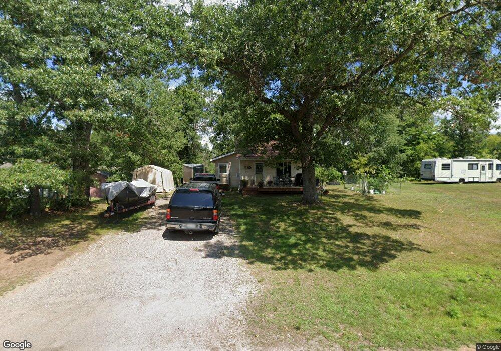
312 E Beaverbrook Ave Spooner, WI 54801
Estimated Value: $115,081 - $239,000
1
Bed
1
Bath
671
Sq Ft
$259/Sq Ft
Est. Value
About This Home
This home is located at 312 E Beaverbrook Ave, Spooner, WI 54801 and is currently estimated at $173,520, approximately $258 per square foot. 312 E Beaverbrook Ave is a home with nearby schools including Spooner Elementary School, Spooner Middle School, and Spooner High School.
Ownership History
Date
Name
Owned For
Owner Type
Purchase Details
Closed on
Mar 29, 2016
Sold by
Lamb Kristine L
Bought by
Kieffer Richard D and Kieffer Robin L
Current Estimated Value
Purchase Details
Closed on
Aug 12, 2011
Sold by
Meyer Lawrence T and Meyer Gloria D
Bought by
Lamb Kristine L
Purchase Details
Closed on
Jul 15, 2011
Sold by
Grade Jerry L and Grade Mary E
Bought by
Meyer Lawrence T and Meyer Gloria D
Create a Home Valuation Report for This Property
The Home Valuation Report is an in-depth analysis detailing your home's value as well as a comparison with similar homes in the area
Purchase History
| Date | Buyer | Sale Price | Title Company |
|---|---|---|---|
| Kieffer Richard D | $47,000 | -- | |
| Lamb Kristine L | -- | -- | |
| Meyer Lawrence T | -- | -- |
Source: Public Records
Tax History
| Year | Tax Paid | Tax Assessment Tax Assessment Total Assessment is a certain percentage of the fair market value that is determined by local assessors to be the total taxable value of land and additions on the property. | Land | Improvement |
|---|---|---|---|---|
| 2025 | $1,477 | $106,400 | $30,300 | $76,100 |
| 2023 | $1,138 | $45,000 | $15,300 | $29,700 |
| 2022 | $807 | $45,000 | $15,300 | $29,700 |
| 2021 | $791 | $45,000 | $15,300 | $29,700 |
| 2020 | $821 | $43,500 | $15,300 | $28,200 |
| 2019 | $760 | $43,500 | $15,300 | $28,200 |
| 2018 | $759 | $43,500 | $15,300 | $28,200 |
| 2017 | $793 | $43,500 | $15,300 | $28,200 |
| 2016 | $905 | $43,500 | $15,300 | $28,200 |
| 2015 | $865 | $43,500 | $15,300 | $28,200 |
| 2014 | $740 | $43,500 | $15,300 | $28,200 |
| 2012 | $777 | $43,500 | $15,300 | $28,200 |
Source: Public Records
Map
Nearby Homes
- XXX Dur A Bilt Rd
- XXX Pine Dr
- 0 Hwy 70 Unit 1594695
- W7234 Wilbur Dr
- 607 College St
- Lot 4 Spooner Outlet Dr
- Lot 5 Spooner Outlet Dr
- Lot 3 Spooner Outlet Dr
- Lot 8 Spooner Outlet Dr
- Lot 6 Spooner Outlet Dr
- 924 Superior St
- Lot 9 Spooner Outlet Dr
- Lot 7 Spooner Outlet Dr
- 1114 Michigan St
- 1120 Northland Dr
- xxx Trails End
- 0 U S 53
- 7395 Miller Rd
- TBD Foss Ln
- W6103 Foss Ln
- 424 E Beaverbrook Ave
- 402 E Beaverbrook Ave
- N4871 Randall Lake Rd
- 282 E Beaver Brook Ave
- 292 E Beaver Brook Ave
- 000 E Beaver Brook Ave
- 4859 Randall Lake Rd
- N4859 Randall Rd
- 290 E Beaverbrook Ave
- 290 E Beaver Brook Ave
- N4887 Randall Lake Rd
- 190 E Beaverbrook Ave
- N4879 Randall Lake Rd
- 808 S Front St
- 724 S Front St
- 811 S Front St
- 922 S Front St
- 708 S Front St
- 4852 Randall Lake Rd
- 0 E Beaverbrook Ave
Your Personal Tour Guide
Ask me questions while you tour the home.