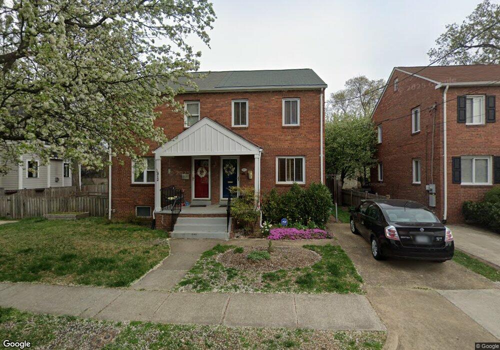
312 E Custis Ave Unit A Alexandria, VA 22301
Del Ray NeighborhoodEstimated Value: $761,408 - $855,000
Studio
1
Bath
1,190
Sq Ft
$682/Sq Ft
Est. Value
About This Home
This home is located at 312 E Custis Ave Unit A, Alexandria, VA 22301 and is currently estimated at $811,102, approximately $681 per square foot. 312 E Custis Ave Unit A is a home located in Alexandria City with nearby schools including Mount Vernon Community School, George Washington Middle School, and Alexandria City High School.
Ownership History
Date
Name
Owned For
Owner Type
Purchase Details
Closed on
Nov 16, 1993
Sold by
Ghauri Wk
Bought by
Broderick Doreen E
Current Estimated Value
Home Financials for this Owner
Home Financials are based on the most recent Mortgage that was taken out on this home.
Original Mortgage
$119,600
Interest Rate
6.79%
Create a Home Valuation Report for This Property
The Home Valuation Report is an in-depth analysis detailing your home's value as well as a comparison with similar homes in the area
Home Values in the Area
Average Home Value in this Area
Purchase History
| Date | Buyer | Sale Price | Title Company |
|---|---|---|---|
| Broderick Doreen E | $149,500 | -- |
Source: Public Records
Mortgage History
| Date | Status | Borrower | Loan Amount |
|---|---|---|---|
| Closed | Broderick Doreen E | $119,600 |
Source: Public Records
Tax History
| Year | Tax Paid | Tax Assessment Tax Assessment Total Assessment is a certain percentage of the fair market value that is determined by local assessors to be the total taxable value of land and additions on the property. | Land | Improvement |
|---|---|---|---|---|
| 2025 | $8,845 | $723,560 | $473,882 | $249,678 |
| 2024 | $8,845 | $723,560 | $473,882 | $249,678 |
| 2023 | $8,032 | $723,560 | $473,882 | $249,678 |
| 2022 | $7,781 | $700,994 | $451,316 | $249,678 |
| 2021 | $7,002 | $630,774 | $382,471 | $248,303 |
| 2020 | $3,727 | $612,405 | $364,102 | $248,303 |
| 2019 | $6,515 | $576,541 | $324,740 | $251,801 |
| 2018 | $6,500 | $575,202 | $324,740 | $250,462 |
| 2017 | $6,258 | $553,795 | $300,685 | $253,110 |
| 2016 | $5,669 | $528,308 | $284,284 | $244,024 |
| 2015 | $5,323 | $510,369 | $266,345 | $244,024 |
| 2014 | $5,117 | $490,629 | $242,131 | $248,498 |
Source: Public Records
Map
Nearby Homes
- 2406 Leslie Ave
- 2403 Burke Ave
- 2205 E Randolph Ave
- 520 E Mount Ida Ave
- 2100 Mount Vernon Ave
- 217 Duncan Ave Unit A
- 527 E Duncan Ave
- 2215 Richmond Hwy Unit 101
- 326 Swann Ave
- 2605 Fall Line St
- 2102 Main Line Blvd
- 1700 Dewitt Ave
- 402 Swann Ave
- 2608 Fall Line St
- 1800 Mount Vernon Ave Unit 207
- 1800 Mount Vernon Ave Unit 306
- 2113 Main Line Blvd
- 106 E Oxford Ave
- 716 Diamond Ave
- 1901 Main Line Blvd Unit 102
- 312 E Custis Ave
- 314 E Custis Ave
- 314 E Custis Ave Unit A
- 314A E Custis Ave
- 308 E Custis Ave
- 316 E Custis Ave
- 313 E Del Ray Ave
- 311 E Del Ray Ave Unit A
- 311 E Del Ray Ave
- 311 A E Del Ray Ave Unit A
- 311 A E Del Ray Ave
- 318 E Custis Ave
- 317 E Del Ray Ave
- 311 E Custis Ave
- 315 E Del Ray Ave Unit A
- 315 E Del Ray Ave
- 315 E Del Ray Ave Unit B
- 315 E Custis Ave Unit A
- 315 E Custis Ave
Your Personal Tour Guide
Ask me questions while you tour the home.