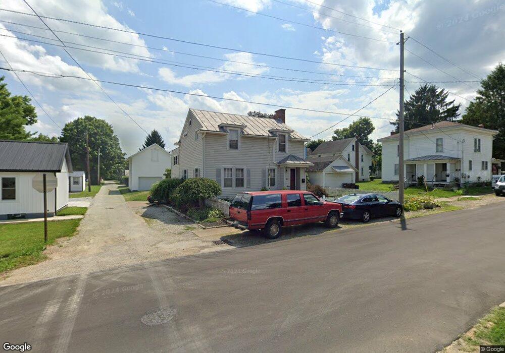
312 E Haskell St Loudonville, OH 44842
Estimated Value: $172,000 - $236,000
4
Beds
2
Baths
1,584
Sq Ft
$119/Sq Ft
Est. Value
About This Home
This home is located at 312 E Haskell St, Loudonville, OH 44842 and is currently estimated at $189,125, approximately $119 per square foot. 312 E Haskell St is a home located in Ashland County with nearby schools including McMullen Elementary School, Budd Elementary School, and Loudonville High School.
Ownership History
Date
Name
Owned For
Owner Type
Purchase Details
Closed on
Oct 10, 2018
Sold by
Abee Janet S
Bought by
Timothy Kay V
Current Estimated Value
Home Financials for this Owner
Home Financials are based on the most recent Mortgage that was taken out on this home.
Original Mortgage
$124,141
Outstanding Balance
$107,378
Interest Rate
4.6%
Mortgage Type
New Conventional
Estimated Equity
$81,747
Purchase Details
Closed on
Sep 4, 2009
Sold by
Hill Charles E and Hill Tiffany M
Bought by
Abee Janet S
Purchase Details
Closed on
Jul 9, 2002
Sold by
Gurney Scott W
Bought by
Hill Charles E
Purchase Details
Closed on
Jul 14, 1997
Sold by
Lance David M
Bought by
Gurney Scott W
Purchase Details
Closed on
May 2, 1994
Bought by
Lance David M
Create a Home Valuation Report for This Property
The Home Valuation Report is an in-depth analysis detailing your home's value as well as a comparison with similar homes in the area
Home Values in the Area
Average Home Value in this Area
Purchase History
| Date | Buyer | Sale Price | Title Company |
|---|---|---|---|
| Timothy Kay V | $121,900 | First Ohio Title Ins | |
| Abee Janet S | $112,500 | -- | |
| Hill Charles E | $91,000 | -- | |
| Gurney Scott W | $78,500 | -- | |
| Lance David M | $60,000 | -- |
Source: Public Records
Mortgage History
| Date | Status | Borrower | Loan Amount |
|---|---|---|---|
| Open | Timothy Kay V | $124,141 |
Source: Public Records
Tax History
| Year | Tax Paid | Tax Assessment Tax Assessment Total Assessment is a certain percentage of the fair market value that is determined by local assessors to be the total taxable value of land and additions on the property. | Land | Improvement |
|---|---|---|---|---|
| 2025 | $1,842 | $47,400 | $3,730 | $43,670 |
| 2024 | $1,842 | $47,400 | $3,730 | $43,670 |
| 2023 | $1,842 | $47,400 | $3,730 | $43,670 |
| 2022 | $1,450 | $32,690 | $2,570 | $30,120 |
| 2021 | $1,470 | $32,690 | $2,570 | $30,120 |
| 2020 | $1,385 | $32,690 | $2,570 | $30,120 |
| 2019 | $1,060 | $24,480 | $2,630 | $21,850 |
| 2018 | $688 | $24,480 | $2,630 | $21,850 |
| 2017 | $693 | $24,480 | $2,630 | $21,850 |
| 2016 | $561 | $21,670 | $2,330 | $19,340 |
| 2015 | $557 | $21,670 | $2,330 | $19,340 |
| 2013 | $637 | $23,490 | $2,370 | $21,120 |
Source: Public Records
Map
Nearby Homes
- 334 N Wood St
- 524 N Union St
- 224 N Water St
- 123 S Spring St
- 800 W Main St
- 8335 Township Road 457
- 7541 Township Road 462
- 7641 Township Road 462
- 6606 Township Road 451
- 6610 Township Road 451
- 367 Algonquion Autumn Unit Lot 367
- 367 Algonquion Autumn
- 367 Alogonquion Autumn Rd
- 14770 Township Road 467
- 131 E Church St
- 979 County Road 3006
- 123 Weltmer Cir
- 609 Ohio 95
- 174 W 2nd St
- 496 Township Road 2402
- 330 E Haskell St
- 330 N Union St Unit 332
- 317 E Haskell St
- 322 N Union St
- 325 E Haskell St
- 404 N Union St
- 335 N Adams St
- 331 N Adams St
- 403 N Adams St
- 410 N Union St
- 325 N Adams St
- 325 N Adams St
- 409 N Adams St
- 316 N Union St
- 416 N Union St
- 317 N Adams St
- 403 N Union St
- 415 N Adams St
- 335 N Union St
- 338 N Adams St
Your Personal Tour Guide
Ask me questions while you tour the home.