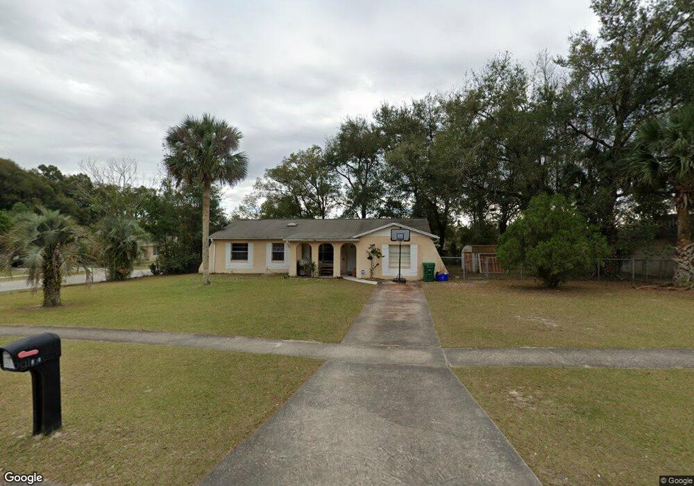
312 E Hubbard Ave Deland, FL 32724
Estimated Value: $228,000 - $288,000
3
Beds
2
Baths
1,512
Sq Ft
$173/Sq Ft
Est. Value
About This Home
This home is located at 312 E Hubbard Ave, Deland, FL 32724 and is currently estimated at $260,887, approximately $172 per square foot. 312 E Hubbard Ave is a home located in Volusia County with nearby schools including Deland High School, Freedom Elementary School, and Deland Middle School.
Ownership History
Date
Name
Owned For
Owner Type
Purchase Details
Closed on
Dec 15, 2008
Sold by
Morton Donna M
Bought by
Aurora Loan Services Llc
Current Estimated Value
Purchase Details
Closed on
Jul 28, 2000
Sold by
Hill Eric H
Bought by
Morton Donna M
Home Financials for this Owner
Home Financials are based on the most recent Mortgage that was taken out on this home.
Original Mortgage
$64,270
Interest Rate
8.12%
Mortgage Type
FHA
Purchase Details
Closed on
Jan 15, 1987
Bought by
U & P Investments Llc
Purchase Details
Closed on
May 15, 1976
Bought by
U & P Investments Llc
Create a Home Valuation Report for This Property
The Home Valuation Report is an in-depth analysis detailing your home's value as well as a comparison with similar homes in the area
Home Values in the Area
Average Home Value in this Area
Purchase History
| Date | Buyer | Sale Price | Title Company |
|---|---|---|---|
| Aurora Loan Services Llc | -- | None Available | |
| Morton Donna M | $64,800 | -- | |
| U & P Investments Llc | $46,000 | -- | |
| U & P Investments Llc | $28,500 | -- |
Source: Public Records
Mortgage History
| Date | Status | Borrower | Loan Amount |
|---|---|---|---|
| Previous Owner | Morton Donna M | $64,270 |
Source: Public Records
Tax History Compared to Growth
Tax History
| Year | Tax Paid | Tax Assessment Tax Assessment Total Assessment is a certain percentage of the fair market value that is determined by local assessors to be the total taxable value of land and additions on the property. | Land | Improvement |
|---|---|---|---|---|
| 2025 | $2,031 | $193,066 | $28,130 | $164,936 |
| 2024 | $2,031 | $196,693 | $28,130 | $168,563 |
| 2023 | $2,031 | $180,309 | $21,299 | $159,010 |
| 2022 | $1,934 | $174,281 | $21,299 | $152,982 |
| 2021 | $1,834 | $149,989 | $13,663 | $136,326 |
| 2020 | $1,563 | $116,641 | $10,448 | $106,193 |
| 2019 | $1,482 | $105,823 | $8,935 | $96,888 |
| 2018 | $1,357 | $89,087 | $8,123 | $80,964 |
| 2017 | $1,242 | $75,439 | $8,084 | $67,355 |
| 2016 | $1,053 | $58,211 | $0 | $0 |
| 2015 | $1,027 | $57,920 | $0 | $0 |
| 2014 | $860 | $39,718 | $0 | $0 |
Source: Public Records
Map
Nearby Homes
- 614 S Amelia Ave
- 338 E Volusia Ave
- 13 Villa Villar Ct Unit 130
- 9 Villa Villar Ct
- 0 S Garfield Ave Unit MFRV4945071
- 35 Villa Villar Ct Unit 35
- 333 E Beresford Ave
- 127 Alexandria Cir
- 590 E Division St
- 47 Villa Villar Ct Unit 470
- 0 Deland Unit MFRV4942835
- 0 Deland Unit 1213697
- 0 Deland Unit R11052053
- 233 Elmwood Ave Unit 290
- 0 U S 92
- 610 E Euclid Ave
- 205 E Voorhis Ave
- 215 E Voorhis Ave Unit 2D
- 138 W Volusia Ave
- 205 W Division St
- 308 E Hubbard Ave
- 603 Larry Dr
- 605 Larry Dr
- 596 Laisy Dr
- 309 E Hubbard Ave
- 307 E Hubbard Ave
- 304 E Hubbard Ave
- 602 Laisy Dr
- 315 E Hubbard Ave
- 607 Larry Dr
- 305 E Hubbard Ave
- 604 Larry Dr
- 550 Barbara Ct
- 302 E Hubbard Ave
- 606 Laisy Dr
- 303 E Hubbard Ave
- 609 Larry Dr
- 601 Laisy Dr
- 608 Larry Dr
- 0 Barbara Ct Unit S4852699