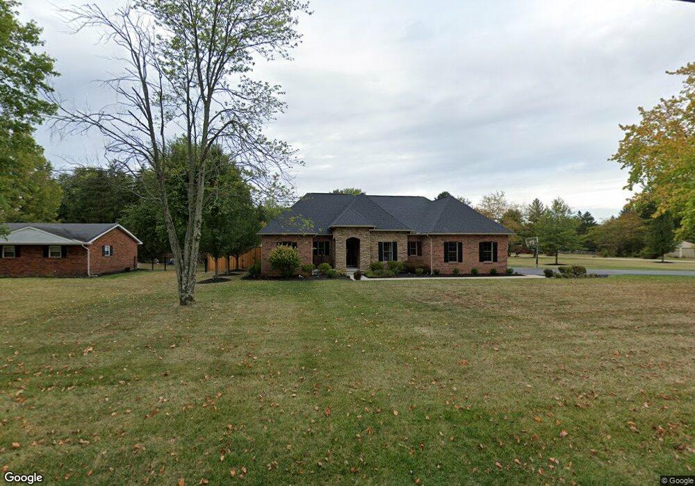
312 Free Soil Rd Georgetown, OH 45121
Estimated Value: $335,000 - $470,328
3
Beds
3
Baths
1,976
Sq Ft
$200/Sq Ft
Est. Value
About This Home
This home is located at 312 Free Soil Rd, Georgetown, OH 45121 and is currently estimated at $395,332, approximately $200 per square foot. 312 Free Soil Rd is a home located in Brown County with nearby schools including Georgetown Elementary School and Georgetown Jr/Sr High School.
Ownership History
Date
Name
Owned For
Owner Type
Purchase Details
Closed on
Jun 27, 2017
Sold by
Parker Robin D
Bought by
Highlander Property Management Llc
Current Estimated Value
Purchase Details
Closed on
Jan 20, 2017
Sold by
Highlander Wade and Highlander Lori
Bought by
Highlander Wade and Highlander Lori
Home Financials for this Owner
Home Financials are based on the most recent Mortgage that was taken out on this home.
Original Mortgage
$240,000
Interest Rate
4.3%
Mortgage Type
New Conventional
Purchase Details
Closed on
Feb 17, 2016
Sold by
Henson Marcella M
Bought by
Highlander Lori
Purchase Details
Closed on
Jul 31, 2006
Sold by
Loudon Bethany J and Loudon Douglas E
Bought by
Highlander Wade
Purchase Details
Closed on
Jul 25, 2006
Sold by
Estate Of Dorothy Highlander
Bought by
Loudon Bethany J and Highlander Loree
Create a Home Valuation Report for This Property
The Home Valuation Report is an in-depth analysis detailing your home's value as well as a comparison with similar homes in the area
Home Values in the Area
Average Home Value in this Area
Purchase History
| Date | Buyer | Sale Price | Title Company |
|---|---|---|---|
| Highlander Property Management Llc | $20,000 | None Available | |
| Highlander Wade | -- | None Available | |
| Highlander Lori | $27,000 | None Available | |
| Highlander Wade | -- | None Available | |
| Loudon Bethany J | -- | None Available |
Source: Public Records
Mortgage History
| Date | Status | Borrower | Loan Amount |
|---|---|---|---|
| Previous Owner | Highlander Wade | $240,000 |
Source: Public Records
Tax History Compared to Growth
Tax History
| Year | Tax Paid | Tax Assessment Tax Assessment Total Assessment is a certain percentage of the fair market value that is determined by local assessors to be the total taxable value of land and additions on the property. | Land | Improvement |
|---|---|---|---|---|
| 2024 | $5,031 | $141,540 | $8,680 | $132,860 |
| 2023 | $5,031 | $115,200 | $6,670 | $108,530 |
| 2022 | $4,457 | $115,200 | $6,670 | $108,530 |
| 2021 | $4,416 | $115,200 | $6,670 | $108,530 |
| 2020 | $3,907 | $95,990 | $5,550 | $90,440 |
| 2019 | $3,879 | $95,990 | $5,550 | $90,440 |
| 2018 | $3,840 | $95,990 | $5,550 | $90,440 |
| 2017 | $2,765 | $82,050 | $5,660 | $76,390 |
| 2016 | $2,764 | $82,050 | $5,660 | $76,390 |
| 2015 | $1,397 | $10,400 | $5,660 | $4,740 |
| 2014 | $1,397 | $39,290 | $5,150 | $34,140 |
| 2013 | $1,393 | $39,290 | $5,150 | $34,140 |
Source: Public Records
Map
Nearby Homes
- 59 Williams Dr
- 27 Marilyn Dr
- 20 Heritage Hill Dr
- 155 Free Soil Rd
- 470 Free Soil Rd
- 20 Lakeview Acres Dr
- 175 Douglas Cir
- 0 Douglas Ln Unit 1641744
- 418 Home St
- 25 Douglas Ln
- 505 S Water St
- 402 S Pleasant St
- 0 St Rt 221 & Footbridge Unit 1826509
- 306 W 2nd St
- 666 E State St
- 708 E State St
- 104 Elm St
- 102 Bill Dee Dr
- 406 E North St
- 405 N Main St
- 324 Free Soil Rd
- 29 Williams Dr
- 334 Free Soil Rd
- 30 Curry Ridge Rd
- 39 Williams Dr
- 40 Curry Ridge Rd
- 341 Free Soil Rd
- 278 Free Soil Rd
- 49 Williams Dr
- 350 Free Soil Rd
- 251 Free Soil Rd
- 251 Free Soil Rd
- 285 Free Soil Rd
- 40 Williams Dr
- 31 Curry Ridge Rd
- 266 Free Soil Rd
- 360 Free Soil Rd
- 41 Curry Ridge Rd
- 60 Curry Ridge Rd
- 168 Lakeview Acres Dr