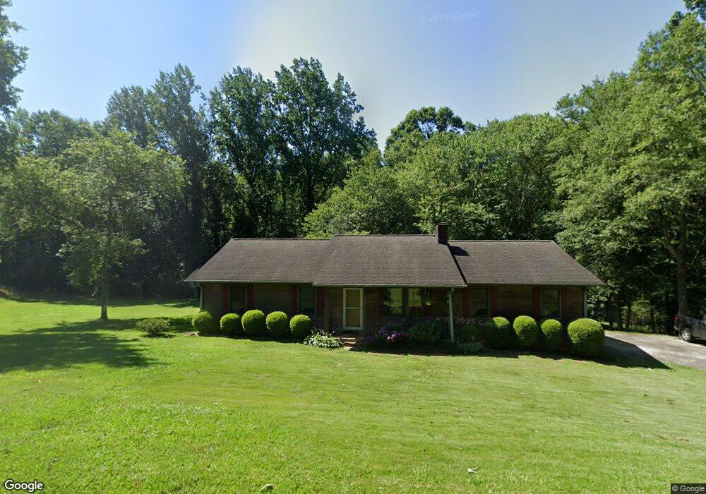
312 Gilstrap Dr Liberty, SC 29657
Estimated Value: $208,000 - $271,000
3
Beds
2
Baths
1,170
Sq Ft
$201/Sq Ft
Est. Value
About This Home
This home is located at 312 Gilstrap Dr, Liberty, SC 29657 and is currently estimated at $234,914, approximately $200 per square foot. 312 Gilstrap Dr is a home located in Pickens County with nearby schools including Liberty Elementary School, Liberty Middle School, and Liberty High School.
Ownership History
Date
Name
Owned For
Owner Type
Purchase Details
Closed on
Jan 30, 2007
Sold by
Anderson Jack W
Bought by
Splawn Jason L
Current Estimated Value
Home Financials for this Owner
Home Financials are based on the most recent Mortgage that was taken out on this home.
Original Mortgage
$80,750
Outstanding Balance
$48,150
Interest Rate
6.08%
Estimated Equity
$186,764
Create a Home Valuation Report for This Property
The Home Valuation Report is an in-depth analysis detailing your home's value as well as a comparison with similar homes in the area
Home Values in the Area
Average Home Value in this Area
Purchase History
| Date | Buyer | Sale Price | Title Company |
|---|---|---|---|
| Splawn Jason L | $85,000 | Attorney | |
| Anderson Jack W | -- | Attorney |
Source: Public Records
Mortgage History
| Date | Status | Borrower | Loan Amount |
|---|---|---|---|
| Open | Splawn Jason L | $80,750 |
Source: Public Records
Tax History Compared to Growth
Tax History
| Year | Tax Paid | Tax Assessment Tax Assessment Total Assessment is a certain percentage of the fair market value that is determined by local assessors to be the total taxable value of land and additions on the property. | Land | Improvement |
|---|---|---|---|---|
| 2024 | $692 | $4,330 | $680 | $3,650 |
| 2023 | $622 | $4,330 | $680 | $3,650 |
| 2022 | $0 | $4,330 | $680 | $3,650 |
| 2021 | $637 | $4,330 | $680 | $3,650 |
| 2020 | $637 | $4,332 | $680 | $3,652 |
| 2019 | $640 | $4,330 | $680 | $3,650 |
| 2018 | $629 | $3,930 | $680 | $3,250 |
| 2017 | $542 | $3,930 | $680 | $3,250 |
| 2015 | $500 | $3,930 | $0 | $0 |
| 2008 | -- | $3,730 | $600 | $3,130 |
Source: Public Records
Map
Nearby Homes
- 11 Moorefield Memorial Hwy
- 10 Moorefield Memorial Hwy
- 09 Moorefield Memorial Hwy
- 03 Moorefield Memorial Hwy
- 12 Moorefield Memorial Hwy
- 01 Moorefield Memorial Hwy
- 00 Moorefield Memorial Hwy
- 02 Moorefield Memorial Hwy
- 05 Moorefield Memorial Hwy
- 426 N Palmetto St
- 311 Davis Rd
- 108 Meadow Ln
- 00 E Main St
- 17 Southern St
- 11 Southern St
- 13 Southern St
- 125 Towns End Dr
- 121 Forrester Dr
- 714 N Ashton Dr
- 409 W Main St
- 310 Gilstrap Dr
- 315 Gilstrap Dr
- 318 Gilstrap Dr
- 111 Blue Ridge Dr
- 309 Gilstrap Dr
- 112 Faye St
- 114 Faye St
- 319 Gilstrap Dr
- 110 Faye St
- 108 Faye St
- 320 Gilstrap Dr
- 102 Faye St
- 305 Gilstrap Dr
- 323 Gilstrap Dr
- 115 Blue Ridge Dr
- 110 Virginia Dr
- 117 Harry Davis Dr
- 105 Faye St
- 200 Harry Davis Dr
- 219 Harry Davis Dr