Estimated Value: $83,000 - $144,000
--
Bed
2
Baths
952
Sq Ft
$117/Sq Ft
Est. Value
About This Home
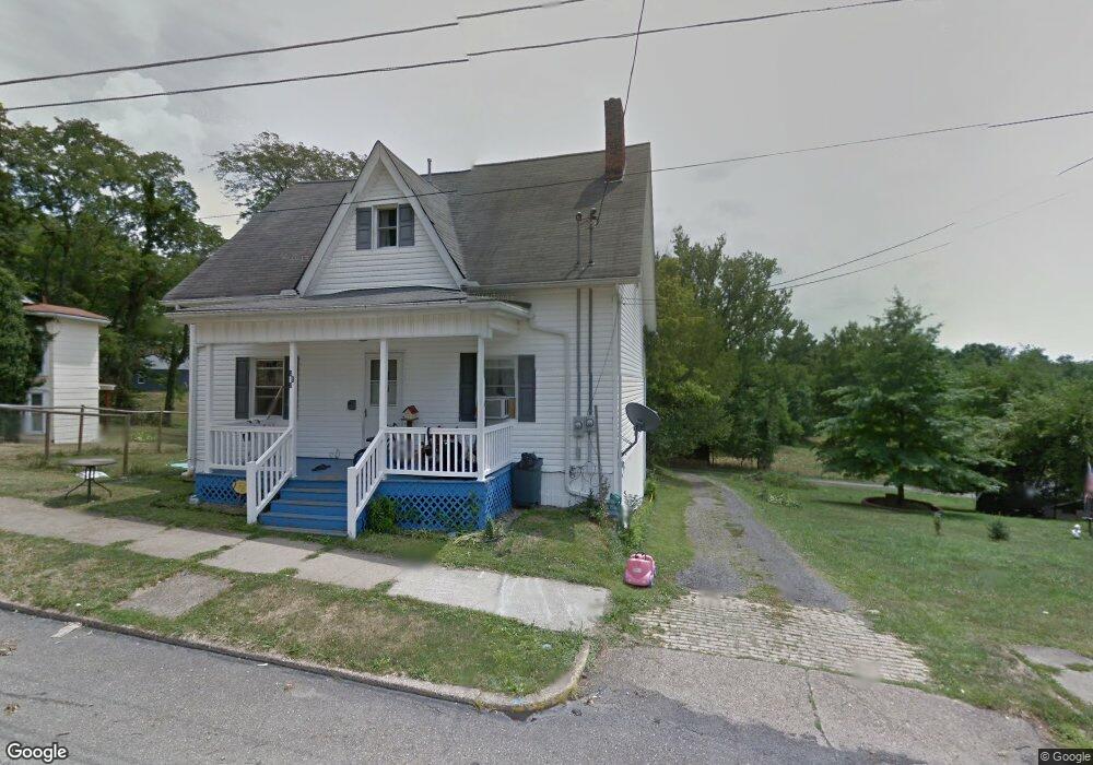
This home is located at 312 Grant St, Cadiz, OH 43907 and is currently estimated at $111,700, approximately $117 per square foot. 312 Grant St is a home located in Harrison County with nearby schools including Harrison Central Elementary School and Harrison Central Junior/Senior High School.
Ownership History
Date
Name
Owned For
Owner Type
Purchase Details
Closed on
Jun 6, 2014
Sold by
Tuttle Charles E and Tuttle Kathleen R
Bought by
Tuttle Shawn F
Current Estimated Value
Purchase Details
Closed on
Feb 11, 2004
Sold by
Marks William J and Marks Tracy J
Bought by
Tuttle Charles E and Tuttle Kathleen R
Purchase Details
Closed on
Jan 28, 2003
Purchase Details
Closed on
Nov 15, 2001
Purchase Details
Closed on
Jul 19, 2000
Purchase Details
Closed on
Aug 31, 1999
Create a Home Valuation Report for This Property
The Home Valuation Report is an in-depth analysis detailing your home's value as well as a comparison with similar homes in the area
Home Values in the Area
Average Home Value in this Area
Purchase History
| Date | Buyer | Sale Price | Title Company |
|---|---|---|---|
| Tuttle Shawn F | -- | None Available | |
| Tuttle Charles E | $72,100 | Eagle Title Agency Inc | |
| -- | -- | -- | |
| -- | -- | -- | |
| -- | $4,000 | -- | |
| -- | $6,000 | -- |
Source: Public Records
Tax History Compared to Growth
Tax History
| Year | Tax Paid | Tax Assessment Tax Assessment Total Assessment is a certain percentage of the fair market value that is determined by local assessors to be the total taxable value of land and additions on the property. | Land | Improvement |
|---|---|---|---|---|
| 2024 | $931 | $23,440 | $3,020 | $20,420 |
| 2023 | $931 | $23,440 | $3,020 | $20,420 |
| 2022 | $892 | $21,010 | $2,500 | $18,510 |
| 2021 | $863 | $21,010 | $2,500 | $18,510 |
| 2020 | $860 | $21,010 | $2,500 | $18,510 |
| 2019 | $737 | $17,800 | $2,110 | $15,690 |
| 2018 | $737 | $17,800 | $2,110 | $15,690 |
| 2017 | $728 | $17,800 | $2,110 | $15,690 |
| 2016 | $711 | $15,840 | $2,000 | $13,840 |
| 2015 | $710 | $15,840 | $2,000 | $13,840 |
| 2014 | $581 | $15,280 | $1,820 | $13,460 |
| 2013 | $581 | $15,280 | $1,820 | $13,460 |
Source: Public Records
Map
Nearby Homes
- 413 Saint Clair Ave
- 419 Saint Clair Ave
- 254 S Buffalo St
- 608 Kerr Ave
- 545 E Market St
- 102 Cadiz Ave
- 388 N Main St
- 804 E Market St
- 0 E Market St
- 265 Old Steubenville Pike
- 390 Oak Park Rd
- 273 Old Steubenville Pike
- 0 N Main St Unit 5153554
- 78791 Kanoski Rd
- 0 Brewer Rd
- 39000 Lees Run Rd
- 77900 Slater Rd
- 85200 Merryman Rd
- 315 Euclid Ave
- 42535 Jewett Scio Rd