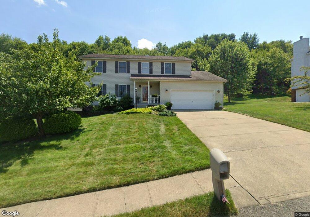
312 Green Fields Ct Cranberry Township, PA 16066
Estimated Value: $458,000 - $538,689
3
Beds
3
Baths
2,310
Sq Ft
$211/Sq Ft
Est. Value
About This Home
This home is located at 312 Green Fields Ct, Cranberry Township, PA 16066 and is currently estimated at $486,422, approximately $210 per square foot. 312 Green Fields Ct is a home located in Butler County with nearby schools including Haine Middle School, Rowan Elementary School, and Ryan Gloyer Middle School.
Ownership History
Date
Name
Owned For
Owner Type
Purchase Details
Closed on
Dec 10, 2003
Sold by
Hanek Brian F
Bought by
Mudrany John E
Current Estimated Value
Home Financials for this Owner
Home Financials are based on the most recent Mortgage that was taken out on this home.
Original Mortgage
$186,000
Outstanding Balance
$86,309
Interest Rate
5.9%
Mortgage Type
New Conventional
Estimated Equity
$400,113
Purchase Details
Closed on
Feb 26, 1999
Sold by
Wing Bruce A
Bought by
Hanek Brian F
Home Financials for this Owner
Home Financials are based on the most recent Mortgage that was taken out on this home.
Original Mortgage
$136,400
Interest Rate
6.76%
Mortgage Type
Purchase Money Mortgage
Create a Home Valuation Report for This Property
The Home Valuation Report is an in-depth analysis detailing your home's value as well as a comparison with similar homes in the area
Home Values in the Area
Average Home Value in this Area
Purchase History
| Date | Buyer | Sale Price | Title Company |
|---|---|---|---|
| Mudrany John E | $232,500 | -- | |
| Hanek Brian F | $173,000 | -- |
Source: Public Records
Mortgage History
| Date | Status | Borrower | Loan Amount |
|---|---|---|---|
| Open | Mudrany John E | $186,000 | |
| Previous Owner | Hanek Brian F | $136,400 |
Source: Public Records
Tax History Compared to Growth
Tax History
| Year | Tax Paid | Tax Assessment Tax Assessment Total Assessment is a certain percentage of the fair market value that is determined by local assessors to be the total taxable value of land and additions on the property. | Land | Improvement |
|---|---|---|---|---|
| 2025 | $5,926 | $33,070 | $3,850 | $29,220 |
| 2024 | $5,750 | $33,070 | $3,850 | $29,220 |
| 2023 | $5,666 | $33,070 | $3,850 | $29,220 |
| 2022 | $5,666 | $33,070 | $3,850 | $29,220 |
| 2021 | $5,581 | $33,070 | $0 | $0 |
| 2020 | $5,581 | $33,070 | $3,850 | $29,220 |
| 2019 | $5,519 | $33,070 | $3,850 | $29,220 |
| 2018 | $5,519 | $33,070 | $3,850 | $29,220 |
| 2017 | $5,419 | $33,070 | $3,850 | $29,220 |
| 2016 | $1,487 | $33,070 | $3,850 | $29,220 |
| 2015 | $670 | $33,070 | $3,850 | $29,220 |
| 2014 | $670 | $33,070 | $3,850 | $29,220 |
Source: Public Records
Map
Nearby Homes
- 109 Founders St
- 109 Foundry Pike
- 405 Mallard Dr
- 311 Palisade Way
- 319 Palisade Way
- Elgin Plan at Brookvue - Single Family
- Ellsworth Plan at Brookvue - Single Family
- Montclair Plan at Brookvue - Single Family
- Dundee Plan at Brookvue - Single Family
- 3500 Unionville Rd Unit Morrison
- Andover Plan at Brookvue - Single Family
- Bromley Plan at Brookvue - Single Family
- 3500 Unionville Rd Unit Dundee
- 3500 Unionville Rd Unit Arundel
- Helston Plan at Brookvue - Single Family
- 3500 Unionville Rd Unit Montclair
- Arundel Plan at Brookvue - Single Family
- 3500 Unionville Rd Unit Bromley
- 3500 Unionville Rd Unit Andover
- Morrison Plan at Brookvue - Single Family
- 310 Green Fields Ct
- 314 Green Fields Ct
- 316 Green Fields Ct
- 308 Green Fields Ct
- 107 Stonefield Dr
- 105 Stonefield Dr
- 311 Green Fields Ct
- 204 Farmview Ct
- 309 Green Fields Ct
- 313 Green Fields Ct
- 403 Summit Ct
- 202 Farmview Ct
- 109 Stonefield Dr
- 318 Green Fields Ct
- 315 Green Fields Ct
- 307 Green Fields Ct
- 111 Stonefield Dr
- 320 Green Fields Ct
- 103 Stonefield Dr
- 317 Green Fields Ct