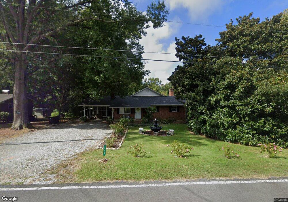
312 Hocutt Rd Durham, NC 27703
Eastern Durham NeighborhoodEstimated Value: $313,206 - $364,000
3
Beds
1
Bath
1,760
Sq Ft
$191/Sq Ft
Est. Value
About This Home
This home is located at 312 Hocutt Rd, Durham, NC 27703 and is currently estimated at $336,302, approximately $191 per square foot. 312 Hocutt Rd is a home located in Durham County with nearby schools including Oak Grove Elementary, John W Neal Middle School, and Southern School of Energy & Sustainability.
Ownership History
Date
Name
Owned For
Owner Type
Purchase Details
Closed on
Jul 9, 2010
Sold by
Ramsey Williams D and Ramsey Jamie R
Bought by
Ramsey William Kyle
Current Estimated Value
Home Financials for this Owner
Home Financials are based on the most recent Mortgage that was taken out on this home.
Original Mortgage
$96,000
Outstanding Balance
$63,825
Interest Rate
4.73%
Mortgage Type
New Conventional
Estimated Equity
$272,477
Purchase Details
Closed on
Apr 16, 2009
Sold by
Ramsey Sara N
Bought by
Ramsey Williams D and Ramsey Jamie R
Home Financials for this Owner
Home Financials are based on the most recent Mortgage that was taken out on this home.
Original Mortgage
$48,000
Interest Rate
5.18%
Mortgage Type
Construction
Create a Home Valuation Report for This Property
The Home Valuation Report is an in-depth analysis detailing your home's value as well as a comparison with similar homes in the area
Home Values in the Area
Average Home Value in this Area
Purchase History
| Date | Buyer | Sale Price | Title Company |
|---|---|---|---|
| Ramsey William Kyle | -- | None Available | |
| Ramsey Williams D | $60,000 | None Available |
Source: Public Records
Mortgage History
| Date | Status | Borrower | Loan Amount |
|---|---|---|---|
| Open | Ramsey William Kyle | $96,000 | |
| Closed | Ramsey Williams D | $48,000 |
Source: Public Records
Tax History
| Year | Tax Paid | Tax Assessment Tax Assessment Total Assessment is a certain percentage of the fair market value that is determined by local assessors to be the total taxable value of land and additions on the property. | Land | Improvement |
|---|---|---|---|---|
| 2025 | $2,220 | $305,036 | $116,000 | $189,036 |
| 2024 | $1,878 | $175,344 | $40,000 | $135,344 |
| 2023 | $1,807 | $175,344 | $40,000 | $135,344 |
| 2022 | $1,751 | $175,344 | $40,000 | $135,344 |
| 2021 | $1,538 | $175,344 | $40,000 | $135,344 |
| 2020 | $1,503 | $175,344 | $40,000 | $135,344 |
| 2019 | $1,485 | $175,344 | $40,000 | $135,344 |
| 2018 | $1,364 | $147,753 | $28,000 | $119,753 |
| 2017 | $1,319 | $147,753 | $28,000 | $119,753 |
| 2016 | $1,279 | $147,753 | $28,000 | $119,753 |
| 2015 | $1,491 | $146,507 | $29,737 | $116,770 |
| 2014 | $1,499 | $146,507 | $29,737 | $116,770 |
Source: Public Records
Map
Nearby Homes
- 2800-2809 Napoli Dr
- 442 Gus Rd
- 5002 Wake Forest Hwy
- 528 Plumleaf Ln
- 13 Blackthorn Ln
- 17 Plumleaf Ln
- 1112 Blackthorn Ln
- 517 Keith St
- 607 Ravenstone Ln
- 601 Crossing Dr
- 208 Lick Creek Ln
- 210 Stallings Rd
- 6 Spicewood Ct
- 807 Outlaw Ave
- 1114 Blackthorn Ln
- 621 Wellwater Ave
- 1056 Arbor Edge Ln
- 1125 Arbor Edge Ln
- 107 Crosswood Dr
- 819 Ember Dr
- 308 Hocutt Rd
- 316 Hocutt Rd
- 211 Hocutt Rd
- 206 Hocutt Rd
- 202 Hocutt Rd
- 206 Hocutt Rd Unit LT 7
- 206 Hocutt Rd Unit LT 8
- 327 Hocutt Rd
- 302 Hocutt Rd
- 315 Hocutt Rd
- 303 Hocutt Rd
- 311 Hocutt Rd
- 320 Hocutt Rd
- 321 Hocutt Rd
- 324 Hocutt Rd
- 305 Robbins Rd
- 226 Hocutt Rd
- 325 Hocutt Rd
- 301 Robbins Rd
- 229 Robbins Rd
Your Personal Tour Guide
Ask me questions while you tour the home.