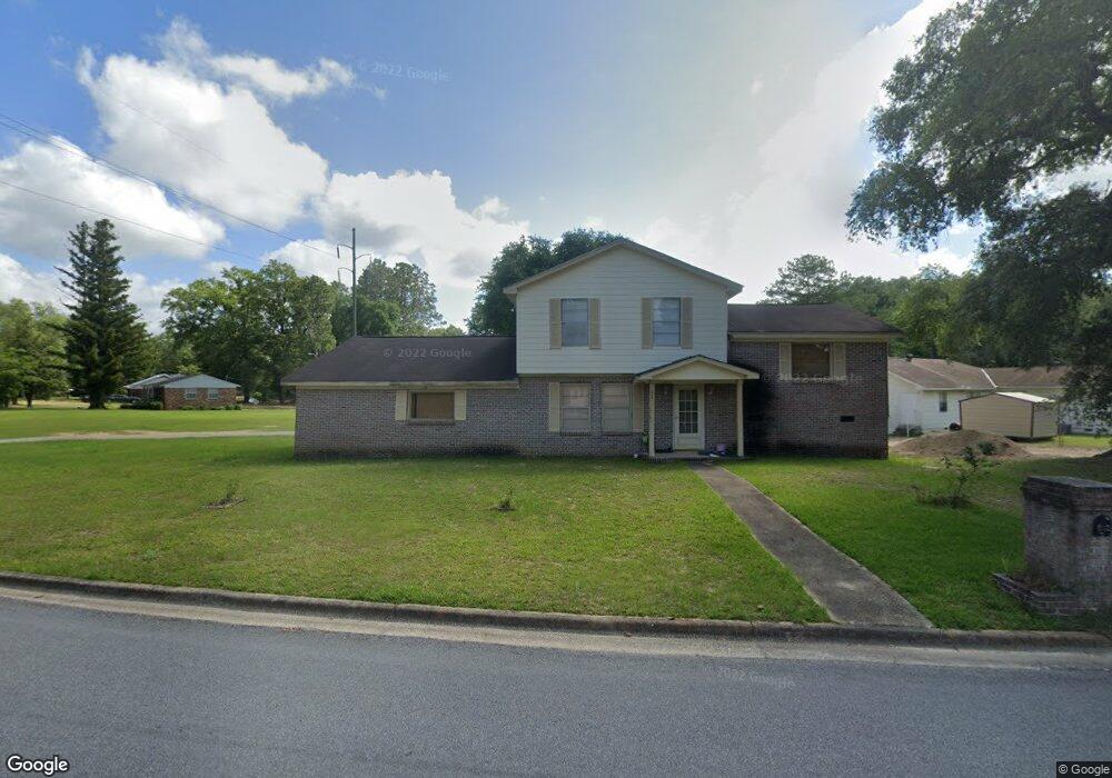
312 Independence Dr Albany, GA 31705
Estimated Value: $58,000 - $133,000
3
Beds
3
Baths
2,476
Sq Ft
$41/Sq Ft
Est. Value
About This Home
This home is located at 312 Independence Dr, Albany, GA 31705 and is currently estimated at $101,219, approximately $40 per square foot. 312 Independence Dr is a home located in Dougherty County with nearby schools including Turner Elementary School, Albany Middle School, and Radium Springs Middle School.
Ownership History
Date
Name
Owned For
Owner Type
Purchase Details
Closed on
Sep 22, 2009
Sold by
Harris Iona
Bought by
Harris Lakeshica
Current Estimated Value
Purchase Details
Closed on
Apr 30, 1991
Sold by
Star Aquistion Corp
Bought by
Harris Iona
Purchase Details
Closed on
May 31, 1990
Sold by
Insilco Corp
Bought by
Star Aquisition Corp
Purchase Details
Closed on
Aug 1, 1989
Sold by
Roberts Larry
Bought by
Insilco Corp
Create a Home Valuation Report for This Property
The Home Valuation Report is an in-depth analysis detailing your home's value as well as a comparison with similar homes in the area
Home Values in the Area
Average Home Value in this Area
Purchase History
| Date | Buyer | Sale Price | Title Company |
|---|---|---|---|
| Harris Lakeshica | -- | -- | |
| Harris Iona | $9,900 | -- | |
| Star Aquisition Corp | $5,000 | -- | |
| Insilco Corp | $10,000 | -- |
Source: Public Records
Tax History Compared to Growth
Tax History
| Year | Tax Paid | Tax Assessment Tax Assessment Total Assessment is a certain percentage of the fair market value that is determined by local assessors to be the total taxable value of land and additions on the property. | Land | Improvement |
|---|---|---|---|---|
| 2024 | $1,706 | $35,760 | $2,200 | $33,560 |
| 2023 | $1,666 | $35,760 | $2,200 | $33,560 |
| 2022 | $1,672 | $35,760 | $2,200 | $33,560 |
| 2021 | $1,550 | $35,760 | $2,200 | $33,560 |
| 2020 | $1,554 | $42,480 | $2,200 | $40,280 |
| 2019 | $1,853 | $42,480 | $2,200 | $40,280 |
| 2018 | $1,861 | $42,480 | $2,200 | $40,280 |
| 2017 | $1,733 | $42,480 | $2,200 | $40,280 |
| 2016 | $1,734 | $42,480 | $2,200 | $40,280 |
| 2015 | $1,739 | $42,480 | $2,200 | $40,280 |
| 2014 | $1,717 | $42,480 | $2,200 | $40,280 |
Source: Public Records
Map
Nearby Homes
- 308 Forrestal Ln
- 2725 Yorktown Ave
- 2529 Cherokee Dr
- 2731 Yorktown Ave
- 2523 Cherokee Dr
- 148 Force Dr
- 2802 Banks Ave
- 234 Cone St
- 410 Johnson Rd
- 3007 E Park Ct
- 405 Pine Bluff Rd
- 513 Johnson Rd
- 306 Elsom St
- 2215 E Broad Ave
- 307 Acorn St
- 309 Acorn St
- 2921 Madeline Rd
- 2006 Keystone Ave
- 2004 Keystone Ave
- 119 N West Rd
- 301 Forrestal Ln
- 303 Forrestal Ln
- 305 Forrestal Ln
- 307 Independence Dr
- 309 Independence Dr
- 315 Independence Dr
- 303 Independence Dr
- 318 Independence Dr
- 317 Independence Dr
- 300 Forrestal Ln
- 301 Independence Dr
- 319 Independence Dr
- 320 Independence Dr
- 301 Lexington Dr
- 209 Lexington Dr
- 321 Independence Dr
- 306 Forrestal Ln
- 322 Independence Dr
- 207 Lexington Dr
- 303 Lexington Dr