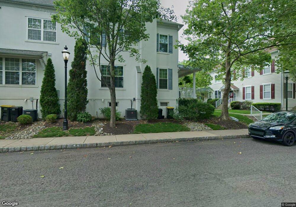
312 Lantern Dr Unit 111 Doylestown, PA 18901
Estimated Value: $474,046 - $508,000
3
Beds
3
Baths
1,400
Sq Ft
$352/Sq Ft
Est. Value
About This Home
This home is located at 312 Lantern Dr Unit 111, Doylestown, PA 18901 and is currently estimated at $492,262, approximately $351 per square foot. 312 Lantern Dr Unit 111 is a home located in Bucks County with nearby schools including Doyle El School, Lenape Middle School, and Central Bucks High School-West.
Ownership History
Date
Name
Owned For
Owner Type
Purchase Details
Closed on
Dec 11, 2002
Sold by
Lantern Hill At Doylestown Lp
Bought by
Connelly Craig
Current Estimated Value
Home Financials for this Owner
Home Financials are based on the most recent Mortgage that was taken out on this home.
Original Mortgage
$179,157
Interest Rate
6.17%
Create a Home Valuation Report for This Property
The Home Valuation Report is an in-depth analysis detailing your home's value as well as a comparison with similar homes in the area
Home Values in the Area
Average Home Value in this Area
Purchase History
| Date | Buyer | Sale Price | Title Company |
|---|---|---|---|
| Connelly Craig | $199,285 | -- |
Source: Public Records
Mortgage History
| Date | Status | Borrower | Loan Amount |
|---|---|---|---|
| Previous Owner | Connelly Craig | $179,157 |
Source: Public Records
Tax History Compared to Growth
Tax History
| Year | Tax Paid | Tax Assessment Tax Assessment Total Assessment is a certain percentage of the fair market value that is determined by local assessors to be the total taxable value of land and additions on the property. | Land | Improvement |
|---|---|---|---|---|
| 2025 | $5,592 | $31,040 | $2,760 | $28,280 |
| 2024 | $5,592 | $31,040 | $2,760 | $28,280 |
| 2023 | $5,327 | $31,040 | $2,760 | $28,280 |
| 2022 | $5,254 | $31,040 | $2,760 | $28,280 |
| 2021 | $5,196 | $31,040 | $2,760 | $28,280 |
| 2020 | $5,139 | $31,040 | $2,760 | $28,280 |
| 2019 | $5,082 | $31,040 | $2,760 | $28,280 |
| 2018 | $5,020 | $31,040 | $2,760 | $28,280 |
| 2017 | $4,967 | $31,040 | $2,760 | $28,280 |
| 2016 | $4,967 | $31,040 | $2,760 | $28,280 |
| 2015 | -- | $31,040 | $2,760 | $28,280 |
| 2014 | -- | $31,040 | $2,760 | $28,280 |
Source: Public Records
Map
Nearby Homes
- 418 North St
- 333 Dorset Ct Unit 333
- 169 N Main St
- 146 N Church St
- 215 N Franklin St
- 90 Chapman Ave
- 146 E Court St
- 20 E Court St
- 37 N Clinton St
- 4 Barnes Ct
- 121 Cottage St
- 1 Gatehouse Ln
- 69 E Oakland Ave
- 155 E Oakland Ave
- 114 Blackfriars Cir
- 100 Bishops Gate Ln Unit 67
- 4 Old Colonial Dr Unit 254
- 62 Constitution Ave
- 110 E Ashland St
- 339 E Ashland St
- 310 Lantern Dr Unit 110
- 306 Lantern Dr Unit 106
- 308 Lantern Dr Unit 109
- 406 Lantern Dr Unit 112
- 404 Lantern Dr Unit 113
- 304 Lantern Dr Unit 107
- 402 Lantern Dr Unit 114
- 18 Edison Ln Unit 7
- 16 Edison Ln Unit 8
- 14 Edison Ln Unit 9
- 412 Lantern Dr
- 410 Lantern Dr
- 410 Lantern Dr Unit 116
- 408 Lantern Dr
- 20 Edison Ln Unit 12
- 212 Lantern Dr Unit 105
- 210 Lantern Dr Unit 104
- 401 Lantern Dr Unit 21
- 403 Lantern Dr Unit 22
- 405 Lantern Dr Unit 23