Estimated Value: $155,000 - $210,000
--
Bed
8
Baths
1,239
Sq Ft
$144/Sq Ft
Est. Value
About This Home
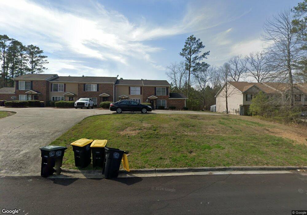
This home is located at 312 Leafmore Rd SW, Rome, GA 30165 and is currently estimated at $178,134, approximately $143 per square foot. 312 Leafmore Rd SW is a home located in Floyd County with nearby schools including Rome High School.
Ownership History
Date
Name
Owned For
Owner Type
Purchase Details
Closed on
Apr 21, 2005
Sold by
Steve2
Bought by
Donadio Richard J
Current Estimated Value
Home Financials for this Owner
Home Financials are based on the most recent Mortgage that was taken out on this home.
Original Mortgage
$41,600
Outstanding Balance
$21,759
Interest Rate
5.99%
Mortgage Type
New Conventional
Estimated Equity
$156,375
Purchase Details
Closed on
Feb 21, 2003
Sold by
Ftr Holdings Llc
Bought by
Steve2 Llc
Purchase Details
Closed on
Aug 31, 2000
Sold by
Desoto Developers Llc
Bought by
Ftr Holdings Llc
Purchase Details
Closed on
Mar 13, 1998
Sold by
Fifth Avenue Developers Inc
Bought by
Desoto Developers Llc
Purchase Details
Closed on
Jan 8, 1990
Bought by
Rogers Jim L Dr
Create a Home Valuation Report for This Property
The Home Valuation Report is an in-depth analysis detailing your home's value as well as a comparison with similar homes in the area
Home Values in the Area
Average Home Value in this Area
Purchase History
| Date | Buyer | Sale Price | Title Company |
|---|---|---|---|
| Donadio Richard J | $52,000 | -- | |
| Steve2 Llc | $44,100 | -- | |
| Ftr Holdings Llc | $187,000 | -- | |
| Desoto Developers Llc | $1,000,000 | -- | |
| Fifth Avenue Developers Inc | -- | -- | |
| Rogers Jim L Dr | -- | -- |
Source: Public Records
Mortgage History
| Date | Status | Borrower | Loan Amount |
|---|---|---|---|
| Open | Donadio Richard J | $41,600 |
Source: Public Records
Tax History Compared to Growth
Tax History
| Year | Tax Paid | Tax Assessment Tax Assessment Total Assessment is a certain percentage of the fair market value that is determined by local assessors to be the total taxable value of land and additions on the property. | Land | Improvement |
|---|---|---|---|---|
| 2024 | $1,951 | $50,752 | $5,527 | $45,225 |
| 2023 | $1,711 | $48,739 | $4,913 | $43,826 |
| 2022 | $1,468 | $40,226 | $3,992 | $36,234 |
| 2021 | $1,357 | $36,562 | $3,992 | $32,570 |
| 2020 | $998 | $26,665 | $3,070 | $23,595 |
| 2019 | $938 | $25,347 | $3,070 | $22,277 |
| 2018 | $888 | $23,987 | $3,070 | $20,917 |
| 2017 | $758 | $20,484 | $3,070 | $17,414 |
| 2016 | $767 | $20,664 | $3,520 | $17,144 |
| 2015 | -- | $20,664 | $3,520 | $17,144 |
| 2014 | -- | $20,664 | $3,520 | $17,144 |
Source: Public Records
Map
Nearby Homes
- 329 Leafmore Rd SW
- 2 Stonebrook Dr SW
- 358A&B Leafmore Rd SW
- 0 Leafmore Rd SW Unit 10562671
- 52 Glenda Dr SW
- 0 Brookvalley Ct SW Unit 7512814
- 0 Brookvalley Ct SW Unit 10444714
- 37 Mountain Chase Rd SW
- 14 Limon Place SW
- 27 Stonebrook Dr SW
- 3 Lovell Ln SW
- 0 E Clinton Dr SW Unit 7497950
- 0 E Clinton Dr SW Unit 10427155
- 107 E Clinton Dr SW
- 12 Lucas Ln SW
- 31 Southfork Dr
- 22 Southfork Dr SW
- 28 Southfork Dr
- 216 Coosawattee Ave SW
- 25 Ridge Dr SW
- 312 Leafmore Rd SW Unit 312-320
- 314 Leafmore Rd SW
- 316 Leafmore Rd SW
- 318 Leafmore Rd SW
- 320 Leafmore Rd SW
- 307 Leafmore Rd SW Unit 307 & 309
- 311 Leafmore Rd SW
- 311 Leafmore Rd SW Unit 313
- 326 Leafmore Rd SW
- 24 Leafmore Dr SW
- 315 Leafmore Rd SW
- 301 Leafmore Rd SW
- 330 Leafmore Rd SW
- 330 Leafmore Rd SW Unit 332
- 18 Westridge Cir SW
- 323 Leafmore Rd SW
- 211 Leafmore Rd SW
- 325 Leafmore Rd SW
- 338 Leafmore Rd SW Unit A & B
- 338 Leafmore Rd SW