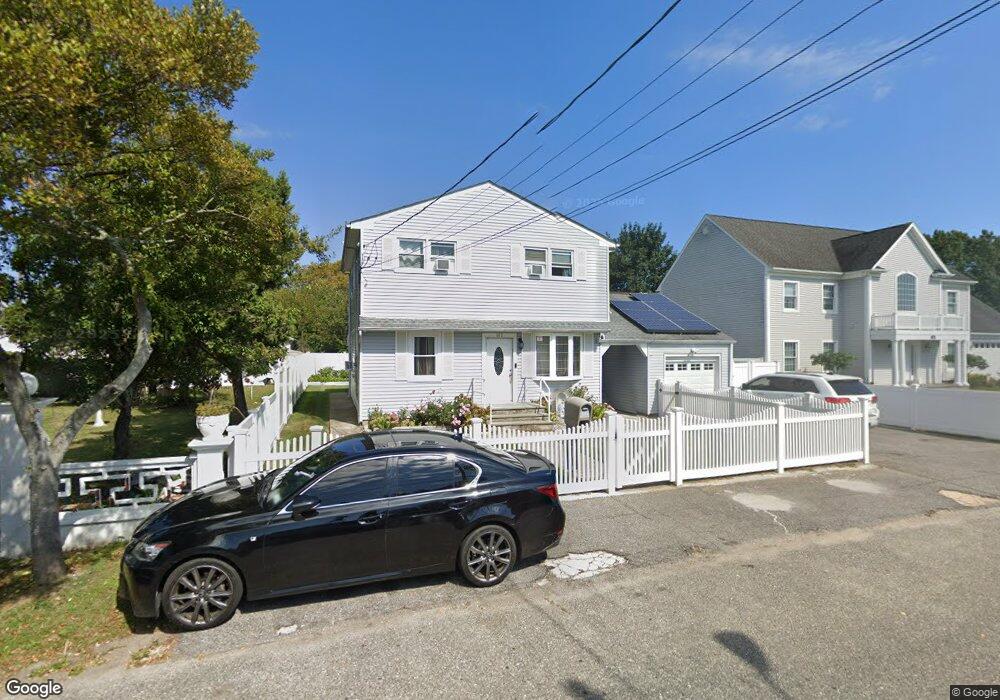
312 Linton Ave Lindenhurst, NY 11757
Estimated Value: $553,000 - $744,000
--
Bed
--
Bath
1,848
Sq Ft
$347/Sq Ft
Est. Value
About This Home
This home is located at 312 Linton Ave, Lindenhurst, NY 11757 and is currently estimated at $641,757, approximately $347 per square foot. 312 Linton Ave is a home located in Suffolk County with nearby schools including Harding Avenue Elementary School, Lindenhurst Middle School, and Lindenhurst Senior High School.
Ownership History
Date
Name
Owned For
Owner Type
Purchase Details
Closed on
Nov 17, 2005
Current Estimated Value
Purchase Details
Closed on
Oct 30, 2003
Sold by
Perez Isabel and Rosa Isabel
Bought by
Almonte Eduardo and Almonte Saturnina
Home Financials for this Owner
Home Financials are based on the most recent Mortgage that was taken out on this home.
Original Mortgage
$318,250
Outstanding Balance
$147,644
Interest Rate
6.01%
Mortgage Type
Purchase Money Mortgage
Estimated Equity
$494,113
Purchase Details
Closed on
Dec 7, 2002
Sold by
Rosa Jose and Perez Isabel
Bought by
Perez Isabel and Rosa Isabel
Create a Home Valuation Report for This Property
The Home Valuation Report is an in-depth analysis detailing your home's value as well as a comparison with similar homes in the area
Home Values in the Area
Average Home Value in this Area
Purchase History
| Date | Buyer | Sale Price | Title Company |
|---|---|---|---|
| -- | -- | -- | |
| Almonte Eduardo | $335,000 | Fidelity National Title Ins | |
| Perez Isabel | -- | Fidelity National Title Ins |
Source: Public Records
Mortgage History
| Date | Status | Borrower | Loan Amount |
|---|---|---|---|
| Open | Almonte Eduardo | $318,250 |
Source: Public Records
Tax History Compared to Growth
Tax History
| Year | Tax Paid | Tax Assessment Tax Assessment Total Assessment is a certain percentage of the fair market value that is determined by local assessors to be the total taxable value of land and additions on the property. | Land | Improvement |
|---|---|---|---|---|
| 2024 | $14,513 | $3,810 | $240 | $3,570 |
| 2023 | $14,513 | $3,810 | $240 | $3,570 |
| 2022 | $12,737 | $3,810 | $240 | $3,570 |
| 2021 | $12,737 | $3,810 | $240 | $3,570 |
| 2020 | $13,191 | $3,810 | $240 | $3,570 |
| 2019 | $13,191 | $0 | $0 | $0 |
| 2018 | $12,698 | $3,810 | $240 | $3,570 |
| 2017 | $12,698 | $3,810 | $240 | $3,570 |
| 2016 | $12,706 | $3,810 | $240 | $3,570 |
| 2015 | -- | $3,810 | $240 | $3,570 |
| 2014 | -- | $3,810 | $240 | $3,570 |
Source: Public Records
Map
Nearby Homes
- 334 Granada Pkwy
- 356 Granada Pkwy
- 349 Lido Pkwy
- 245 Lido Pkwy
- 219 Granada Pkwy
- 3 Garfield Place
- 225 Granada Pkwy
- 28 Harding Ave
- 248 E Shore Rd
- 311 Riviera Pkwy
- 738 Shore Walk
- 390 E Shore Rd
- 750 Shore Walk
- 733 Shore Walk
- 115 Riviera Pkwy
- 765 Shore Walk
- 10 Pine Place
- 696 Madison Ave
- 651 Madison Ave
- 823 Venetian Blvd
- 304 Linton Ave
- 316 Linton Ave
- 320 Granada Pkwy
- 320 Granada Pkwy Unit 1st Fl
- 270 Granada Pkwy
- 324 Granada Pkwy
- 328 Linton Ave
- 315 Linton Ave
- 303 Linton Ave
- 323 Linton Ave
- 328 Granada Pkwy
- 340 Linton Ave
- 264 Linton Ave
- 331 Linton Ave
- 262 Granada Pkwy
- 322 Granada Pkwy
- 312 Wyona Ave
- 318 Wyona Ave
- 330 Granada Pkwy
- 306 Wyona Ave