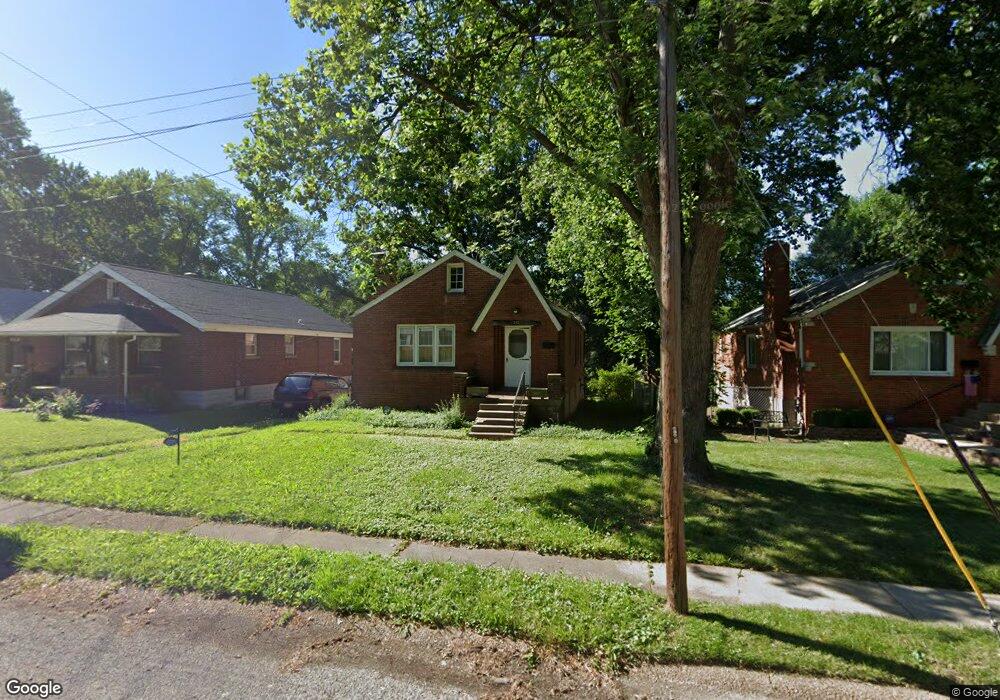
312 Louisa Ave Saint Louis, MO 63135
Estimated Value: $106,000 - $163,000
2
Beds
1
Bath
1,150
Sq Ft
$108/Sq Ft
Est. Value
About This Home
This home is located at 312 Louisa Ave, Saint Louis, MO 63135 and is currently estimated at $124,583, approximately $108 per square foot. 312 Louisa Ave is a home located in St. Louis County with nearby schools including Central Elementary School, Ferguson Middle School, and McCluer High School.
Ownership History
Date
Name
Owned For
Owner Type
Purchase Details
Closed on
Sep 11, 2007
Sold by
Caskey Mary A
Bought by
Caskey Byron C
Current Estimated Value
Purchase Details
Closed on
Jun 25, 1998
Sold by
Caskey Byron C
Bought by
Family Mtg Service Corp
Purchase Details
Closed on
Oct 24, 1997
Sold by
Caskey Sharon
Bought by
Caskey Byron C
Home Financials for this Owner
Home Financials are based on the most recent Mortgage that was taken out on this home.
Original Mortgage
$47,600
Interest Rate
11.6%
Create a Home Valuation Report for This Property
The Home Valuation Report is an in-depth analysis detailing your home's value as well as a comparison with similar homes in the area
Home Values in the Area
Average Home Value in this Area
Purchase History
| Date | Buyer | Sale Price | Title Company |
|---|---|---|---|
| Caskey Byron C | -- | None Available | |
| Family Mtg Service Corp | $36,000 | -- | |
| Caskey Byron C | -- | Nations Title Agency Inc |
Source: Public Records
Mortgage History
| Date | Status | Borrower | Loan Amount |
|---|---|---|---|
| Previous Owner | Caskey Byron C | $47,600 |
Source: Public Records
Tax History Compared to Growth
Tax History
| Year | Tax Paid | Tax Assessment Tax Assessment Total Assessment is a certain percentage of the fair market value that is determined by local assessors to be the total taxable value of land and additions on the property. | Land | Improvement |
|---|---|---|---|---|
| 2025 | $1,431 | $22,110 | $2,430 | $19,680 |
| 2024 | $1,431 | $19,680 | $2,430 | $17,250 |
| 2023 | $1,423 | $19,680 | $2,430 | $17,250 |
| 2022 | $1,260 | $15,160 | $3,060 | $12,100 |
| 2021 | $1,220 | $15,160 | $3,060 | $12,100 |
| 2020 | $1,161 | $12,950 | $2,770 | $10,180 |
| 2019 | $1,139 | $12,950 | $2,770 | $10,180 |
| 2018 | $1,086 | $11,000 | $2,410 | $8,590 |
| 2017 | $1,065 | $11,000 | $2,410 | $8,590 |
| 2016 | $1,017 | $10,330 | $2,030 | $8,300 |
| 2015 | $1,024 | $10,330 | $2,030 | $8,300 |
| 2014 | $1,362 | $13,680 | $1,820 | $11,860 |
Source: Public Records
Map
Nearby Homes
- 230 Randolph Ave
- 401 Estelle Ave
- 406 Tiffin Ave
- 223 Wiegel Dr
- 337 Wiegel Dr
- 221 S Harvey Ave
- 433 Jean Ave
- 226 S Marguerite Ave
- 302 S Dade Ave
- 215 Carson Rd
- 19 Lee Ave
- 720 Tiffin Ave
- 30 Paul Ave
- 804 Marion Place
- 818 Arline Ave
- 801 Elsworth Place
- 903 Arline Ave
- 811 Marvin Ave
- 358 Plaza Ave
- 14 Patricia Ave
- 314 Louisa Ave
- 310 Louisa Ave
- 316 Louisa Ave
- 306 Louisa Ave
- 318 Louisa Ave
- 302 Louisa Ave
- 305 Randolph Ave
- 301 Randolph Ave
- 309 Randolph Ave
- 259 Randolph Ave
- 311 Randolph Ave
- 313 Louisa Ave
- 320 Louisa Ave
- 250 Louisa Ave
- 309 Louisa Ave
- 317 Louisa Ave
- 315 Randolph Ave
- 255 Randolph Ave
- 305 Louisa Ave
- 321 Louisa Ave