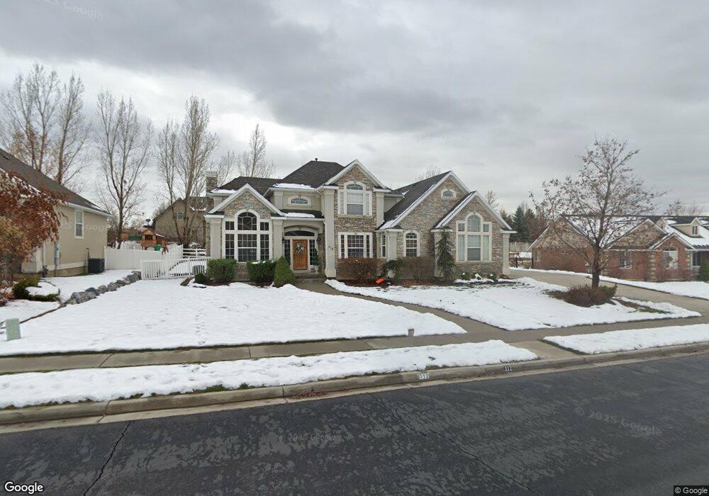
312 Maple Dr Alpine, UT 84004
Estimated Value: $1,120,000 - $1,383,000
5
Beds
4
Baths
4,539
Sq Ft
$267/Sq Ft
Est. Value
About This Home
This home is located at 312 Maple Dr, Alpine, UT 84004 and is currently estimated at $1,213,048, approximately $267 per square foot. 312 Maple Dr is a home located in Utah County with nearby schools including Westfield School, Timberline Middle School, and Lone Peak High School.
Ownership History
Date
Name
Owned For
Owner Type
Purchase Details
Closed on
Apr 3, 2024
Sold by
Black Jonathan K and Black Shellie A
Bought by
Jacobsen Eliot W and Jacobsen Marcelle D
Current Estimated Value
Purchase Details
Closed on
Dec 18, 2023
Sold by
Black Jonathan K
Bought by
Black Jonathan K and Black Shellie A
Purchase Details
Closed on
Feb 27, 2006
Sold by
Black Jonathan K
Bought by
Black Jonathan K and Warwick David S
Home Financials for this Owner
Home Financials are based on the most recent Mortgage that was taken out on this home.
Original Mortgage
$192,000
Interest Rate
6.27%
Mortgage Type
New Conventional
Purchase Details
Closed on
Dec 30, 2005
Sold by
Black Jonathan K and Black Shellie A
Bought by
Black Jonathan K
Home Financials for this Owner
Home Financials are based on the most recent Mortgage that was taken out on this home.
Original Mortgage
$192,000
Interest Rate
6.27%
Mortgage Type
New Conventional
Purchase Details
Closed on
Sep 2, 2005
Sold by
Black Jonathan K and Black Shellie A
Bought by
Black Jonathan K
Home Financials for this Owner
Home Financials are based on the most recent Mortgage that was taken out on this home.
Original Mortgage
$50,000
Interest Rate
5.81%
Mortgage Type
Credit Line Revolving
Purchase Details
Closed on
Sep 29, 2004
Sold by
Porter Michael William and Porter Christine C
Bought by
Black Jonathan K and Black Shellie A
Home Financials for this Owner
Home Financials are based on the most recent Mortgage that was taken out on this home.
Original Mortgage
$385,200
Interest Rate
5.76%
Mortgage Type
Purchase Money Mortgage
Purchase Details
Closed on
Jun 25, 1999
Sold by
Michael Porter Construction Inc
Bought by
Porter Michael William and Porter Christine C
Home Financials for this Owner
Home Financials are based on the most recent Mortgage that was taken out on this home.
Original Mortgage
$240,000
Interest Rate
7.05%
Create a Home Valuation Report for This Property
The Home Valuation Report is an in-depth analysis detailing your home's value as well as a comparison with similar homes in the area
Home Values in the Area
Average Home Value in this Area
Purchase History
| Date | Buyer | Sale Price | Title Company |
|---|---|---|---|
| Jacobsen Eliot W | -- | Masters Title | |
| Black Jonathan K | -- | Masters Title | |
| Black Jonathan K | -- | Accommodation | |
| Black Jonathan K | -- | Security Title & Abstract | |
| Black Jonathan K | -- | Capitol Title | |
| Black Jonathan K | -- | Capitol Title | |
| Porter Michael William | -- | First American Title Co |
Source: Public Records
Mortgage History
| Date | Status | Borrower | Loan Amount |
|---|---|---|---|
| Previous Owner | Black Jonathan K | $192,000 | |
| Previous Owner | Black Jonathan K | $50,000 | |
| Previous Owner | Black Jonathan K | $432,000 | |
| Previous Owner | Black Jonathan K | $385,200 | |
| Previous Owner | Porter Michael William | $240,000 | |
| Closed | Black Jonathan K | $72,225 |
Source: Public Records
Tax History
| Year | Tax Paid | Tax Assessment Tax Assessment Total Assessment is a certain percentage of the fair market value that is determined by local assessors to be the total taxable value of land and additions on the property. | Land | Improvement |
|---|---|---|---|---|
| 2025 | $4,166 | $525,030 | -- | -- |
| 2024 | $4,166 | $485,595 | $0 | $0 |
| 2023 | $3,943 | $493,405 | $0 | $0 |
| 2022 | $3,968 | $482,185 | $0 | $0 |
| 2021 | $3,574 | $674,700 | $251,800 | $422,900 |
| 2020 | $3,483 | $643,500 | $228,900 | $414,600 |
| 2019 | $3,056 | $589,400 | $228,900 | $360,500 |
| 2018 | $2,717 | $517,800 | $203,500 | $314,300 |
| 2017 | $2,809 | $284,790 | $0 | $0 |
| 2016 | $2,824 | $266,970 | $0 | $0 |
| 2015 | $2,748 | $245,740 | $0 | $0 |
| 2014 | $2,664 | $235,730 | $0 | $0 |
Source: Public Records
Map
Nearby Homes
- 596 S Cascade Ct
- 875 S Blue Ridge Ln
- 250 S Main St Unit 25
- 250 S Main St Unit 9
- 250 S Main St Unit 7
- 682 Healey Blvd
- 202 E Alpine Dr
- 5046 W Jonathon Rd Unit 10
- 868 S Braddock Ln
- 259 Twin River Loop
- 30 S Main St
- 243 W Conrad Ct
- 48 N 100 E
- 366 River Rd
- 887 E Village Way
- 1063 E Alpine Dr
- 11056 N Manor Dr
- 11107 Manor Dr Unit 1
- 499 E 300 N
- 1263 E Chapman Ct
- 312 E Maple Dr
- 213 Maple Dr
- 351 E Pheasant Ridge Dr
- 351 E Pheasant Ridge Dr Unit 4
- 333 Maple Dr
- 359 Maple Dr
- 304 Maple Dr
- 298 Maple Dr
- 303 E Pheasant Ridge Dr
- 303 E Pheasant Ridge Dr Unit 3
- 299 Maple Dr
- 374 Maple Dr
- 288 Ridge Dr
- 397 E Pheasant Ridge Dr
- 397 E Pheasant Ridge Dr Unit 5
- 286 Maple Dr
- 396 Maple Dr
- 629 S Pheasant Ridge Ct
- 629 S Pheasant Ridge Ct Unit 8
- 629 S Pheasant Ridge Cir
Your Personal Tour Guide
Ask me questions while you tour the home.